Download
1 / 18
190 likes | 281 Views
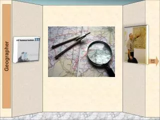
Chapter 2 Seeing the World Like a Geographer. 2.1 Introduction. To the person next to you discuss the question: “ when have you used a map ” “ what do they show ” Be prepared to share In 1854 a disease called Cholera struck a neighborhood in London, England, In 10 days 500 people died

E N D
2.1 Introduction To the person next to you discuss the question: “when have you used a map”“what do they show” Be prepared to share In 1854 a disease called Cholera struck a neighborhood in London, England, In 10 days 500 people died With a partner close to you, try to make a list of different things you could map. John Snow figured out how people where dying. He started to think like a Geographer by mapping the houses who had people who died of the disease The map he used was called a Thematic Map
2.2 Geographic Setting • Thematic Maps can show Physical or Human Geography • Focus on a specific topic or theme • Maps can focus on landforms (mountains, valleys, plains, plateaus) • Bodies of water (rivers, sea, oceans, lakes) • Political Maps, Climate, Population, Economic Activity • When reading a Thematic Map always read the title and map legend first to identify what you are looking at
2.3 Mapping Earth’s Physical Features (Look @ Map pg 28 & 29) • Geographers have given names to many landforms so they can be identified • Peninsula, mountain ranges, plains, plateau, canyon, hill, river, dune are just a few • Physical features maps show the shapes of features as seen from above • They show elevation, height above sea level, colors are used to show elevation change • Water is also found on a physical map
2.4 Hot, Cold, Wet, Dry: Earth’s Climates (Look @ Map) • Climate Zones – each zone has a particular pattern of temperature and precipitation • Climagraph – used to show average temp. & Precip. in a place over a year • What affects climate? – location such as latitude, coastal, inland, elevation, etc.. • Turn to page 30-31 in your book
Geography 2.4Pg30-31 • What types of Thematic Maps are on these pages? • Identify the 12 climate zones shown. • Where can you find the cities names on the graph? • The left side of the graph indicates what? • The right side of the graph indicates what?
Geography 2.4Pg 30-31 Find the Minneapolis/St. Paul graph: What climate zone is it in? What is the highest average temperature? What month is the highest average temperature? What is the highest average rainfall? What month does the highest average rainfall in?
Geography 2.4Pg 30-31 Find the Shanghai, China graph: • What climate zone is it in? • What is the highest average temperature? • What month is the highest average temperature? • What is the highest average rainfall? • What month does the highest average rainfall in?
Geography 2.4Pg 30-31 Find the Nice, France graph: • What climate none is it in? • What is the highest average temperature? • What month is the highest average temperature? • What is the highest average rainfall? • What month does the highest average rainfall in?
Geography 2.4Pg 30-31 Use the rest of the maps on this page to answer these questions: • What city has the highest average rainfall for 1 month? • What month does it happen in? • What city has an arid climate? • What city has a subarctic climate? • What city averages 1 inch of rain or more for the entire year? • What months will the average rainfall fall below 4 inches of rain in Sydney, Australia? • What are the 3 lowest months of rainfall on average in Nome, Alaska? • What city has the highest rainfall in July over all the other months?
2.5 Earth’s Vegetation (Look @ Map) What types of vegetation is around us? In the City? In Minnesota? Please list a few & be prepared to share. Vegetation Zones – geographers study where different plants grow Turn to page 32-33 in your book
Geography 2.5Pg 32-33 Identify the 11 vegetation Zones. What color indicates Desert? Describe what mixed forest looks like? Describe what broadleaf evergreen forest looks like? Which vegetation is described as evergreen trees with needles and cones? What parts of the world will you find Tundra? What countries in North America will have Tundra? Out of the 11 vegetation zones, which ones would you chose to be the best fit for Minnesota?
Chapter 2.6 Population Density (Look @ Map) Population density tells us how crowded a place is Divide total number of people by total land area Density effects how people live (Can you think of how this would effect how someone lives?) Turn to page 34-35 in your book
Ch. 2.6 Pg. 34 & 35 • In your own words explain each population density. • Which 1 would fit best for Minneapolis? • Which 1 would fit best for Chicago? • Which 1 would fit best for New York City? • Which 1 would fit best for Breckenridge (my hometown)?
Ch. 2.6 Pg. 34 & 35 Look at the Map of China: Describe where most of the people live. Describe where the least people live. Give 2 reasons why China’s density is so distinct. What population is in the city of Shanghai? What population is in the city of Xi’an? What population is in the city of Hong Kong? What population is in the city of Beijing?
Chapter 2.7 Land & Resources (Look @ Map) What types of resources do we use from the land here in Minnesota? Maps that show economic activity – land, forestry, fossil fuels, hydroelectric power Turn to page 36-37 in our book
Ch 2.7 Pg. 36 & 37 Which of the land uses do we have in Minnesota? Using the Economic activity map, please list 3 of the 7 resources. What icon indicates petroleum? What icon indicates hydroelectric power? What color indicates commercial fishing? Find Iceland, what land uses will you find there?
2.8 Regions (Look @ Map) • Region – area with 1 or more features that set it apart from other areas • Defined by either physical or human features • Sun Belt – (Florida to California) because of it sunny climate • Corn Belt – central states who raise corn • Worlds 7 regions – See book pg 39