Download
1 / 51
510 likes | 1.08k Views
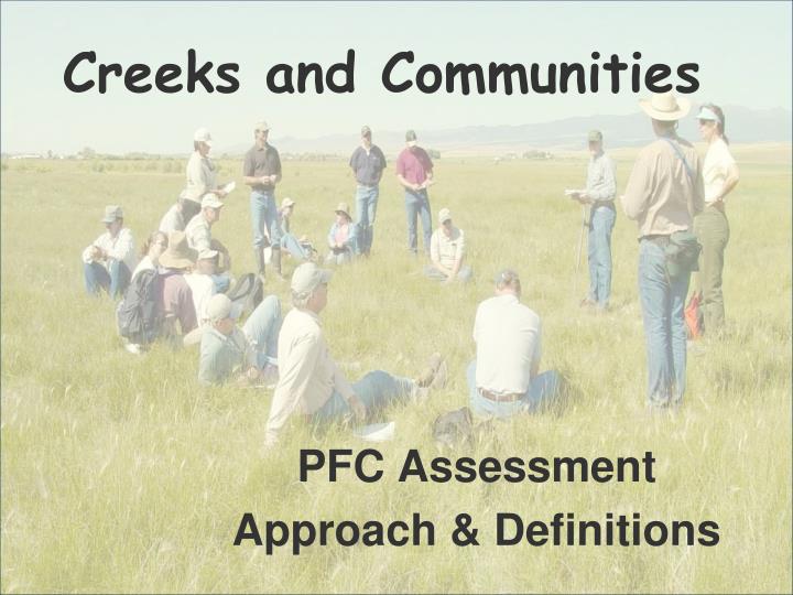
Creeks and Communities. PFC Assessment Approach & Definitions. What is possible?. Bear Creek, OR. 1977. 1988. What is possible?. Burro Creek, AZ. 1981. 2000. PFC Assessment Development.

E N D
Creeks and Communities PFC Assessment Approach & Definitions
What is possible? Bear Creek, OR 1977 1988
What is possible? Burro Creek, AZ 1981 2000
PFC Assessment Development • ID Team from the BLM, the FWS, and the NRCS with expertise in vegetation, hydrology, soils, and biology. • Four year study period in the 12 Western States (1988-92). • Collected soil, hydrology, and vegetation information at field sites – ESI • Identified common and important attributes/ processes that could be visually assessed.
PFC Development continued • Incorporated these elements into lotic & lentic checklists. • Draft document TR 1737-9 & 11. • Additional field test. • Finalized TR 1737-9 (1993) & 11 (1994) • Riparian Coordination Network Review • User Guides TR 1737-15 (1998) & 16 (1999)
Riparian-Wetland Areas Vegetation Landform, Soil Water
The PFC Assessment Tool • Requires an interdisciplinary (ID) team • Vegetation • Hydrology • Soils • Biology Local, on-the-ground experience in interpreting quantitative sampling techniques that support the PFC checklist
PFC Assessment Method • Requires an interdisciplinary team with strong technical skills and experience. • All members of the community can participate. Water Soil, Landform Vegetation Common Vocabulary
Lotic Lentic Standing water Running water
Wetland Area • Inundated or saturated by surface or ground water • Frequency and duration sufficient to support a prevalence of vegetation typically adapted for life in saturated soil conditions • Marshes, swamps, bogs are examples Lentic = standing water systems
Riparian Area • Transition between the wetlands and upland areas • Vegetation and physical (soil) characteristics reflect the influence of permanent surface or subsurface water • Land along streams, shores of lakes are examples Lotic = running water systems
Perennial Stream A stream that flows continuously. Perennial streams are generally associated with a water table in the localities through which they flow.
Intermittent Stream Meinzer’s suggestion (1923): flow continuously for periods of at least 30 days A stream that flows only at certain times of the year when it receives water from springs or from some surface source such as melting snow in mountainous areas.
Ephemeral Channel Meinzer’s suggestion (1923): do not flow continuously for periods of at least 30 days A stream that flows only in direct response to precipitation, and whose channel is at all times above the water table.
Interrupted Stream A stream with discontinuities in space
Riparian Proper Functioning Condition • Term is used in two ways • Assessment process • Defined on the ground condition • How well the area’s physical processes are functioning • State of resiliency that will allow an area to hold together during moderately high flows, such as 5-, 10-, and 20-year events
Dissipate stream energy Reduce erosion Filter sediment Capture bedload Aid floodplain development Improve floodwater retention and groundwater recharge Develop root masses that stabilize stream banks Increased water quality and quantity Diverse ponding and channel characteristics Habitat for fish and wildlife Greater biodiversity Lotic PFC Adequate vegetation, landform or large woody material to: To Yield Physics Values
Dissipate energies – wind, wave, overland flow Reduce erosion Filter sediment Improve floodwater retention and groundwater recharge Develop root masses that stabilize islands and shoreline features against cutting action Restrict water percolation Increased water quality and quantity Diverse ponding and channel characteristics Habitat for fish and wildlife Greater biodiversity Lentic PFC Adequate vegetation, landform or debris is present to: To Yield Physics Values
Dissipate stream energy Reduce erosion Filter sediment Capture bedload Aid floodplain development Improve floodwater retention and groundwater recharge Develop root masses that stabilize stream banks Increased water quality and quantity Diverse ponding and channel characteristics Habitat for fish and wildlife Greater biodiversity PFC On-The-Ground Condition Adequate vegetation, landform or large woody material to: To Yield Physics Values
Potential The highest ecological status a riparian-wetland area can attain given no political, social, or economical constraints, and is often referred to as the potential natural community (PNC).
Capability Highest ecological status an area can attain given political, social, or economic constraints, which are often referred to as limiting factors.
Functional - At Risk Riparian-Wetland Areas that are in Functional Condition But an existing attribute • Soil • Water • Vegetation Makes them susceptible to degradation during high-flow events such as the 5-, 10-and 20- year events
Nonfunctioning Areas that are clearly not providing adequate vegetation, landform, or large woody material To: • Dissipate stream energy • Improve floodwater retention & groundwater recharge • Stabilize streambanks • And other characteristics common to PFC
Unknown For accounting purposes • Riparian-wetland areas that lack sufficient information to make any form of determination • Has not been visited
Areas that are clearly not providing adequate vegetation, landform, or large woody material
An existing attribute makes them susceptible to degradation during high-flow events such as the 5-, 10-and 20- year events
Adequate vegetation, landform or large woody material present
PFC Assessment Procedure • A. Review Existing Documents • B. Analyze the Definition of PFC • C. Assess Functionality using an ID Team
Dissipate stream energy Reduce erosion Filter sediment Capture bedload Aid floodplain development Improve floodwater retention and groundwater recharge Develop root masses that stabilize stream banks Increased water quality and quantity Diverse ponding and channel characteristics Habitat for fish and wildlife Greater biodiversity B. Analyze the Definition of PFC Adequate vegetation, landform or large woody material to: To Yield Physics Values
C. Assess Functionality using an ID Team 1. Stratification 2. Attributes & Processes 3. Potential & Capability 4. Functioning Condition
Assess Functionality using an ID Team 1 1 1. Stratification 1 2 2 3 • Stream order • Valley bottom type • Stream type (Rosgen) • Management/ landowner change Reference or comparison sites
2. Attributes & Processes Lotic Example from Great Basin
3. Determining Potential & Capability • Relic areas (preserves, exclosures etc.) • Historic photos, survey notes, documents • Species lists – animals & plants • Soils & Hydrology • Ecological site classifications • Identify major landforms • Look for limiting factors, both human-caused and natural, and determine if they can be corrected Experienced ID Team (Hydrology, Soils, Vegetation, Biology)
4. Functioning Condition The condition of the entire watershed/catchment is important
Area Shape Orientation Geology Elevation Climate 4. Functioning Condition Fixed Catchment/Watershed Variables
4. Functioning Condition Management Influenced Catchment/Watershed Variables • Impervious Area • Soils • Drainage Density • Vegetation • Channel Features
4. Functioning Condition Some riparian-wetland areas can function properly before they achieve their potential.
4. Functioning Condition Others may require the potential vegetation to function.
4. Functioning Condition State E State D State C State B PFC State A
IDT and Community Working Through the PFC Assessment Helps Determine • Potential & Capability • How well physical processes are working • How well withstand energies of high-flow events like 5-, 10-, and 20- year events