Download
1 / 79
980 likes | 1.26k Views
Principles of Agroclimatology. Course Lecturers: Olaoye , Gbadebo Office Location : – Professorial Suite Olaniyan , J.O. Office Location : – Department of Agronomy Building Ahamafule , H. A. Office Location : – Department of Agronomy Building. General Introduction.

E N D
Principles of Agroclimatology Course Lecturers: Olaoye, Gbadebo Office Location: – Professorial Suite Olaniyan, J.O. Office Location: – Department of Agronomy Building Ahamafule, H. A. Office Location: – Department of Agronomy Building
General Introduction. Terminologies relating to climate, factors of climate and relevance of climate to general agriculture. • Elements of climate General Influence of weather variables –temperature, heat, relative humidity, wind, cloud and atmospheric pressure on crops. Evaporation and evapotranspiration.
Rain formation and rainfall pattern Process of rain formation. Process of rain formation –convection, cyclonic and orographic. Factors affecting rainfall distribution and amount. Importance of rainfall on vegetation and distribution of crops. • Weather equipment and maintenance of standard meteorological stations Weather station. Components of weather station. Instruments for measuring temperatures, sunshine, relative humidity, wind direction and speed, atmospheric pressure and solar radiation.
Methods for estimating evaporation and evapotranspiration Use of evaporating pans, Atmometers, Sunking Tank, mass transport method, water balance method design and use of lysimeters • Climate and Agriculture Nature of the tropical climate and crop distribution. Implications on the type of cash and arable crops that could be cultivated. Impact of climate change especially global warming on general agriculture and by implication human nutritional status and health.
Climatic variables and crop productivity I Sun Energy Influence of sun’s energy, air temperature on crop productivity. Components of the atmospheric air-ammonia, carbon dioxide • Climatic variables and crop productivity II- Soil moisture • Soil moisture properties. Soil surface temperature on crop growth and performances. Plant water status
Estimating effects of climatic variables on crop growth and productivity Equipment used in measurement of crop response to differences in climatic variables. Measurement of CO2 exchange between atmosphere and vegetation, carbon dioxide flush, loss of ammonia, combined effects of carbon dioxide and air temperature. • Cropping patterns in relation climate Sole cropping versus crop mixture. Different intercropping patterns – mixed cropping, alley cropping relay cropping, strip cropping and terracing.
Irrigation in a sustainable agriculture • Irrigation as source of water in dry land agriculture. Irrigation requirements. Meteorological parameters associated with irrigation agriculture. • Problems associated with irrigation • Effects of erosion, leaching, water logging on crop productivity, human lives and community health. • General revision
Lecture 1-General Introduction Agroclimatology • Term describes the interrelationship between elements of climate and agriculture • Branch of science which deals with the study of climate and effects on crop and livestock productivity • A special discipline of agriculture that • relates the influence of climatic factors to agriculture, • measurements of climatic factors and • how they can be used to enhance crop and livestock productivity • Climate is the average of all weather conditions of a given place over a period of time • Weather is the state of the atmosphere at a given point in time and at a given location • Weather and climate occupy central position within the broad spectrum of environmental science and consequently in the field of agriculture • In tropical Africa, weather also determines the type of vegetation, the type of crops that could be grown and also the types of livestock that can be raised.
Relevance of Climate to Agriculture • It is the basis for the distinction between regions (Temperate versus Tropical zones • It influences life and development of organisms • It has significant effect on general agriculture including • livestock production, • nature of vegetation, • soil characteristics, • types of crops that could be cultivated in a particular area and • farming systems in a given locality.
lecture 2: Elements of Climate Temperature, wind, pressure, rainfall, etc. are collectively referred to as elements of climate Temperature • Defined as the heat condition of a given place. • Two major aspects of temperature are insolation and heating/cooling effects • Directly related to amount of insolation received in an area. • Every crop has a range of temperature (minimum, maximum and optimum) within which it could survive and not only become productive but gives it best. • Similarly, livestock has a range of temperature for optimal performance. • Most crops give their best within the temperature range of 15oC and 32oC.
Differences exist among crops and livestock in their tolerance to temperatures (high or low). For example, millet (Sorghum bicolor) tolerates high temperature better than maize (Zea mays L). • Temperature affects crops by influencing • the actual amount of vapour in any medium thereby deciding its moisture carrying capacity and • affecting evaporation and evapo-transpiration rates, consequently, condensation to form relative humidity (RH). • High temperatures may cause • pollen abortion in maize, • boll shedding in cotton (Gossipiumspp), • premature fruit drop in tomatoes (Lycopersiconesculentus) and orange (Citrus spp), • drop in egg production in poultry birds, etc.
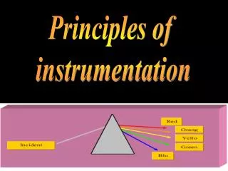
Insolation • Defined as the sun’s energy which is converted into heat at the earth’s surface i.e. solar radiation). • It is the ultimate source of terrestrial and atmospheric energy. • Approximately 45% of incoming insoaltion reaches the earth surface while the rest is scattered, absorbed or partly reflected by various components (water droplets, cloud, dust and various gases present in the atmosphere. • Solar radiation is the source of energy utilized by plants in photosynthesis and chief determinant of dry matter production in plants. • Cereal crop yields are usually superior in the northern Nigeria to the south due to better insolation (less cloudy sky) and late cropping season yields better than early season crop yields in the south for the same reason. • High temperature in conjunction with low relative humidity ensures better livestock productivity in the northern Nigeria relative to the south.
Total sun energy approaching the earth’s surface and the proportion that actually reaches the earth’s surface.
Factors influencing temperature of a place These are latitude/altitude, ocean current/distance from the sea, wind, cloud cover, relative humidity and day length among others. Latitude/Altitude • At high altitude, air contains very little vapour or dust and heat from earth’s surface rapidly escapes so that air remains cold. • Latitude/Altitude also affects diurnal range of temperature especially in the arid areas where there is marked differences between day (very hot) and night (very cold) temperatures. Ocean currents/Distance from the sea • Cold currents often raise or lower the temperatures of land surfaces. Warm currents carry tropical warmth from the pole into high altitudes. • Warm currents (between Latitudes 0o and 40o) on eastern sides of continents, raise costal temperatures.
Winds • On-shore winds of tropical latitudes modify the temperatures of coastal regions owing to its blowing over cooler surfaces Cloud cover • Clouds reduce the amount of solar radiation reaching the earth’s surface and the amount of radiation leaving the earth the earth’s surface. • Heavy cloud cover of equatorial regions is responsible for day temperatures exceeding 30oC (86oF). • Absence of cloud cover in the desert regions results in excessive high day and low night temperatures.
Relative Humidity (RH) • It is the amount of water vapour in the air which is directly related to the atmospheric temperature. • RH has a considerable effect on the moisture requirements of crops. • Lower relative humidity (RH) at a given temperature encourages fast absorption of transpired water through evaporation in the leaves. Day Length • Very important to growth and development of crop plants, having a pronounced effects on flowering and seed germination. • Certain cowpea (Vignaunguiculata L Walp) are long day plants (>14 hours). Most rice (Oryza sativa) cultivars are generally short day plants (<10 hours). Maize is a day neutral crop (10-14hours).
Wind • Strong wind such as hurricanes, cyclones, etc., may cause soil erosion and stem breakage resulting in severe crop losses especially in the cereals (maize, sorghum, millet, sugarcane). • Strong winds may also increase the rate of evapo-transpiration in the leaf surfaces of plants, thus affecting moisture balance in crops. • Moderate winds may • promote photosynthetic rate in plants and • enhance pollination in wind pollinated crops (maize). Atmospheric Pressure • The weight of the air which it exerts on the atmosphere is referred to as atmospheric pressure. Atmospheric pressure depends upon three elements: altitude, temperature and rotation of the earth.
Rain • Rainfall (amount and distribution) is the most important climatic factor influencing agriculture in the tropics. • It determines to a large extent, • agricultural potential of an area, • crop and livestock types, • farming systems and timing of farm operations. • Rainfall distribution also determines the number of cropping seasons (two in the south and one in the north).
Clouds • Made of water droplets or ice particles. • Mist and fogs are low level clouds. • When air is cooled, some of its water may condense into tiny droplets of water. • Shape, height and movement of clouds indicate the type of weather which is likely to occur. • Dew point temperature is the temperature at which the change of water droplets or ice particles to form cloud.
Evaporation and Evapotranspiration • Evaporation (E) is the amount of water moved from the leaf surfaces of plants. • Physical process by which liquid or solid is transferred to gaseous state. • E Occurs from the immediate surfaces of water bodies (oceans, lakes, rivers), from soils and wet vegetation. • Process from the plant surfaces is through the plant → root hairs→ vascular tissue →leaves or other organs → plant into the surrounding air → stomata or cuticular surfaces and the process is therefore referred to as Transpiration. • Soil evaporation and plant transpiration occur simultaneously.
E rate is affected by wind velocity which absorbs any available moisture. • Evapotranspiration (ET) is a combination of evaporation of water remaining on the surfaces of vegetation after precipitation and transpiration (water lost from plant’s surface). • ET is used to describe total process of water transfer into the atmosphere from vegetated land. • Potential evaporation (PE) occurs when the soil moisture is greater than a critical value above which evaporation takes place. • Actual evaporation (AE) occurs when soil moisture is less than the critical value resulting in the rate of evaporation itself far below PE (i.e. soil moisture is less than critical value)
Lecture 3: Rainfall and Vegetation Pattern Process of Rain formation Air Rises→ Air Cools→ Air Condenses→ Clouds Form and →Precipitation Occurs. • Under certain conditions, water vapour(in form of a gas) becomes tiny droplets of water in the lower layer of the atmosphere. • When droplets become too heavy (in the presence of condensation) to remain suspended in air, may then fall as rain (Tropical regions) or snow (Temperate regions). • They may initially appear as cloud, mist, fog, hail, dew or rain referred to as Precipitation.
Three conditions for precipitation • Air must be saturated. • Air must contain small particles of matter (dusts) around which droplets are formed. • Air must be cooled below its dew point which is achieved either through rising of air or passing of air over a cold surface.
Types of rains • Convectional Rainfall • Relief Rainfall and • Frontal (Cyclonic or Depression) Rainfall The three types of rainfall: Relief (left), Frontal (middle) and Convectional (right).
Conventional rainfall • Convectional rain is caused by convection where the surface layer of the atmosphere is heated causing the moisture laden air to rise. • Forms due to heating of the ground by the sun. • The condition of rising currents of warm air separated by more wide-spread areas of slowly sinking air is referred to as convection.
Air (close to the ground) is heated, becomes lighter and begins to rise → then cools forming (water vapour) → condenses back to water droplets→ forms clouds which when it grow bigger→ rain under the influence of gravity. • Common in areas where ground is heated by the hot sun (for example the Tropics). • Convectional rain can also be found year round in regions near the equator.
Relief Rainfall • Forms where moist air is forced to rise over mountains or hills. • Presence of hills or mountains leads to the warm air rising. • The winds pick up moisture from the sea as they pass over it, and this makes the air moist.
As the air rises to pass over the higher land, it cools and the water vapour condenses, forming clouds. • The droplets then fall as rain, sleet, hail, or snow, depending on the atmospheric conditions.
Frontal (Cyclonic or Depression) Rainfall • Frontal rainfall occurs where warm air meets cold air. • The warm air is lighter than cold air and it is therefore forced to rise above it. • As the air rises it begins to cool and condense. • As the water vapour condenses back to water droplets, clouds are formed. As the clouds grow bigger it starts to rain.
This rain is caused by depressions • Cyclonic rain originates where warm tropical air meets cold polar air. The warm air overrides the cold air. • When contrasting air masses make contact, an abrupt zone or boundary is formed. • This boundary is called a Front and is accompanied by rather abrupt changes in temperature, pressure and humidity. • When a mass of warm air moves into a region of cold air, the warm air overrides the cold air mass, forcing the cold air to retreat. • This situation is called a Warm Front, which is characterized by several days of rain.
Nigeria vegetation • Forests (where there is significant tree cover), • Savannahs (insignificant tree cover, with grasses and flowers located between trees) • Montane land (mainly found in the mountains near the Cameroonian border). • Forest and Savannah zones are each divided into three parts.
Peculiarities of forest zone • Some of the forest zone's most southerly portion, especially around the Niger River and Cross River deltas, is mangrove swamp. • North of this is fresh water swamp, containing different vegetation from the salt water mangrove swamps, and • north of that is rain forest.
Peculiarities of the savanna zone • Guinea forest-savanna mosaic, made up of plains of tall grass which are interrupted by trees, the most common across the country; • Sudan savannah, similar but with shorter grasses and shorter trees; • and Sahel savannah patches of grass and sand, found in the northeast.
Types of Cropping Season • Nigeria, like the rest of West Africa and other tropical lands, has only two seasons • Dry season and • Rainy season. • The dry season is accompanied by a dust laden air mass from the Sahara Desert, locally known as Harmattan, or by its main name, The Tropical Continental (CT) air mass. • The rainy season is heavily influenced by an air mass originating from the South Atlantic Ocean, locally known as the south west wind, or by its main name, The Tropical Maritime (MT) air mass.
Lecture 4: Weather Measuring Equipment • Rain Gauge – Amount of precipitation • Thermometers – Air temperature • Hydrometer – Moisture content or humidity of the air • Wind vane – Direction of the wind • Anemometer- Wind speed or Velocity • Barometer - atmosphere air pressure • Evaporating pans –Evaporation and • Lysimeters - Evapotranspiration
Weather Station Weather is "the state of the atmosphere at a given time and place, with respect to variables such as temperature, moisture, wind velocity, and barometric pressure." Weather Station: A weather station is a facility (either on land or sea) with instruments and equipment for observing atmospheric conditions to provide information • for weather forecasts and • study the weather and climate. The measurements taken include temperature, barometric pressure, humidity, wind speed, wind direction and precipitation amounts.
Old (Greenveson weather station) Modern weather station (Mauritius Sugar Research Institute)
Components of a Weather Station • Thermometers for measuring air temperature, • Hydrometer for measuring relative humidity, • Barometer detects atmospheric pressure, • Anemometer for measuring wind speed and • Gauges measure rain and snow.
Front (a) and back view (b) of typical weather station containing sunshine recorder, wind vane and other accessories for recording climatic data at CMMYT station, Kenya.
Measurement of Rainfall-Rain Gauge • Measures the amount of rainfall at a given time interval • Can be any container (Fig. 1), with marked measurements (in, cm or mm). • It is important to use the correct rain gauge, as evaporation can be a factor. Most standard rain gauges have a wide funnel leading into the cylinder and are calibrated so that one-tenth of a mm of rain measures 1mm when it collects inside.
In the more modern era, a common rain gauge is called the tipping bucket type. • Contains a pair of small receiving funnels alternate in the collection of the rains. • When one fills up with water, it tips, spills out, and the other comes into place to do the collecting. • The funnels tip each time rainfall amounts to .01 inches, which triggers a signal that is transmitted and recorded.
Measurement of Air Temperature-Thermometers • Thermometers measure air temperature by using materials that change in some way when they are heated or cooled. • More specifically, the device measures the air’s heat content. • Temperatures are measured in degrees Celsius or degrees Fahrenheit, depending on location. • There is a combination of maximum and minimum thermometers • Thermometers used for keeping weather records are usually enclosed within a specified shelter (Right) called the Stevenson’s Screen so as to minimize environmental effects, such as topography, or shade and shadows which can skew thermometer readings.
Thermometers used for keeping weather records are usually enclosed within a specified shelter (Right) called the Stevenson’s Screen. • The purpose is to minimize environmental effects, such as topography, or shade and shadows which can skew thermometer readings.
Maximum and Minimum Thermometer • Consists of a U shaped glass tubewith two separate temperature scales set along each arm of the U • The bulbs are hidden by a plastic housing. • One housing is for recording max tempt and the other for min tempt. • Left-hand (minimum arm) full of alcohol measures the tempt by expansion and contraction of the liquid. Maximum and Minimum Thermometer
Right-hand (maximum arm) contains alcohol and a bubble of low-pressure gas or alcohol vapour. • This accommodates expansion in the other bulb and allows the train of alcohol and mercury to move in the U-shaped tube as the temperature changes. • A metal in the bend of U section contains mercury which is liquid at normal temperatures. Which is pushed around the tube by the thermal expansion and contraction of the alcohol in the first bulb as it responds to the external temperature.
Note: • At the end of every reading, the thermometer must be reset by moving the markers to the top of the mercury, usually by hand using a small magnet to slide them along the tube. • As the temperature varies, the markers will remain in their positions unless the temperature becomes higher (for maximum) or lower (for minimum) than already recorded, in which case the relevant marker is pushed further. • Typically the thermometer is reset every 24 hours to measure the diurnal temperature variation
Six's thermometer • Commonly known as a maximum-minimum, minimum-maximum, maxima-minima or minima-maxima thermometer • Records maximum and minimum temperatures reached over a period of time, for example 24 hours. • Records extremes of temperature at a location, for instance in meteorology and horticulture. • The thermometer indicates the current temperature as well as the highest and lowest temperatures since last reset. Six’s Thermometer