Download
1 / 14
140 likes | 387 Views
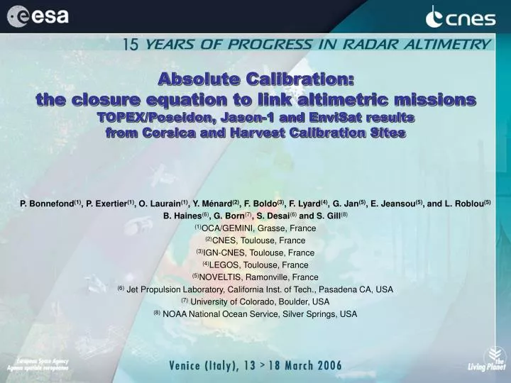
Absolute Calibration: the closure equation to link altimetric missions TOPEX/Poseidon, Jason-1 and EnviSat results from Corsica and Harvest Calibration Sites.

E N D
Absolute Calibration:the closure equation to link altimetric missionsTOPEX/Poseidon, Jason-1 and EnviSat resultsfrom Corsica and Harvest Calibration Sites P. Bonnefond(1), P. Exertier(1), O. Laurain(1), Y. Ménard(2), F. Boldo(3), F. Lyard(4), G. Jan(5), E. Jeansou(5), and L. Roblou(5) B. Haines(6), G. Born(7), S. Desai(6) and S. Gill(8) (1)OCA/GEMINI, Grasse, France (2)CNES, Toulouse, France (3)IGN-CNES, Toulouse, France (4)LEGOS, Toulouse, France (5)NOVELTIS, Ramonville, France (6) Jet Propulsion Laboratory, California Inst. of Tech., Pasadena CA, USA (7) University of Colorado, Boulder, USA (8) NOAA National Ocean Service, Silver Springs, USA
Historical overview • Absolute calibration of radar altimeters has been used previously for numerous missions such as: • Seasat in Bermuda (1978) • ERS-1 in Venice (1991) • TOPEX/Poseidon in Lampedusa (1993) • TOPEX/Poseidon and Jason-1 on the Harvest platform (since 1992) • TOPEX/Poseidon, Jason-1 and EnviSat in Corsica (since 1998) • Concept • The calibration principle is to compute the difference between the sea surface height (ssh) measured with the altimeter and the ssh recorded by local sensors (tide gauge, GPS-buoy, …). These two ssh are sometimes located at two distant points. For these situations, the link between the two ssh is partly the geoid slope from offshore altimetric measurement to local sensors locations. • RELATIVE CALIBRATION • Statistically significant • Less sensitive to Geographically Correlated Errors • Provide only relative behavior • ABSOLUTE CALIBRATION • Provide absolute biases • Enable separation of error sources using information from multiple in situ sensors (e.g., tide gauge, GPS, radiometer) • Highly sensitive to Geographically Correlated Errors Definition of altimeter bias calibration: sea height bias = altimeter sea height - in situ sea height Sea height bias < 0 meaning the altimetric sea height being too low (or the altimeter measuring too long)Sea height bias > 0 meaning the altimetric sea height being too high (or the altimeter measuring too short) INTRODUCTION 15 YEARS OF PROGRESS IN RADAR ALTIMETRY, Venice, March 2006
Harvest Corsica ASC. TRACKS s = 16 mm (mm) 129 141 153 165 177 189 DES. TRACKS s = 12 mm Bass Strait (mm) 129 141 153 165 177 189 Why Distributed Calibration Sites?Geographically Correlated Errors INTRODUCTION • Systematic sea-surface height errors revealed by flying Jason-1 in formation with TOPEX/POSEIDON (for ~200 d) 15 YEARS OF PROGRESS IN RADAR ALTIMETRY, Venice, March 2006
Established by NASA in 1992. Ten years of T/P overflights ended 8/13/2002 (Cycle 365) Continuous monitoring of Jason-1 since 2002 Active drilling platform (Arguello). Lies directly on Jason-1 ground track. Located in open ocean (~10 km from land) at western entrance to Santa Barbara (CA) channel. Employs concentrated configuration. All instrumentation (e.g., GPS, tide gauges, radiometer) collocated at platform. Jason-1 radar altimeter illuminates the platform as s/c passes overhead. JASON TRACK LOS ANGELES HARVEST HARVEST Harvest Calibration Site 15 YEARS OF PROGRESS IN RADAR ALTIMETRY, Venice, March 2006
Long-Term Sea-Surface Height Bias Estimates T/P&JASON|1 13 Years of Monitoring at Harvest, 4 Altimeter Systems 15 YEARS OF PROGRESS IN RADAR ALTIMETRY, Venice, March 2006
TMR - GPS Bias (2003.0) = +5.3 ± 1.0 mm, Rate = -0.8 ± 0.2 mm/yr JMR - GPS Bias (2003.0) = +7.3 ± 1.8 mm, Rate = -5.2 ± 0.9 mm/yr 40 Uncalibrated (MGDR TMR & GDR-A JMR) 0 D Delay (mm) -40 40 Calibrated (Calibrated TMR & GDR-B JMR) D Delay (mm) 0 -40 TMR - GPS Bias (2003.0) = +12.6 ± 1.0 mm, Rate = +0.1 ± 0.2 mm JMR - GPS Bias (2003.0) = +2.0 ± 1.7 mm, Rate = -0.8 ± 0.7 m/yr 1992 1994 1996 1998 2000 2002 2004 2006 Calibration of Vertical Wet Path Delay at Harvest WET TROPOSPHERE USING DATA FROM HARVEST GPS RECEIVERS 15 YEARS OF PROGRESS IN RADAR ALTIMETRY, Venice, March 2006
CNES calibration site established in 1998 Supports continuous monitoring of Jason-1 (and formerly T/P) Employs distributed configuration Fiducial point near Ajaccio equipped with GPS/FTLRS/DORIS. Senetosa coastal site (along ground track) equipped with tide gauges. Open-ocean verification point for GPS buoy deployments. Open-ocean altimeter readings connected to tide gauges via detailed local geoid model Derived from intensive GPS buoy and catamaran surveys along ground track. Extension to Ajaccio (2005) and Capraia (2004) EnviSat, ERS, GFO, Jason-1. CORSICA Corsica Calibration Site 15 YEARS OF PROGRESS IN RADAR ALTIMETRY, Venice, March 2006
Senetosa Site TOPEX/POSEIDON TOPEX/Poseidon altimeters (ALT-A and ALT-B) have been calibrated from 1998 to 2002 using MGDR. Results show a great coherence between both altimeters -3 ±3 mm and +1 ±6 mm for ALT-A and ALT-B respectively. 15 YEARS OF PROGRESS IN RADAR ALTIMETRY, Venice, March 2006
Senetosa Site JASON|1 At Senetosa POSEIDON-2 altimeter bias is +100 ±4 mm, based on the whole set of GDR-A products (135 cycles). 15 YEARS OF PROGRESS IN RADAR ALTIMETRY, Venice, March 2006
Senetosa Site WET TROPOSPHERE Jason-1 - JMR The wet tropospheric path delay (correction to be applied to the altimetric range) issued from Senetosa GPS data are compared to Jason-1 Microwave Radiometer (JMR, GDR-A and GDR-B data) and ECMWF model tropospheric corrections. The agreement between GPS and ECMWF is very good (-7mm) while JMR (GDR-A) exhibits a bias (+24mm) and a drift (+2.4 ±2 mm/yr). This drift effect is due to steps in the JMR calibration coefficients and clearly affects the Jason-1 altimeter bias time series. The future release of Jason-1 altimetric data includes new calibration coefficients and then this drift is removed (see JMR GDR-B). 15 YEARS OF PROGRESS IN RADAR ALTIMETRY, Venice, March 2006
150 140 130 120 110 100 90 80 70 60 50 40 30 20 10 Senetosa 0 Bias or relative bias (mm) Harvest -10 -20 Repro. JMR -30 Jason-1 GDR-A Jason-1 GDR-A Jason-1 GDR-B Jason-1 GDR-B TOPEX-B Retrack2 -40 TOPEX-B Retrack1 -50 TOPEX-B MGDR + TMR drift TOPEX-A MGDR + TMR drift TOPEX-B MGDR + TMR drift TOPEX-A MGDR + TMR drift -60 GDR-B - TOPEX-B (+retrack1) GDR-B - TOPEX-B (+retrack2) POSEIDON-1 MGDR + TMR drift SSH: JASON ABSOLUTE SERIES -70 SSH: TOPEX ON CORSICA PERIOD SSH: FORMATION FLIGHT ANALYSES -80 Jason-1 GDR-A + GPS Orbit (rlse06b) + GDR-B - TOPEX-B MGDR (+TMR correction) SSH: TOPEX/POSEIDON ABSOLUTE SERIES GDR-A - TOPEX-B MGDR (+TMR correction) -90 -100 -110 -120 -130 -140 Type of comparison CORSICA/HARVEST -150 All these analyses have been realized in a joint effort with Harvest calibration site in order to adopt common standards. The Figure resumes all the computed biases for both calibration sites along with their error bars. Results presented here are divided into 3 main sections: the Jason-1 absolute altimeter bias (ssh: JASON absolute series), the TOPEX/Poseidon absolute altimeters biases (ssh: TOPEX/Poseidon absolute series) and the absolute biases (or relative biases) during the formation flight phase (ssh: formation flight analyses). 15 YEARS OF PROGRESS IN RADAR ALTIMETRY, Venice, March 2006
Ajaccio Site ENVISAT At Ajaccio RA-2 altimeter bias is +437 ±10 mm, based on cycle 10 to 41 (GDR products). 15 YEARS OF PROGRESS IN RADAR ALTIMETRY, Venice, March 2006
Ajaccio Site WET TROPOSPHERE EnviSat - MWR The wet tropospheric path delay (correction to be applied to the altimetric range) issued from Ajaccio GPS data are compared to EnviSat Microwave Radiometer (MWR) and ECMWF model tropospheric corrections. The mean differences with GPS are +5mm and +10mm for MWR and ECMWF respectively. The slope of MWR is +1.3 ±3 mm/yr. From Senetosa and Ajaccio results, the wet tropospheric path delay derived from GPS data demonstrates that it is a very powerful and accurate method to monitor on board radiometers. 15 YEARS OF PROGRESS IN RADAR ALTIMETRY, Venice, March 2006
Corsica Results (Harvest results): ALT-A (aging): +1 ±6 mm (+22.3 ± 8) ALT-B: -3 ±3 mm (+6 ±4) POSEIDON-2: +100 ±4 mm (+119 ±3) RA-2: +437 ±10 mm CONCLUSION ALT-B (MGDR): Bias 2002.0 = -2 ± 6 mm (+3 ±5) Slope = +1 ±1 mm/yr (-3 ±3) POSEIDON-2 (GDR-A): Bias 2002.0 = +108 ± 7 mm(+142 ±6) Slope = -5 ±3 mm/yr(-12 ±3) RA-2 (ECMWF+USO): Bias 2002.0 = 439 ± 45 mm Slope = -1 ±16 mm/yr (on cycles 17-40) However we should now speak in term of bias at a reference epoch along with its drift The RA-2 calibration is a very good example of what will arrive in case of gap between missions. Indeed, because we have no data (for the moment) at the beginning of the mission, we do not have overlap with Jason-1 and so theerror bar at the reference 2002.0 epoch is four times the standard error on the mean bias even with a small trend. This is also amplified by the 35-days repeat period which leads to a lower data set for a single location. 15 YEARS OF PROGRESS IN RADAR ALTIMETRY, Venice, March 2006