Download
1 / 61
630 likes | 844 Views
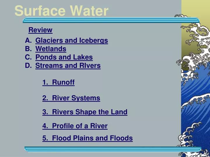
Surface Water. Review. Glaciers and Icebergs Wetlands Ponds and Lakes Streams and RIvers. 1. Runoff. 2. River Systems. 3. Rivers Shape the Land. 4. Profile of a River. 5. Flood Plains and Floods. Water Phase Changes. Hydrologic Cycle. A. Glaciers and Icebergs.

E N D
Surface Water Review • Glaciers and Icebergs • Wetlands • Ponds and Lakes • Streams and RIvers 1. Runoff 2. River Systems 3. Rivers Shape the Land 4. Profile of a River 5. Flood Plains and Floods
A. Glaciers and Icebergs • Glacier-huge mass of ice and snow that moves slowly over the land scraping and reshaping it • Valley • b. Continental
B. Wetlands An area of land covered with a shallow layer of water for all or part of the year Sheltered waters rich with nutrients provide great habitats help control flooding 3 main types: bogs, marshes and swamps Florida Everglades largest
C. Ponds and Lakes Form when water collects in hollows and low-lying land areas Ponds-shallow lake where sunlight reaches the bottom Lake-large body of water; usually deep; formed in depressions like craters, glacial deposits or from dams (reservoirs) Turnover-seasonal mixing of bottom and top layers that refresh nutrients Eutrophication-nutrient build-up causes algae to overgrow
D. Streams and Rivers • Runoff-water that flows over the ground. Several factors affect this flow. • Type of surface • Rate of rainfall • Slope of the land
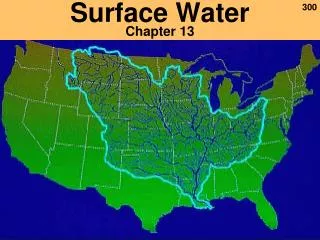
2. River Systems Tributary Divide River A river system consists of a river and all of its tributaries. The drainage basin of a river system is all the land that is drained by the river and its tributaries. This is also called a watershed . There are many but we live in the largest. It is the Mississippi River Basin
Important Definitions River System • ____________ – a stream and all its tributaries • ________ – a smaller stream that empties into a larger stream • _________ – the land area drained by a river system • ______ – a high point that separates river systems Tributary Watershed Divide
River Channels and Drainage There are different types of river channel patterns and river drainage patterns. • Dendritic • Radial • Rectangular • Trellis
Dendritic -interconnecting streams resemble the pattern that branches of a tree might make
Radial network Radial- streams flow outward from a cone-shaped mountain, and make a pattern resembling spokes on a wheel.
Rectangular streams join each other at right angles because of a rectangular grid of fractures that breaks up the ground
Trellis-A system that develops across a landscape of parallel valleys and ridges so that major tributaries flow down the valleys and join a trunk that cuts through the ridge; the resulting map pattern resembles a garden trellis.
3. Rivers Shape the Land • a. River speed is a factor that can be determined by the: • Steepness of a slope • The channel it flows through (this creates friction) • Volume of water
Flow Suspension: Silt and clay Bed load: sand, gravel, pebbles and boulders Materials carried in solution cannot be seen. b. Rivers wear down Earth’s surface and erode and deposit materials like sediments. A river may carry materials in solution, in suspension, and in its bed load.
Erosion • 1.________ – wearing away of materials • 2.__________ – soil and rock are left behind • 3._________ – rock and soil picked up and dropped in erosion and deposition Deposition Sediments
4. A stream can carry its load in three different ways: • ________ – material is dissolved • __________ – particles are held up by stream’s moving water • _________ – material pushed or rolled along the stream’s channel solution suspension bed load
c. The speed of a river determines what drops out of the water to create different landforms. These landforms can be: 1. Canyons
5. Alluvial Fan ____________ – deposit formed when a stream spreads out onto a less steep area like at the base of a mountain Write the definition down!
6. Delta _____ – where a stream empties into a larger body of water Write the definition down!
4. Profile of a River • Headwaters-Beginning or river source; fast water and narrow canyons • Downriver-slope less steep; tributaries increase water volume; channel is wider and deeper because of erosion
c. Flood Plain-broad, flat area that has other river features • Meanders-looping curves • Oxbow lakes-crescents of land cut off from the main river • d. Mouth- Point where the river flows into another body of water (deltas, alluvial fans)
Meanders ________ – the bends and curves of a stream
Oxbow lake deposition erosion
River Valleys Surface Water Youthful rivers form steep-sided canyons and V-shaped valleys. The lowest level to which a river can erode its bed is called its base level. Rapids can form as a river runs down a deep slope, while a river that plunges over a cliff forms a waterfall.
________: Rapids Waterfalls Fast-moving water Steep slope _______: Broad floodplain Meanders Oxbow lakes Meander Scars Stream Stages Youthful Old
River Systems Youthful Mature Old
Rejuvenation ____________ – when an old age stream downcuts to “make it new again”
5. Floodplains and Floods Valley wall Back swamp Oxbow lake Meander Natural levees Yazoo tributary floodplain A river that has cut down close to its base level tends to erode the sides of its valley, forming a meandering river in a wide flood plain.
Floodsoccur when the volume of water in a river increases and overflows its channels. River floods are natural events that can have constructive as well as destructive effects. They destroy habitats and homes but they leave behind land rich in nutrients. People have developed different methods to control and prevent river flooding. One is a man-made dam called a levee