Download
1 / 15
150 likes | 187 Views
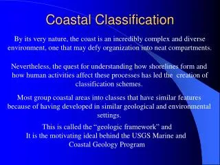
CEM Part IV: Chapter 2 Coastal Classification and Morphology. Coastal Classification Classification of Specific coastal environments around the U.S.

E N D
CEM Part IV: Chapter 2 Coastal Classification and Morphology • Coastal Classification • Classification of Specific coastal environments around the U.S. • Geologists in the 19th and 20th centuries described coastal landforms, examined their origin and development as a function of geologic character, history, and dynamic processes, and devised classification schemes to organize and refine their observations. • The most widely used classification was proposed by Francis Shepard (1973).
Early Coastal Classification • Characterized by: • rising sea level - submergence • falling sea level - emergence • both - compound coasts Valentin (1952)
Emphasis of onshore and shoreline morphology: • Inman and Nordstrom (1971): considered continental margins and devised a classification based on a tectonic framework
TECTONIC CLASSIFICATION SPREADING PLATES Create new ocean basins, e.g.. Atlantic and Pacific widening at 0.04-0.06 m/yr. Inman and Nordstrom, 1971
TECTONIC CLASSIFICATION LEADING EDGE COASTS • COLLISION COASTS (active coasts) • e.g.. Pacific coasts of North and South America • (thick and thin plates collide) • ISLAND ARC COLLISION COASTS • e.g.. Philippines, Indonesian and Aleutian Island arcs • (thin plates collide)
TECTONIC CLASSIFICATION TRAILING EDGE COASTS • NEO-TRAILING EDGE COAST • New trailing edge coasts formed near beginning separation centers and rifts e.g.. Red Sea and Gulf of California • AFRO-TRAILING EDGE COAST • Opposite coast of the continent is also trailing thus potential for terrestrial erosion and deposition is low e.g.. Atlantic and Indian Ocean coasts of Africa • AMERO-TRAILING EDGE COAST • Trailing edge of a continent with a collision coast modified by depositional material and erosive effects from high interior mountains e.g.. East coasts of North and South America
NEO-TRAILING EDGE COAST • AFRO-TRAILING EDGE COAST • AMERO-TRAILING EDGE COAST
TECTONIC CLASSIFICATION MARGINAL SEA COASTS Coasts fronting on marginal seas and protected by island arcs from the open sea e.g. Vietnam, South China, Korea, Gulf of Mexico, Northeast Australia
FIRST ORDER COASTS • Mountain Coast • Narrow Shelf • Headlands and Bays • Coastal Plain • Wide Shelf • Headlands and Bays • Coastal Plain • Deltaic Coast • Reef Coast • Glaciated Coast
The Tectonic Classification of the World’s Coastlines, Based on the Work of Inman and Nordstrom (1971)
After a complete year of simulation, things are looking better. The attached ppt file shows that the accreted volume in the inlet area is close to the historic annual value. The second slide shows the same slide as the first, but with the areas specified for dredging in the 2006 dredging plans. The dredging area doesn't change that much from one cycle to the next according to the plans provided. The model appears to be accumulating sediment in those areas (as well as other places outside the navigation channel) which is what I believe we want. It took some of the larger wave conditions in the third 4-month simulation to see significant deposition, especially in the more northerly area. The waves may be enhancing a circulation back toward the inlet very close to shore on the west side. I will look more closely at the circulation to better understand the processes. The model now is running a second year to see if material continues to build in those areas at a reasonable rate. Please let me know if you see something amiss about this (for example, if the dredging area looks incorrect). If the interpretation of the dredging plans is correct, this is one of the better morph change model calibrations that I've seen (after hammering out the hydrodynamics and getting the bay bathymetry fixed). The second year of simulation may be done by mid next week and might be done in time for your interim report. The modeling draft report is being modified now to reflect the additions you requested and to include this latest result.
Jan through Dec Morphology Change Accreted volume: 75,798 cu m
Jan-Dec depth change (1 year) with outline of 2006 dredging area shown in purple