Download
1 / 35
350 likes | 497 Views
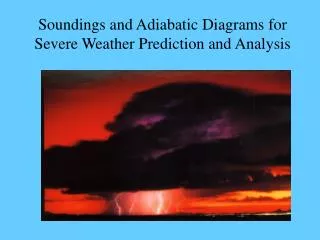
Severe weather – origins and prediction. Ross Reynolds Department of Meteorology University of Reading. US National Weather Service definition of a severe thunderstorm * wind gust > 50 knots (25 m/s) &/or * hail of diameter > ¾ inch &/or * tornado (funnel cloud reaching

E N D
Severe weather – origins and prediction Ross Reynolds Department of Meteorology University of Reading
US National Weather Service definition of a severe thunderstorm * wind gust > 50 knots (25 m/s) &/or * hail of diameter > ¾ inch &/or * tornado (funnel cloud reaching surface)
Source of winds thunderstorms: localised frontal depressions: large-scale tropical cyclones: large-scale
Hail production strength of updraft (can be >50 msˉ¹) vertical extent of updraft (residence time of hailstone) water vapour & supercooled water concentration in updraft 1cm diameter falls at ~ 9ms¹ 8cm “ ~ 48ms¹
Recipe for severe storm surface heating vertical wind shear low-level stable layer – temp inversion cold & dry upper troposphere
Vertical wind shear & temperature inversion
Downbursts from rapidly descending, rain-loaded air Derechos straight line winds associated with a line of thunderstorms
Recipe for a supercell as for the severe thunderstorm + growth of deep convection in an environment within which the wind changes direction with height
Tornado – only occurs when a funnel cloud or debris cloud is in contact with the ground
UK tornadoes Spanish plume
Spanish plume • Stream of hot, dry air moves north from meseta; overruns higher theta W air north of Pyrenees & is overrun by colder, drier air
Doppler windfield
Phased array radar • 20 to 30 second frequency of simultaneous scanning of multiple targets (NEXRAD 6 to7 minutes). Increase warning from 10 to 20 minutes. Developed from US Navy SPY-1 radar ($10,000,000 funding from Navy to adapt).
Tornado watch 29 May 2007 • SEL4 URGENT - IMMEDIATE BROADCAST REQUESTED TORNADO WATCH NUMBER 304 NWS STORM PREDICTION CENTER NORMAN OK 1230 PM MDT TUE MAY 29 2007 THE NWS STORM PREDICTION CENTER HAS ISSUED A TORNADO WATCH FOR PORTIONS OF NORTHEAST COLORADO NORTHWEST KANSAS SOUTHWEST NEBRASKA EFFECTIVE THIS TUESDAY AFTERNOON AND EVENING FROM 1230 PM UNTIL 800 PM MDT. TORNADOES...HAIL TO 2 INCHES IN DIAMETER...THUNDERSTORM WIND GUSTS TO 70MPH...AND DANGEROUS LIGHTNING ARE POSSIBLE IN THESE AREAS. THE TORNADO WATCH AREA IS APPROXIMATELY ALONG AND 55 STATUTE MILES NORTH AND SOUTH OF A LINE FROM 10 MILES NORTHWEST OF DENVER COLORADO TO 25 MILES EAST NORTHEAST OF MCCOOK NEBRASKA. FOR A COMPLETE DEPICTION OF THE WATCH SEE THE ASSOCIATED WATCH OUTLINE UPDATE (WOUS64 KWNS WOU4). REMEMBER...A TORNADO WATCH MEANS CONDITIONS ARE FAVORABLE FOR TORNADOES AND SEVERE THUNDERSTORMS IN AND CLOSE TO THE WATCH AREA. PERSONS IN THESE AREAS SHOULD BE ON THE LOOKOUT FOR THREATENINGWEATHER CONDITIONS AND LISTEN FOR LATER STATEMENTS AND POSSIBLEWARNINGS. DISCUSSION...STRONG/ISOLATED SEVERE STORMS CONTINUE TO DEVELOP/INTENSITY OVER PARTS OF SWRN NEB AND ALONG THE FRONT RANGE IN CO. ACTIVITY IS ASSOCIATED WITH COLD FRONTAL BOUNDARY THAT WILL MOVE SWD/SEWD THIS AFTERNOON INTO MODERATELY UNSTABLE AIR MASS. MLCAPE IS2000-2500 J/KG OVER SWRN NEB ATTM...AND BETWEEN 500-1500 J/KG OVER ERN CO. DEEP LAYER SHEAR IS 40-45 KT WHICH IS FAVORABLE FOR STRONG ROTATINGUPDRAFTS AND THE POSSIBILITY OF ISOLATED TORNADOES. AVIATION...TORNADOES AND A FEW SEVERE THUNDERSTORMS WITH HAIL SURFACE AND ALOFT TO 2 INCHES. EXTREME TURBULENCE AND SURFACE WIND GUSTS TO 60 KNOTS. A FEW CUMULONIMBI WITH MAXIMUM TOPS TO 450. MEAN STORM MOTION VECTOR 23030. ...MCCARTHY Top of Page/All Current Watches/Forecast Products/Home Weather Topics:Watches, Mesoscale Discussions, Outlooks, Fire Weather, All Products, Contact UsNOAA / National Weather ServiceNational Centers for Environmental PredictionStorm Prediction Center120 David L. Boren Blvd.Norman, OK 73072 U.S.A.spc.feedback@noaa.govPage last modified: May 29, 2007DisclaimerCreditsGlossary
Hurricane genesis SST>26C to 60m deeply unstable troposphere moist middle troposphere (5-7km) low vertical windshear (1-9km) large low level relative vorticity
Hurricane prediction National Hurricane Centre, Miami use range of global models + statistical problem with eye landfall two days ahead for large-scale evacuations asymmetry in damage; worse on forward right quadrant wind, rain, surge