Download
1 / 15
150 likes | 383 Views
Environmental Monitoring Using Synthetic Aperture Radar Technology. Student: Alex Ng Supervisor: Dr Linlin Ge. Objectives. To use Synthetic Aperture Radar (SAR) for monitoring different environmental conditions and impacts over a large area.

E N D
Environmental Monitoring Using Synthetic Aperture Radar Technology Student: Alex Ng Supervisor: Dr Linlin Ge School of Surveying & Spatial Information Systems The University of New South Wales, Australia
Objectives • To use Synthetic Aperture Radar (SAR) for monitoring different environmental conditions and impacts over a large area. • Identify new application or environmental variables that can be detected by SAR. Alex Ng
Introduction • Why Radar? • Most weather conditions • 24 hours system • Complement existing surveying techniques Alex Ng
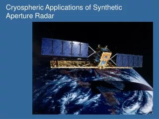
SAR Platform TOPSAR • Airborne • AIRSAR/TOPSAR • GeoSAR • E-SAR • Spaceborne • ERS 1/2 • ENVISAT • RADARSAT 1/2 • JERS • ALOS • TerraSAR (2006) • COSMO-Skymed (2007) GeoSAR E-SAR Alex Ng
ERS 1/2 Alex Ng
ENVISAT • Spatial Resolution: ~30 m • Polarization: single & dual (VV and VH) • C-Band • Repeat cycle: 35 days Alex Ng
ALOS • Spatial Resolution: ~10m • Polarization: Full (HH, HV, VH and VV) • L-Band • Repeat cycle: 46 days Alex Ng
RADARSAT 2 • Spatial Resolution: ~3 m • Polarization: Full (HH, HV, VV and VH) • C-Band • Repeat cycle: 24 days Alex Ng
TerraSAR • Spatial Resolution: ~1-2 meters • Polarization: single & dual (HH, HV, VV and VH) • X-Band • Repeat cycle: 11 days Alex Ng
COSMO-SkyMed • 4 Satellites • Spatial Resolution: a few meters • Polarization: single & dual (HH, HV, VV and VH) • X-Band • Repeat cycle: ~12 hours Alex Ng
Introduction – Application Area • Security • Reconnaissance Imagery • War Damage Assessment • Underground Nuclear Testing • Marine • Ship Detection Service • Oil Spill Monitoring • Sea Ice Monitoring • Marine Gravity Anomaly Mapping • Shallow Water Bathymetric Mapping • Sea State Forecasting & Monitoring • Seasonal climatology (Wave) Estimation • Risk • Flood Damage Assessment • Fire Damage Assessment • Storm Damage Assessment • Land Subsidence • Seismic deformation • Volcanic activity • Fires • Agriculture • Precision Farming Suite • Crop Inventory • Land Subsidence • Forestry • Strategic Forest Inventory • Forest extent and type mapping • Bushfire Monitoring • Forest Damage Monitoring • Cartography • Environmental Planning Map • Infrastructure Planning Map • Regional Planning Map • Land Use Map • Geology • Geology Structure Map • Geology Image Map • Digital Elevation Model • Oil Seep Detection • Terrestrial Mineral Deposits Identification Alex Ng
Methodology • Disaster Damage Detection • Intensity • Measures the amount of backscattering • Coherence • Measures the correlation between the two images • Digital Elevation Model • Interferometric Synthetic Aperture Radar (InSAR) • Land Subsidence • Differential Interferometric Synthetic Aperture Radar (DInSAR) Alex Ng
Master SAR Image Slave SAR Image Image Registration Interferogram Coherence Map Phase Unwrapping Geocoding DEM InSAR Processing Chain Digital Elevation Model Alex Ng
Possible Oil Slick Oil Spill started Oil Spill Detection Oil Spill Alex Ng
War Damage Assessment Before war After war Before war 21/07/06 16/06/06 03/03/06 Change Detection 18/11/05 09/09/05 Alex Ng