Download
1 / 42
430 likes | 460 Views
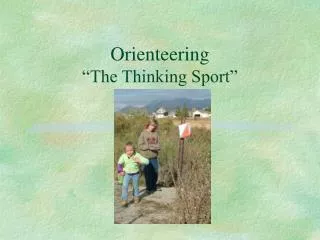
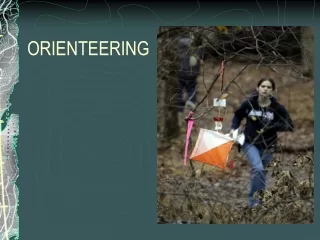
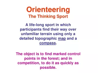
Orienteering The Thinking Sport. A sport in which participants find their way over unfamiliar terrain using only a detailed topographic map and a compass . The object is to find marked control points in the forest; and in competition, to do it as quickly as possible. Features.

E N D
OrienteeringThe Thinking Sport A sport in which participants find their way over unfamiliar terrain using only a detailed topographic map and a compass. The object is to find marked control points in the forest; and in competition, to do it as quickly as possible.
Features • Combines mental skills (navigation and route selection) with physical skills (moving over natural wooded terrain) • Orienteer choosesthe activity level • Run, jog, walk, stroll, meander • Easy, moderate, and difficult courses • Take your performance seriously or not • Compete against your own age group or not
Overview • Orienteering Maps • What skills you need and who does O • What a course is and what the orienteer does at an event • Types of events • Orienteering when there is no event • The Big Picture of Orienteering • Variations on a theme
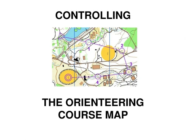
Map Features • Scale - usually 1:15000 or 1:10000 5 Colors; each has meaning: • Black Roads, trails, boulders, cliffs • Blue Ponds, lakes, streams, marshes • Brown Contour lines - connecting points of equal elevation; usual interval is 5 meters. • Yellow Open, cleared areas • Green Vegetation, darker means thicker • North pointing lines – to magnetic north
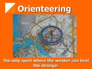
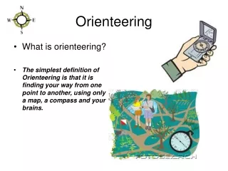
The Compass Used to keep yourself oriented Used in taking a bearing Used when you become disoriented (lost)
Skills Used • Terrain association (the first step) - ability to translate what the orienteer sees in the forest into its depiction on the map and vice versa. • Taking a bearing – finding a direct route to the next control. • Counting paces – to measure distance • Making route choices – deciding how to get from here to there • Adjusting for errors • When in competition – doing it all on the run
So, Who Does This? • Orienteers • Boy scouts, girl scouts, cub scouts • 4-H clubs • ROTC and JROTC • Civil Air Patrol • Search and Rescue units • Adventure racers • Cross-country runners, Hikers, Hunters • Almost anyone who enjoys the outdoors and wants a little structure or challenge in their activities
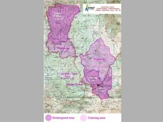
A Course • Typical “cross-country” course: sequence of marked locations in the forest, each is called a control point • Control points are marked in the forest by orange and white control flags and on the map by purple circles • The circles are connected by lines to show sequence but not route • The orienteer must choose his/her own route • The orienteer also gets descriptions of the control location
Course Differences • Distances (measured in a straight line) - from beginner’s 1.5 - 2.5 km to most competitive expert’s 8.0 - 12.0 km • Difficulties – from beginner’s who go along trails and fields to expert’s who rarely use trails • Control placements – from beginner’s large and obvious features to expert’s small, subtle features • Skills needed – from beginner’s orienting the map to expert’s route choices and planning
Course Designations • USA uses color coding for courses • White: beginners, 1.5–2.5 km • Yellow: advanced beginners, 2.5-3.5 km • Orange: intermediate, 3.5-5.0 km • Brown, Green, Red and Blue: all expert level in increasing order of length from 3.5 km to as much as 11 or 12 km
What an Orienteer Does • Interval starts on course of your choosing; spaced at least two minutes apart • Go to each control in sequence • At the control, make a record of having been there • After the last control, go to the finish and get the record verified and time recorded • Brag or complain about how things went; compare with others on the same course
Event Categories A Serious competition, national event, courses for all levels of competitors, seven or more courses to choose from B Moderate competition, regional event, courses for most basic competition levels, usually seven courses C Fun or practice event, local, limited selection of courses (three or four)
Competition Categories • Division by sex • Division by age • Kids: 10 & under, 12 & under, 14 & under, 16 & under, 18 & under • Adults: 18-20, 21 & over, 35 & over, 40 & over, 45 & over, and every five years through age 90
Permanent Course Controls 4-inch white/orange squares with letter and/or number Placed on a post Orienteer records square letter on paper; and checks letter sequence for correctness
Nearby Permanent Courses • Yellow Creek SP, two courses • Prince Gallitzin SP, three courses • Stackhouse Park, Johnstown, three suggested courses • Highland Regional Park, Johnstown, one course • Other courses on lesser maps: Whipple Dam SP and Greenwood Furnace SP
Worldwide Orienteering • Started in Norway and Sweden (1920’s) • Europe still has majority of orienteers Large events draw 30,000 competitors • About 65 clubs in the United States, under auspices of OUSA (about 25 clubs in Canada, under the COF) Large events draw 500-1000 competitors Local events draw 20 to 200 competitors
Western Pennsylvania Orienteering Club • Public O-meets, Fall & Spring • Free instruction for all novices • And it’s near you – throughout Western PA • www.wpoc.org • orienteeringusa.org for other clubs in USA
Western PA O Maps State Parks Jennings Env Ed Ctr Laurel Hill Keystone Prince Gallitzin Raccoon Creek Yellow Creek County Parks Blue Spruce William D. Boyce Deer Lakes Hartwood Acres Mingo Creek Pine Ridge White Oak*
Western PA O Maps Other Areas City of Beaver Bushy Run Battlefield Frick Park Highland Regional Park IUP Co-Op Park Pittsburgh South Side Stackhouse Park Camp Twin Echo Brady’s Run Park Canoe Creek SP* Moraine SP* Oil Creek SP* Developing Maps Settlers Cabin Park Laurel Ridge SP North Park
Spring 2015 Schedule • Mar 22 Raccoon Creek SP • Apr 12 Deer Lakes Park • Apr 25 Brady’s Run Park • May 17 Frick Park • Jun 7 Yellow Creek (south) SP Any Day: The Permanent Courses in various parks
Foot-O Variations • Score – find as many controls as you can in any order in a limited amount of time • Line – follow a line on the map • Trail (Precision) – mostly un-timed, on trails, open to disabled competitors • Night – totally in the dark • Long or short – course lengths are adjusted
Variations Not on Foot • Ski-O using cross-country skis • Bike-O using mountain bikes • Canoe-O using canoes or kayaks • Horse-O on horseback • Scuba-O underwater
Related Sports • Rogaining – 6-, 12-, and 24-hour events • Trail Running • Adventure Racing • Hashing • MedWAR • Geocaching – using GPS • Amateur Radio Direction Finding