Download
1 / 15
150 likes | 274 Views
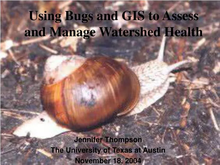
Using Bugs and GIS to Assess and Manage Watershed Health. Jennifer Thompson The University of Texas at Austin November 18, 2004. What are benthic macroinvertebrates?. Benthic = bottom-dwelling Invertebrates = no backbone Macro =visible to unaided eye. Why study benthic macroinvertebrates?.

E N D
Using Bugs and GIS to Assess and Manage Watershed Health Jennifer Thompson The University of Texas at Austin November 18, 2004
What are benthic macroinvertebrates? • Benthic = bottom-dwelling • Invertebrates = no backbone • Macro =visible to unaided eye
Why study benthic macroinvertebrates? • Sensitive to physical and chemical changes in their environment • Reflect conditions for a duration of time • Interact with both sediment and water • Don’t move or swim away • Easy to collect • Relatively inexpensive to monitor
Water Quality Parameters specific to Bug Abundance and Diversity • Temp • Conductivity • TSS • Flow • Nitrate as N • Dissolved Oxygen
Metrics and Biological Indices • 3 taxa groups: Pollution- intolerant, pollution-intermediate, and pollution- tolerant organisms • EPT index • Hilsenhoff Index • % community as relates to trophic structure • Aquatic Life Use
Scavenger Beetle 5 Larvae 5 Larvae Predacious Diving Beetle Adult 5 Shrimp 5 Adult TOLERANT 5 VERY SENSITIVE 5 4 Riffle Beetle Biting Midge Larvae 5 5 Yabbie Adult Larvae 5 Adult Whirligig Beetle 5 10 5 5 Freshwater Slater 4 Black Fly Larvae 8 Seed Shrimp Mayfly Nymph Larvae 5 5 10 Water Strider Freshwater Mussel Scud 4 7 Larvae Pupae Water Mite Mosquito 4 Copepod 9 8 Stonefly Nymph Water Measurer 7 VERY TOLERANT Water Scorpion Leech 5 Hydra Back Swimmer 4 SENSITIVE 4 Water Boatman Soldier Fly Larvae 4 7 Crane Fly Larvae 1 7 Round Worm Caddisfly Larvae 1 6 2 6 Segmented Worm Snail 6 6 Dragonfly Nymph Damselfly Nymph Water Flea 3 Freshwater Crab Flatworm 3 2 2 Springtail Water Spider Non-Biting Midge Larvae Aquatic Macro-invertebrate Identification Key Here are the most common aquatic macro-invertebrates that will be found in the Adelaide region. Tick the spaces next to the numbers to indicate which invertebrates you have found in your samples. The number indicates the sensitivity of the invertebrate, the higher the number, the more sensitive to pollution it is. Also tick the invertebrates that you find on the ‘Record Sheet’ so you can determine the stream pollution index.
Importance to Watershed Managers and Regulators • Identify areas of concern • Focus monitoring efforts • Track success of remediation efforts
Focus: Colorado River Basin • 22,200 square miles • Total basin inflow: 10,738,000 acre-feet • Total basin outflow: 1993: 9,097,000 acre-feet • Irrigated acreage, 1992: 958,000 acres • Water quality: typically satisfactory • Primary data source: • TCEQ TRACS and Surface Water quality databases
Objectives • Provide a spatial representation of monitoring sites and bug and water quality data using different biological indices for bugs • Provide a temporal representation of data from 1996-2003 • Compare biological integrity with state criteria (screening and water quality standards) and evaluate how the Colorado River Basin measures in comparison • Determine what impact urban development has on health of streams
Problem: • Only 67 bug data entries between 1996 and 2003 for the Colorado River Basin
City of Austin- An example of a comprehensive dataset and the Power of GIS • > 1,000 bug data points from ’93-’03 • >24,000 water quality data points from ’93-’03 • More powerful indices used to prioritize subwatersheds for addressing CIP projects, monitoring programs, and planning in general (e.g. Ecological Integrity Index) • More in-depth parameters taken at time of sampling (e.g. flow)
Ecological Integrity Index (EII) • Composed of 6 sub-indices: water quality, sediment quality, contact recreation, habitat quality, and aquatic life • Assign a score for each EII site or watershed • Scores range from 0-100 (very bad to excellent)
What’s next? • Spatially represent changes in indices or scores over time • Use linear referencing to assign addresses to streams and creeks • Depending on frequency of data, use Time Series to show water quality changes over time • Overly land-use coverages to determine if urban impacts exist • Statistical analyses with flow • Compare water quality to state screening levels and criteria