Download
1 / 13
130 likes | 311 Views
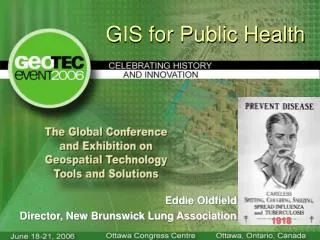
GIS and Health Communication. Dominic Popowich April 11, 2013. The History of GIS. GIS = Geographic Information Systems Developed in Canada in the 1960s to assist with the Canada Land Inventory With advances in technology, GIS has seen widespread adoption in many sectors

E N D
GIS and Health Communication Dominic PopowichApril 11, 2013
The History of GIS • GIS = Geographic Information Systems • Developed in Canada in the 1960s to assist with the Canada Land Inventory • With advances in technology, GIS has seen widespread adoption in many sectors • Commercial (e.g. Google Earth) • Government (e.g. land surveys) • Academic (e.g. health geography)
GIS and Public Health • Mapping for public health purposes goes back centuries (e.g. John Snow) • Effective tool for displaying and analyzing the geographic distribution of health outcomes • Disease surveillance • Spatial epidemiology
GIS for Health Communication • Interactive maps • Interactivity promotes public interest, but there is an increased risk of user error • Particularly useful when available online • Static maps • Useful when one wants to control the message • Maps should be comprehensible when taken out of context
GIS for Health Communication Source: http://www.cdc.gov/flu/weekly/WeeklyFluActivityMap.htm
GIS for CBPR • Toxic Avengers • High school students in Williamsburg/Greenpoint • Mapped local environmental hazards • Through making this map helped organize coalition (Community Alliance for the Environment) • Spurred collaboration on other environmental health issues • Using GIS to target health disparities
Advantages of GIS • There is an enormous amount of free GIS-ready data available online • One may link multiple datasets and perform various analyses on them • A well-made map can provide a concise summary of complex information • Quickly convey spatial trends in the data • Influence politicians and other policymakers • E.g. mapping at the scale of legislative districts
GIS Tools • Full software suites • ArcGIS • Quantum GIS (Open Source) • Free mapping tools • ArcGIS Explorer Online • GeoCommons
Creating a map in GeoCommons • Go to http://geocommons.com • Sign up by providing your name and email • Start mapping!…let’s work through an example.
Challenges of GIS • Map literacy • Ecological fallacy • Quality and compatibility of data • Understanding relational databases • Software usability GIS is just a tool, don’t get carried away!
Map Design • Five principles of map design • Visual contrast • Legibility • Figure-ground organization • Hierarchical organization • Balance • Well-designed maps and poorly-designed maps
Additional Resources • Map Design • ICA Commission on Map Design • Design a great map layout - Land Trust GIS • Cartographic Communication – University of Colorado • GIS for Public Health • Public Health GIS Resources - University of California, Berkeley • Mapping Health Statistics to Inform Policymakers and the Public • Data sources • Statistics Canada • CDC GIS Data Sources
References • Bell, S., Hoskins, R., Pickle, L., & Wartenberg, D. (2006). Current practices in spatial analysis of cancer data: Mapping health statistics to inform policymakers and the public. International Journal of Health Geographics, 5 (49), • Cashman, S., Adeky, S., Allen, A., Corburn, J., Israel, B., Montano, J., Rafelito, A., Rhodes, S., Swanston, S., Wallerstein, N., & Eng, E. (2008). The power and the promise: Working with communities to analyze data, interpret findings, and get to outcomes. American Journal of Public Health, 98 (8), 1407-1417. • Osborn, D., Hinkle, L., & Rosenthal, J. (2011). Using geographic information to target health disparities: State experience. Retrieved from http://www.hcup-us.ahrq.gov/reports/race/GeographicInfoIB.jsp. • Parrott, R., Hopfer, S., Ghetian, C., & Lengerich, E. (2007). Mapping as a visual health communication tool: promises and dilemmas. Health Communication, 22 (1), 13-24.