Download
1 / 22
240 likes | 513 Views
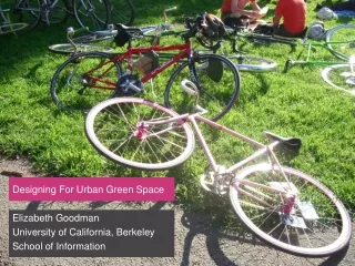
DSS for Planning and Design of Urban Green Space. Claudia Pelizaro Harry Timmermans. Urban Planning Group. Contents. Project’s background and objectives. System components Data Available What so far (Demonstration) Future developments. GreenSpace Project.

E N D
DSS for Planning and Design of Urban Green Space Claudia Pelizaro Harry Timmermans Urban Planning Group
Contents • Project’s background and objectives. • System components • Data Available • What so far (Demonstration) • Future developments
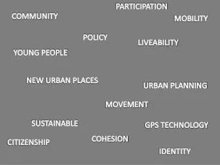
GreenSpace Project • Supported through the European Union's Fifth Framework under Key Action 4 "City of Tomorrow and Cultural Heritage" of the programme "Energy, Environment and Sustainable Development". • Aims to achieve active participation of policy makers and the public through innovative approaches to environmental evaluation.
Greenspace project’s Objectives • Advance the planning and design of all types of urban green space, highlighting the benefits that people derive from green areas in European Towns and Cities • Focus: people’s recreation
DSS and Tu/e • Objective: Develop Decision Support System to plan, design and maintain recreational green space (squares, parks, green corridors, waterfronts, recreation areas and nature reserves) in urban areas.
Set of models comprising the DSS • Database • Micro-simulation Model: observe and predict green activity patterns • MNL model • Activity-Scheduling model • Performance indicator Model: scenario evaluation
Database • Foundation of the DSS : • GIS component: integrate geographic data with other data from various sources, ex: survey data. • Offers systematical solutions to data handling problems(storage, retrieve, manipulation and display/report of spatial data) - inputto models and analysis programs ) • Database management system: study area / cells – data information has been structured and conveniently stored in the cell system
Study Area: - Cells; - Dataset over layer analysis;
Micro-Simulation Model • Discrete Choice model (MNL model): • Model based on observed choice made by individual • “The probability of individuals choosing a given option is a function of their socio-economic characteristics and the relative attractiveness of the option” • Attractiveness of alternatives are represented by the concept of utility (defined as what the individual seeks to maximize)
MNL model • Green activity individual data: “revealed preferences” utilities inferred from observations of choice behavior (cross-sectional data - only time independent explanatoryvariables) utilities are derived from alternatives’ characteristics and those of the individual. • Observable utility is usually a linear combination of variables • In order to predict if an alternative will be chosen, the value of its utility must be contrasted with those of all alternative options and transformed into a probability value between 0 and 1.
Activity-Based Model • Another model to predict the green activity patterns; • Predict which activities are conducted, where, when, for how long, with whom and the transport model involved. • Focus on people and their activities as opposed to spatial entities and spatial patterns
Activity Scheduling Model • Represents the decision making process involved in the activity patterns as opposed to the choice behavior hold by utility maximization theory • Time dependent explanatory variables - people adjusting their planned activity schedule as function of time is more relevant.
Performance Indicators Model • Scenario-based analysis (observed and predicted data) • Evaluation of indicators such as accessibility, equity (as function of total utility), total travel time. • Different plans could be evaluated on these criteria – how alternative plans would perform on the set of selected criteria (multi-criteria evaluation)
Design and Maintenance • Incorporated by: • Interface to allow one changing the attributes of the park (=design); • As a criteria (= maintenance cost)
Progress • Programming (C++ environment) • Data collection and preparation • Green activity questionnaire – data analysis in progress • Activity diary data coming soon • Data structuring (GIS component) – some progress has been done