Download
1 / 25
250 likes | 351 Views
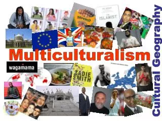
Geography 911: NeoGeography GIS 2.0 and Software Toolkits. Joshua S. Campbell – 23 February 2010. Biography. PhD Candidate GIS 2.0: Definition, Implications for Humanitarian Information Management, Disruptive Strategy for Implementation Built the Cyberinfrastructure system at KARS/KBS

E N D
Geography 911: NeoGeographyGIS 2.0 and Software Toolkits Joshua S. Campbell – 23 February 2010
Biography • PhD Candidate • GIS 2.0: Definition, Implications for Humanitarian Information Management, Disruptive Strategy for Implementation • Built the Cyberinfrastructure system at KARS/KBS • 4th year of the project • Web mapping core, metadata portal, dynamic HTML redesign • Humanitarian Intelligence Analyst • Humanitarian Information Unit (HIU), U.S. Department of State
NeoGeography • Does it really exist? • Began as an expression of Web 2.0 applied to maps • AJAX, JavaScript APIs, RSS • Craigslist mashup / Chicago Crime Maps * • Democratization of geographic tools • Web Developers discovered Geography… • What about Geographers discovering the Web?
What is Web 2.0? • “a transformative force that’s compelling companies across all industries towards a new way of doing business characterized by harnessingcollective intelligence, openness, and network effects” --Tim O’Reilly
What is a GIS? • A digital representation of the earth, structured to support analysis (Dobson, 2007) • Automated systems for the collection, storage, retrieval, analysis, and display of spatial data (Clarke, 1995) • Should also include dissemination • Composed on software, hardware, and people
GIS 2.0: A Reformulation • Free and Open Source Software • Web 2.0 philosophy • collective intelligence, network effects, openness • Internet as a platform • Open Standards • Interoperability
GIS 2.0: A Reformulation • Ubiquitous communication • Widespread wired and wireless networks (voice and data) • Device convergence • Mobile devices increasing in power and functionality • Phone, camera, GPS, form-based database input, cellular, wifi • Cloud computing • SaaS, PaaS, IaaS • Network-driven commoditization of IT
Open Street Map – Haiti Edits Video http://vimeo.com/9182869
GeoStacks • Process Driven • Neogeography • Capture • Produce • Communicate • Aggregate • Consume • GIS • Collect • Store / Retrieve • Analyze • Visualize • Disseminate • Essentially the same process • GIS + Web Publishing
GIS 2.0: Dissemination • Multiple tiers of users • Web mapping applications • . • GeoCommons Finder!
Geography 911 Project • Goal: Design and implement a neogeography application that allows users to access, input, and modify spatially relevant data on a map of the University of Kansas Lawrence campus. • Scope:... provides to the community the means to share geotagged content and geographic data from multiple locations in multiple formats on the internet. • Content and data can be uploaded into or embedded on individual layers then be displayed on a map of the Lawrence campus. • Examples of content may include photos, videos, text comments, vector-style locations (such as routes and “push-pins”), or user information
Project Architecture (Input) • How do people get data into the system? • Data Collection • On-screen digitize, SMS, email, forms • How to capture existing authoritative data? • RSS, geocode • Storage / Retrieval • Leverage geographic nature of data requires spatial data types • PostGIS::ArcSDE
Project Architecture (Output) • Once data is in the system, how do people interact with the information? • Visualize • Web Map Server (GeoServer, MapServer::ArcGIS Server) • Styling (SLD, MAP files::ArcMap) • Map Window (OpenLayers: :ESRI JavaScript or Flex, Google) • Widgets (GeoExt::ESRI JavaScript (Dojo) or Flex) • (Layers, Queries, Analysis, Draw tools…) • Base Layer Data (Open Street Map::ESRI, Google, Microsoft) • Storage / Retrieval • SQL statements for user queries • Spatial analysis functions intrinsic to spatial database
Project Architecture (Output) • Once data is in the system, how do people interact with the information? • Disseminate • Publish data in a several different formats • Web Services (OGC), KML, CSV, text…. • RSS, SMS, email updates