Download
1 / 37
370 likes | 473 Views
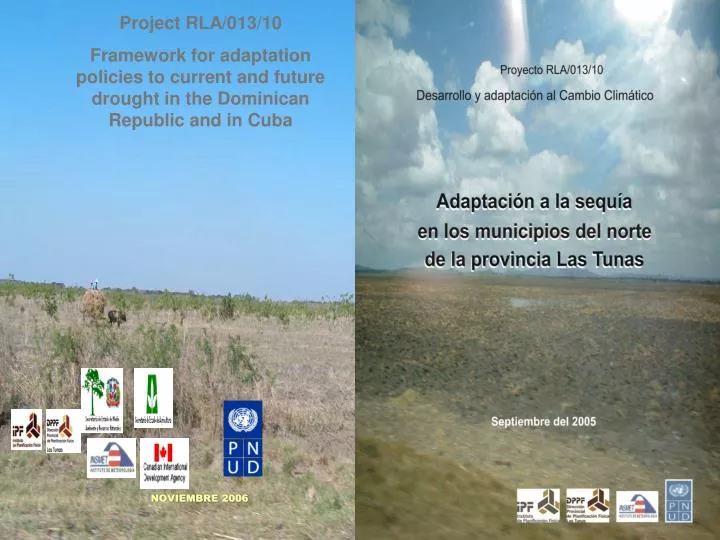
Project RLA/013/10 Framework for adaptation policies to current and future drought in the Dominican Republic and in Cuba. NOVIEMBRE 2006. To strengthen and facilitate adaptaton to drought by socio-economic sectors impacted by climate change and variablity

E N D
Project RLA/013/10 Framework for adaptation policies to current and future drought in the Dominican Republic and in Cuba NOVIEMBRE 2006
To strengthen and facilitate adaptaton to drought by socio-economic sectors impacted by climate change and variablity To propose and implement adaptation policies in local and regional territorial planning, with emphasis on the population and productive activities Objectives
Deforestation Inappropriate tecnology Improper use or contamination of water sources Improper use of soils Human intervention • Can increase drought severity 2. Can reduce its impact • Rationaluse of natural resources • Adaptation measures
Distribution of dry zones Affects: 14 % of the country, 1056 settlements (94% of them rural) and more than 1 million inhabitants dry Sub- humid Dry Sub-humid Annual precipitation <800mm <1000mmm Months of drought 9-11 8-10 evaporation 2000/2400mm >2400mm prec/evap. >60 >40 Source Ministry of Agriculture, 1995
Case study: CUBA LAS TUNAS PROVINCE MANATÍ PUERTO PADRE MUNICIPALITIES J. MENÉNDEZ
Area studied • 3 municipalities • Total surface 2 771 km2 • Total population of 180 000 inhabitants • Population density of 68 pp/km2 • 69 settlements > 500 inhabitants
Stages of the research ASSESSMENT SURVEY PROSPECTUS SCENARIOS FRAMEWORK FOR ADAPTATION POLICIES
1 Introduction 2 Objectives, scope, content, methodology 3 Survey design 4 Synthesis of the assessment 5 Results of the survey of farmers 6 Results of survey of the population 7 Survey results for key informants 8 Vulnerability of the agricultural sector V = I - A Vulnerability of the population 9 10 11 CHAPTER I CHAPTER II CHAPTER III Proposed adaptation measures for the current situation Proposed adaptation measures per future scenario CHAPTER IV
Socio-economic assessment of the province and the municipalities (Schema y master plans)
Water resources Situation: some dry reservoirs, others with low water accumulation Historical precipitation average diminishes from 1126 mm to 998 mm
Soil usage Natural potential Forestry tourism Average agricultural productivity Protected area Move from sugarcane to pastures forestry sugarcane Mixed crops pastures Bad drainage idle land Underground water Territorial Planning Studies, DPPF Las Tunas (Adaptation) Proposal for transformation Low agricultural productivity, salinity
ADAPTATION MEASURES IMPACTS CURRENT VULNERABILITY Conceptual model
Hypothesis The population’s response capacity depends on: • education level • extent of information that the population has on drought • Drought influences social vulnerability social in regard to: • housing conditions and typology • hygiene and sanitary conditions • overcrowding in housing • vectors • illnesses augmented by drought • Migration of the population to other territories is a reflection of: • soil degradation • water scarcity • lack of employment
Method of analysis: Survey Areas studied Selection of indicators primary survey (direct information from an informant - written or verbal) • Qualitative procedure, sample determined by expert judgement, based on soil usage and population distribution
Selected locations Proposal: Total to survey = 34 settlements, covering 49% of the area,2.3% of the population and 929 people interviewed Actual: 57 settlements and 940 people interviewed
Types of surveys: • concentrated housing • dispersed housing • farmer • key informant Individual interview • farmers Group interview • socio-economic sectors and scientific institutions (agriculture, environment, sanitation, health care) Open interview
Personal and community safety • Food security, health and economic problems • Environmental safety and public policies Variables
Workshops with the interviewers (very positive) • Training workshop for actors and interviewers • Workshop after survey data collected but before it was processed • Objectives were to gather views on the territory visited, perceptions of the drought impacts, solutions implemented to date and assistance provided by local governments and the population itself TALLERES
Vulnerability of the agricultural sector by People’s Councils (districts)
Vulnerability of the livestock farming sector by People’s Councils (districts)
Hypothetical scenarios allow for anticipatory actions to be undertaken in the present, to reduce future vulnerability to drought on the local level. Selection of 25 key variables Scenarios
Impact, vulnerability and adaptation matrix established: • Giving an order of priority to measures and actions identified • Existing facilities for their implementation
DROUGHT ADAPTATION Measures proposed WATER (26) SOILS (13) AGRICULTURE (26) LIVESTOCK (15) FORESTRY (15) BEE FARMING (6) POPULATION (16) HOUSING AND SETTLEMENTS (25) Total 142 Priority I - 95 Priority II - 25 Priority III - 22
Inter-disciplinary team with members from various institutions Dynamic testing conducted to validate the surveys The need for territorial baseline data Support from institutions and government at all stages of the project facilitated the training of actors and the implementation of results Training workshops held with various actors at different moments of the research project The alliance and joint work carried out between scientists from two fields (meterology and planning) enhanced the quality of the results obtained Selection of the area to be studied based on expert judgement and the appplication of the survey in the middle of a severe drought Lessons learned (positive)
The use of Geographic Information Systems (GIS) for spatial representation of the vulnerability and its components The use of scenario techniques (climatic, economic and social variables), the identification of existign strengths and barriers in order to arrive at a proposal for adaptation measures The research results allowed for the elaboration of specific project outlines for achieving adaptation in different time periods and affected territories Potential for application of this experience in other countries in the region with similar characteristics Incorporation of the results into the territorial planning