Download
1 / 21
210 likes | 324 Views
MDL Accomplishments and Plans: MOS, LAMP, EKDMOS, Storm Surge, AutoNowCaster , VLab NCEP Production Suite Review December 4, 2013. MOS FY14 Implementations. GFS-MOS cool season wind equations update (COMPLETED: 11/5) Pacific MOS ceiling height and sky cover (COMPLETED: 11/5)

E N D
MDL Accomplishments and Plans: MOS, LAMP, EKDMOS, Storm Surge, AutoNowCaster, VLab NCEP Production Suite Review December 4, 2013
MOS FY14 Implementations • GFS-MOS cool season wind equations update (COMPLETED: 11/5) • Pacific MOS ceiling height and sky cover (COMPLETED: 11/5) • GFS-MOS extended range (MEX) mean sky cover (COMPLETED: 11/5) • Add 216 stations to the Colorado Basin SHEF message • Add predominant weather, probabilistic QPF and precipitation type to GFS-based gridded MOS product suite for CONUS and Alaska • Extend GFS-based gridded MOS forecasts for CONUS and Alaska to day 10 • Implement station based ECMWF MOS into the NCEP production suite
FY14 Other MOS Activities • Generate (47/95 km) GFS archive in the GFS-MOS operational job stream • Perform evaluations of parallel NAM and GFS model data to access impact changes will have on the MOS guidance. • Remove all dependencies in operations on GRIB1 model data and convert all output to be GRIB2.
LAMP 2013 Accomplishments • Transitioned LAMP and Gridded LAMP systems to WCOSS • Provided experimental LAMP convection (new) and lightning (upgraded) gridded guidance for 60 day public comment period (Sept-Nov 2013). Comments have been positive, and we are working on handing the code off for implementation.
LAMP Implementations Planned for 2014-2015 • Implement LAMP convection and updated 2.5-km lightning guidance into NCEP’s parallel jobstream and experimental NDGD. February 2014. • Implement update to Gridded LAMP forecasts and observations for current elements of temperature, dewpoint, ceiling, and visibility and add sky cover operationally Summer 2014. • Provide experimental prototype guidance for improved LAMP convection, lightning, ceiling height, and visibility guidance Spring 2015. • Provide experimental prototype guidance for gridded LAMP and Gridded observations for winds, probabilities of ceiling height, visibility, and sky cover experimentally by Summer 2015.
Ensemble Kernel Density MOS (EKDMOS) Probabilistic forecast guidance from NAEFS (GEFS+CMCE) 11 probability levels (0.05, 0.10, 0.20, 0.30, 0.40, 0.50, 0.60, 0.70, 0.80, 0.90, 0.95) and ensemble mean. NDGD grids Operational elements Temperature (T), dew point (Td) Days 1-10 Daytime maximum temperature (MaxT), nighttime minimum temperature (MinT) Days 1-16
EKDMOS (Cont.) Experimental elements Apparent Temperature (AppT), Wind Speed (WSP) Days 1-10 Probabilistic Quantitative Precipitation Forecast (PQPF) 6-hr PQPF, Days 1-7 12-hr PQPF, Days 1-10 Current development Add ECMWF ensembles Use BMA to weight ensemble forecast systems Incorporate more Mesonet stations Include climatology information
SREF Winter Guidance (SWinG) • Supports LWX’s winter weather pilot project • Probabilistic guidance from the SREF ensembles • National Data Assimilation System (NDAS) used as proxy for truth • Use statistical post-processing techniques that can work with short developmental samples • Bayesian Model Averaging (BMA) • Use decaying averages instead of fixed sample size • Select predictands that reliably occur daily • Meteorological parameters vs.sensible weather • Re-use code where possible (SPC, BUFKIT) • Meteograms and text products are currently available at http://www.mdl.nws.noaa.gov/~BMA-SREF/BMAindex.php
Sample SWinG Meteograms • 2-M Surface temperature (C) • 850 mb Temperature (C) • 1000-500 mb Thickness (m) • 850-500 mb Thickness (m) • 1000-850 mb Thickness (m) • Red line: 50% chance of rain or snow occurrence for that particular location based on climatology captured from a sample of 10 cool seasons. • Blue line: Rule-of-thumb value for differentiating rain and snow
Sample SWinG Meteograms (cont) • 1000-700 mb Thickness (m) • Cobb Snow/Liquid Water Ratio • Czys Unconditional Precipitation Type • +/- Energy Conditional Precipitation Type
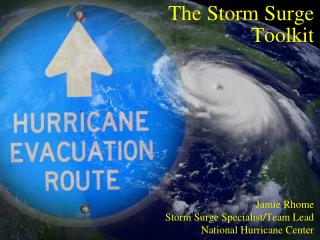
Extra-Tropical Storm Surge • Sandy Supplemental funding has enabled NWS to accelerate plans to improve extra-tropical storm surge modeling upgrades including: • Upgrading the Extra-Tropical Storm Surge (ETSS) (SLOSH based) model to provide overland inundation (based on surge + tide) for extra-tropical storms for the Gulf of Mexico and East Coast • Re-design the ETSS post processing system • Create Probabilistic Extra-Tropical Storm Surge (PETSS) by forcing the upgraded ETSS model with all 21 GFS ensemble members (scalable to include other ensemble model's members) • Alaska Region is providing OST/MDL with funds to hire a SLOSH basin developer for the Bering Sea/Arctic area.
Tropical Storm Surge • Recent enhancements to probabilistic storm surge (P-Surge) to go into operations for 2014 • Latest SLOSH basins • Incorporate tides • Provide above ground level guidance • Provide 6-hr temporal guidance • Sandy Supplemental funding has enabled NWS to accelerate plans to improve tropical storm surge modeling by enhancing P-Surge to: • Incorporate greater than 100-hr tracks • Allow it to handle sub-hurricane strength storms • Allow it handle two simultaneous storms • Develop products for Caribbean Basins
Thunderstorm AutoNowCaster (ANC) Implemented CONUS version of ANC using MRMS mosaic as radar input Tested and Evaluated at AWC’s 2013 Aviation Weather Testbed Summer Experiment 1-hour ANC Convective Initiation forecast highly rated by AWC Forecasters Developing plans to transition ANC to NCEP Operations
Radar Obs(dBZ) HRRR(dBZ) ANC Initiation 2106Z 2100Z 2106Z 2154Z 2206Z 2200Z 2324Z 2304Z 2300Z LAMP 2200Z 2300Z 2100Z
NWS Virtual Laboratory https://nws.weather.gov/innovate/ • The Virtual Laboratory (VLab) is a set of services and IT framework which enables NWS employees and their partners to share ideas, collaborate, engage in software development, and conduct applied research. • The Goal of VLab is to manage innovation, streamline O2R, and accelerate R2O in NOAA. • VLab provides NWS’s R&D partners with a clear and inexpensive path to operations.
Current and Future LAMP Work • MDL has begun investigating development of improved gridded convection guidance using new input sources of MRMS radar data and RAP/HRRR model data. • MDL will investigate practicality of 1-hr LAMP convection guidance for the very short-term. • MDL has begun investigating the use of new gridded sources of information to augment Gridded LAMP guidance of ceiling height and visibility. Potential sources of additional information are: • RAP/HRRR analysis/forecast grids • Experimental RTMA observation grids
EKDMOS Method • Use forward screening multiple linear regression with the NCEP's GEFS and CMCE’s ensemble means • Estimate error variance directly from the regression • Perform a second regression to obtain a spread-skill relationship • Apply equations to individual ensemble members and combine results with Kernel Density fitting • Gaussian kernel • Standard deviation produced by the regression • Apply a spread-skill relationship to calibrate the spread
SREF Elements • 2-M Surface Temperature* • 850 mb Temperature* • 1000 - 500 mb Thickness* • 850 - 700 mb Thickness • 1000 - 850 mb Thickness* • 1000 - 700 mb Thickness • Snow Liquid Equivalent (Cobb-Waldstreicher algorithm) • Czys Unconditional Precipitation Type • Positive/Negative Energy below freezing level *Station-specific 50% rain/snow climatology values are also displayed