Download
1 / 42
440 likes | 685 Views
Chapter 13. Urban Patterns. City VS. Country. Urban Geographers are interested in the where question at two scales. Geographers examine the global distribution of urban settlements Also interested in where people and activities are distributed within urban spaces

E N D
Chapter 13 Urban Patterns
City VS. Country • Urban Geographers are interested in the where question at two scales. • Geographers examine the global distribution of urban settlements • Also interested in where people and activities are distributed within urban spaces • Models explain why differences occur within urban
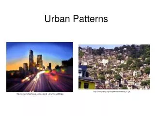
Urbanization: The process by which the population of cities grow • As recently as 1800, only 3% of the Earth’s population lived in cities. • Only one city in the world had a population of more than a million inhabitants. Which one? • London • 200 years later: • 50% of the earth’s population lives in cities • Nearly 400 cities have at least one million inhabitants • Urbanization has two dimensions • Increase in the number of people living in cities • Increase in the percentage of people living in cities
Ancient urbanization Urbanization dates back to the time of sedentary agriculture, but developed very slowly. Athens and Rome were important urban areas in the ancient world.
Urban areas begin to thrive… • During the middle ages
Great European cities Vienna Emerged in the 1400’s Prague Madrid
Spanish develop colonial cities • 1500’s in the Americas
Urbanization takes off in 18th century • Due to Industrial Revolution
LDC’s v. MDC’s • MDC’s have higher percentages of urban dwellers • LDC’s have larger number of people living in urban areas • These include 7 of the 10 most populous cities: Mexico City, Sao Paulo, and Seoul • These are megacities and are characterized by chaotic urban growth, pollution and poverty • Huge change from 100 years ago when 9 of the top 10 urban areas were in MDC’s
Built environment and social space • Nearly all countries have a political system that recognizes cities as legal entities with fixed boundaries. • In the US, a city that is surrounded by suburbs is sometimes called a central city • The central city and surrounding suburbs are together known as an urbanized area
Metropolitan Statistical Area (MSA) • According the the US Census Bureau • Metropolitan Statistical Areas… • Include a central city of at least 50,000 people, with high density adjacent counties where the majority of inhabitants work in non-agricultural jobs
Micropolitan Statistical area • Includes an urbanized area of between 10,000 and 50,000 inhabitants with adjacent counties tied to the city
Consolidated Metropolitan Statistical Area (CMSA) • Two or more adjacent MSAs with overlapping commuter patterns • Washington-Baltimore is a CMSA • Within a CMSA, an MSA that exceeds one million people may be classified as a Primary Metropolitan Area (PMSA)
Megalopolis • The metropolitan areas of the northeastern US now form one continuous urban complex or megalopolis (from the Greek word meaning “Great City”)
Comparative models of internal city structure • Concentric Zone Model was developed by Burgess, and describes cities that have concentric rings of urban land use emanating outward from a core or central business district (CBD) • The rings each contain different kinds of urban land use and residences become more high class further away from the CBD
The Sector Model • Developed in 1939 by Hoyt, who saw the city developing as a series of sectors rather than rings • Cities have numerous nodes of business and other urban land uses rather than one central core • The sectors often followed transportation lines • Hoyt and Burgess both claimed that social patterns in Chicago supported their model
Urbanization over the last 200 years • In MDC’s is a consequence of of rural to urban migration to work in factories and services • LDC’s also experienced more recent rural to urban migration in search of economic activities • Urban jobs are much less available in LDC’s
The Multiple Nuclei Model • Developed by Harris and Ullman • They believed that cities lack one central core, but instead have numerous nodes of business and cultural activities
Differences in cities • The models help geographers understand where different people live in urban areas and why they live there • Cities in MDCs as well as LDCs exhibit characteristics of these models, but no one city matches any model perfectly
Application of models • US Census Bureau divides urban areas into census tracts • These are essentially urban neighborhoods • In European cities wealthier people tend to live closer to the CBD, and there is more suburban poverty • Islamic cities, such as Mecca, were laid out surrounding a religious core
Latin American Cities • Griffin and Ford developed a model of a Latin American city which shows the wealthy living close to the CBD • Industrial sectors radiate out from the CBD • The poorest live on the urban fringe in squatter settlements • The latter are known by a variety of names such as barrios
Problems in the inner city • One of the major physical problems is filtering, which is when houses are subdivided and occupied by successive waves of lower-income people • It can lead to total abandonment • This has caused the inner cities to have a rapidly declining population • Redlining is when banks draw lines on a map to identify areas where they will refuse to loan money, although the Community Reinvestment Act has essentially made this illegal
Government revitalization plans • Called urban renewal • Helps to revitalize inner-city neighborhoods • Substandard inner-city housing is demolished and replaced with public housing for low-income people • Many of the high rise housing built in the 1950’s and 1960’s have been demolished • Most recently the trend has been to renovate deteriorating houses in the inner-city so that they will appeal to the middle-class • This process is known as gentrification
Suburban problems • North American Cities are increasingly following a structure that Harris calls the peripheral model • This consists of an inner city surrounded by growing suburbs that combine residential and business areas and are tied together by a beltway or ring road • Nodes of business and consumer services called edge cities have developed around the beltway • Edge cities have grown from suburbs that were originally primarily residential
Suburban Sprawl • In North American urban areas, the further one gets from the center of the city, there will be a decline in the density at which people live • This is called the density gradient • Suburban sprawl has increased at the expense of agricultural land • Several British cities are surrounded by greenbelts, or rings of open space to prevent suburban sprawl • Zoning ordinances, which prevent the mixing of land uses have resulted in segregated residential suburbs
Urban Sprawl • Has resulted in an increased dependence on transportation • Especially motor vehicles in the US • Public transportation is much more important in most European and Japanese cities • Public transportation in the form of rapid transit is becoming more common in the US, although it’s still not recognized as a key utility that needs to be subsidized
Political organization of urban areas • Many urban regional problems cannot be easily solved because of the fragmentation of local government. • There are 1,400 local governments in the NY area alone! • Most US metropolitan areas have a council of government, that can do some planning for the entire area • A federation system of government combines the various municipalities of a metropolitan area into a single government. Toronto, Miami and Indianapolis are all examples of this.
Smart Growth Limits suburban sprawl and preserves farmland on the urban periphery Maryland ranks among the top in the US for smart growth policies (Go us!)