Download
1 / 17
180 likes | 663 Views
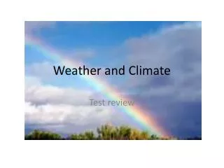
Weather and Climate at A2 Major climate controls : The structure of the atmosphere, the atmospheric heat budget, the general atmospheric circulation, planetary surface winds, latitude, oceanic circulation and altitude.

E N D
Weather and Climate at A2 Major climate controls: The structure of the atmosphere, the atmospheric heat budget, the general atmospheric circulation, planetary surface winds, latitude, oceanic circulation and altitude. The climate of the British Isles: Basic climatic characteristics: temperature, precipitation and wind. Air masses affecting the British Isles. Origin and nature of depressions. The Weather changes associated with depressions. Origin and nature of anticyclones. Associated weather conditions in winter and summer. Storm events: their occurrence, their impact and responses to them. One case study from within the last 30 years should be undertaken. The climate of one tropical region (tropical wet/ dry savanna or monsoon or equatorial): Basic climatic characteristics: temperature, precipitation and wind. The role of sub-tropical anticyclones and the ITCZ Tropical revolving storms. Their occurrence, their impact, management of the hazard and responses to the event. Two case studies of recent (within the last 30 years) tropical revolving storms should be undertaken from contrasting areas of the world. Climate on a local scale: Urban - the urban heat island effect. Precipitation: frequency and intensity, fogs, thunderstorms, and their relationship to urban areas Air quality: particulate pollution, photochemical smog and pollution reduction policies. Winds: the effects of urban structures and layout on variations in wind speed, direction and frequency Global climate change: Evidence for climatic change over the last 20 000 years. Global warming – possible causes. Possible effects: globally, on the chosen tropical region (above) and on the British Isles. Responses to global warming: international, national and local
Environmental lapse rate= decrease in temperature with altitude 6.4 degrees per 1km http://www.learner.org/courses/envsci/unit/text.php?unit=2&secNum=2
With the aid of a diagram, describe the structure of the atmosphere. (8 marks) Level 1 (1-4 marks) (Midpoint 3) Simple statements/annotations of the structure of the atmosphere. Naming of terms with no development; or one zone described well (likely to be the troposphere). A basic diagram. Level 2 (5-8 marks) (Midpoint 6) Detailed description of at least two zones within the atmosphere with some development of each. Recognition and description of three zones should achieve maximum credit. Accurate/detailed diagram. No diagram = maximum 6 marks.
Near the equator, from about 5° north and 5° south, the northeast trade winds and southeast trade winds converge in a low pressure zone known as the Intertropical Convergence Zone or ITCZ. Solar heating in the region forces air to rise through convection which results in high precipitation. The ITCZ is a key component of the global circulation system. The equatorial region lacks a dry season and is constantly hot and humid. The location of the ITCZ varies throughout the year and while it remains near the equator, the ITCZ over land ventures farther north or south than the ITCZ over the oceans due to the variation in land temperatures. The location of the ITCZ can vary as much as 40° to 45° of latitude north or south of the equator based on the pattern of land and ocean. In Africa, the ITCZ is located just south of the Sahel at about 10°, dumping rain on the region to the south of the desert. Also known as the doldrums by sailors due to the lack of horizontal air movement (the air simply rises with convection).. Or the Equatorial Convergence Zone or Intertropical Front.
Winds Wind is driven by the pressure gradient: air molecules move from areas of high to areas of low pressure
What else influences climate? • Latitude • Altitude • Continentality • Oceanic circulation
EL NINO AND LA NINA In normal, non-El Niño conditions (top panel of schematic diagram), the trade winds blow towards the west across the tropical Pacific. These winds pile up warm surface water in the west Pacific, so that the sea surface is about 1/2 meter higher at Indonesia than at Ecuador. The sea surface temperature is about 8 degrees C higher in the west, with cool temperatures off South America, due to an upwelling of cold water from deeper levels. This cold water is nutrient-rich, supporting high levels of primary productivity, diverse marine ecosystems, and major fisheries. Rainfall is found in rising air over the warmest water, and the east Pacific is relatively dry.
During El Niño, the trade winds relax in the central and western Pacific leading to a depression of the thermocline in the eastern Pacific, and an elevation of the thermocline in the west. This reduces the efficiency of upwelling to cool the surface and cut off the supply of nutrient rich thermocline water to the euphotic zone. The result is a rise in sea surface temperature and a drastic decline in primary productivity. Rainfall follows the warm water eastward, with associated flooding in Peru and drought in Indonesia and Australia. The eastward displacement of the atmospheric heat source overlaying the warmest water results in large changes in the global atmospheric circulation, which in turn force changes in weather in regions far removed from the tropical Pacific. (Europe)
http://www.cpc.ncep.noaa.gov/products/analysis_monitoring/ensostuff/ensoyears.shtmlhttp://www.cpc.ncep.noaa.gov/products/analysis_monitoring/ensostuff/ensoyears.shtml http://www.pmel.noaa.gov/tao/elnino/nino-home.html
Explain how each of altitude and oceanic circulation influence climate. (10 marks) Level 1 (1-4 marks)(Midpoint 3) Simple statements of influence of altitude and oceanic circulation on climate. No specific detail or elaboration is provided; or discussion of one aspect only. Level 2 (5-8 marks) (Midpoint 6) Both elements covered with specific or detailed statements of influence of altitude or oceanic circulation on climate; may be still an imbalance of influence. Level 3 (9-10 marks) (Midpoint 9) A fully developed answer, with good elaboration and explanation of a range of influences, with both elements reaching a Level 2 response. The answer demonstrates both breadth and depth of understanding There have been no other short mark questions on this section of the specification apart from the ones in this PowerPoint so will next year be the lucky year…
Weather Essay Questions • ‘The Earth has a fever, and the fever is rising…. We are what is wrong, and we must make it right.’ (Al Gore, 2007) In the context of global warming, discuss the extent to which you agree with this statement. (40 marks) • Large cities .... have their own climatic conditions.’ (Andrew Goudie) To what extent is this true? (40 marks) • Assess the relative roles of sub-tropical anticyclones and the inter-tropical convergence zone in creating the characteristic features of the climate of one tropical region that you have studied. (40 marks) • To what extent can preparedness and planning mitigate the effects of tropical revolving storms? (40 marks) • To what extent do urban areas modify their climate? (40 marks) • “Up and down, up and down – that is how temperature and climate have always gone in the past and there is no proof they are not still doing exactly the same now. In other words, climate change is an entirely natural phenomenon, nothing to do with the burning of fossil fuels.” David Bellamy Discuss the extent to which you agree with this statement. (40 marks)
To what extent is oceanic circulation the main driving force behind the Earth’s climate -40 marks • What are the key points? • What needs to be in your introduction? • What else do you need to cover? • ‘to what extent’ so…? • What will your conclusion be?