Download
1 / 39
390 likes | 568 Views
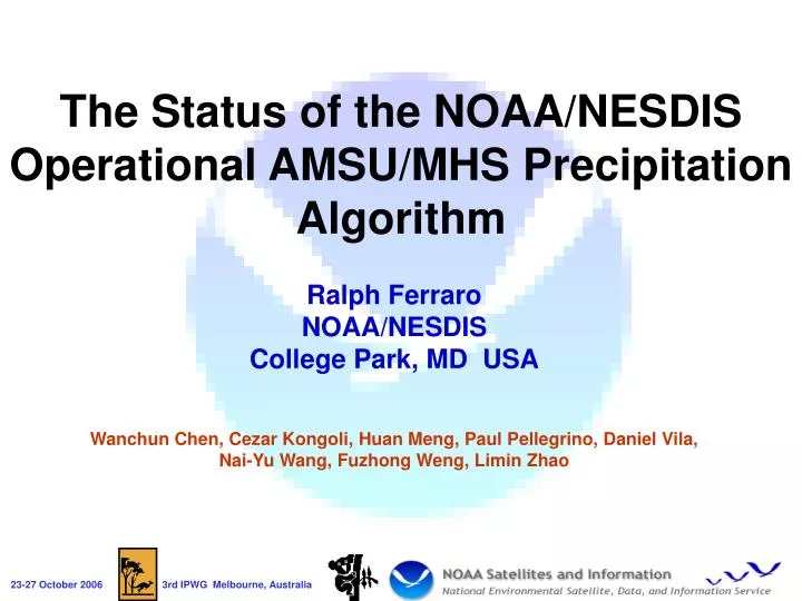
The Status of the NOAA/NESDIS Operational AMSU/MHS Precipitation Algorithm. Ralph Ferraro NOAA/NESDIS College Park, MD USA Wanchun Chen, Cezar Kongoli, Huan Meng, Paul Pellegrino, Daniel Vila, Nai-Yu Wang, Fuzhong Weng, Limin Zhao. Outline . Review of AMSU and operational algorithm

E N D
The Status of the NOAA/NESDIS Operational AMSU/MHS Precipitation Algorithm Ralph Ferraro NOAA/NESDIS College Park, MD USA Wanchun Chen, Cezar Kongoli, Huan Meng, Paul Pellegrino, Daniel Vila, Nai-Yu Wang, Fuzhong Weng, Limin Zhao 3rd IPWG Melbourne, Australia
Outline • Review of AMSU and operational algorithm • Recent changes • NOAA-18 • Coastlines • Upcoming Improvements • Ocean/emission rainfall • LZA bias removal • Snowfall rates • Future • METOP • NPP • MIRS 3rd IPWG Melbourne, Australia
NOAA AMSU Sensor • AMSU is a cross-track scanning radiometer (unlike SSM/I, AMSR-E, TMI) • AMSU-A (45 km nadir FOV) • 15 channels • 23, 31, 50 – 57 (13), 89 GHz • AMSU-B (15 km nadir FOV) • 89, 150, 183+1,3,7 GHz • MHS replaces AMSU-B on N-18 • 89, 157, 183+1,3, 190.3 GHz 3rd IPWG Melbourne, Australia
NOAA Produces Operational Products from AMSU 3rd IPWG Melbourne, Australia
Characteristics of the NOAA AMSU Rain Rate Algorithm • Physical retrieval of IWP and De – 89 & 150 GHz • Use of other window and sounding channels • Derive needed parameters for retrieval • Filters for possible ambiguous surfaces • Use of ancillary data & other AMSU derived products • IWP to RR based on limited CRM data and RTM • RR = A0 + A1*IWP + A2*IWP2 • 183 GHz bands used to identify deep convection • Use another set of ‘A’ coefficients • 50 GHz bands used to identify snowfall over land 3rd IPWG Melbourne, Australia
Example of Global Real Time Data 3rd IPWG Melbourne, Australia
Example of Regional Retrievals 3rd IPWG Melbourne, Australia
Example of Monthly Data 3rd IPWG Melbourne, Australia
Continuous monitoring of algorithm performance via IPWG validation sites 3rd IPWG Melbourne, Australia
Performance vs. GPCC (8/03 – 12/05) 3rd IPWG Melbourne, Australia
AMSU Summary/Limitations • Land • In general, performs well • Too high in convective situations • Regional biases (of course!), esp. too high in drier regimes • Better sensitivity to lighter rain rates • Falling snow detection (but not rates) • Ocean • Restricted to convective precipitation • Overall, low due to missing precipitation without ice (generally lighter rain intensities) • Rain coverage less than other sensors • Conditional rain rates too high • LZA bias in IWP • Coastlines • Not adequately handled • View angle dependencies • Larger FOV on scan edges results in varying rain rate distributions • Unrealistic PDF’s 3rd IPWG Melbourne, Australia
NOAA-18: MHS replaces AMSU-B • NOAA, DMSP and METOP will operate POES constellation • Changes include • Microwave Humidity Sounder (MHS) instead of AMSU-B • 157 GHz vs. 150; 190.3 GHz vs. 183+7 • MHS will fly on NOAA-N (18), -N’ and METOP (Successful launch 10/19) • Synthetic NOAA-N 150 and 183+7 GHz based on coincident measurements with NOAA-16 • Operational 29 Sep 2005 3rd IPWG Melbourne, Australia
Coastline Precipitation • Most passive MW algorithms fail miserably in coastal regions • Emissivity contrast between land and ocean • Different physics package • Imager approaches • “Extend” land algorithm to coasts • Bring in scattering rain types • “Correct” TB’s based on % of FOV filled with land • Computer expensive; used in regional approaches • Sounders • Utilize channels that are mainly insensitive to surface 3rd IPWG Melbourne, Australia
Improved AMSU Coastline Algorithm • Utilizes AMSU 53.6, 150, 183+1, 3 and 7 GHz to identify potential rain and a synthetic IWP along coastlines • Compute rain rate in same manner via IWP • Also updated land/sea/coast tag • Implemented into operations 7/31/06 • Substantially better retrievals with minimal false alarms 3rd IPWG Melbourne, Australia
OLD NEW RADAR 3rd IPWG Melbourne, Australia
Improvement of Oceanic Rain Rates and Removal of Angular BiasesDaniel Vila (details at his poster) • High oceanic bias attributed to unrealistic PDF’s • Function of LZA, problem traced to IWP retrieval • Corrected via adjustment with SSM/I PDF’s • Oceanic rain coverage low • Non-convergence of IWP/De algorithm in mostly light rain rates • Corrected by adding in emission component • Low bias at edge of scan due to large FOV 3rd IPWG Melbourne, Australia
Results – April 2005 Current AMSU Warm/shallow rain Reduced ocean rainfall Slight reduction over land Corrected AMSU SSM/I GPROF V6 3rd IPWG Melbourne, Australia
Zonal Mean Rain Frequency Significant improvement due to CLW Little change AMSU>SSMI due to 150 GHz 3rd IPWG Melbourne, Australia
Zonal Mean Rain Amount Corrected AMSU much closer to SSM/I • Reduction in rainfall amounts, mostly in convective zones 3rd IPWG Melbourne, Australia
Snowfall Rate Algorithm DevelopmentHuan Meng • Use RTM to retrieve IWP under snow condition • 1 layer & two-streams • Derive empirical equation connecting IWP with NEXRAD reflectivity • Adopt an existing reflectivity-snowfall rate equation • Derive snowfall rate from IWP 3rd IPWG Melbourne, Australia
Matching AMSU-B with Radar Data • WSR-88D radar reflectivity (Z) • Z is Quality controlled by QCNN (Quality Control Neural Network) algorithm • Use radar data from the lowest elevation (0.4º) and within 100 km. • Assume AMSU-B spatial sensitivity follows Gaussian function within an FOV when matching with radar data 3rd IPWG Melbourne, Australia
Retrieved AMSU IWP Corresponding NEXRAD Reflectivity 3rd IPWG Melbourne, Australia
Regression between IWP and Z • Data from 10 snow cases with 227 matching points • 3rd order fit between IWP and Z • = 0.48 3rd IPWG Melbourne, Australia
Choice of Z-R Relationship? 3rd IPWG Melbourne, Australia
Choice of Z-R Relationship (2) • Sekhon & Srivastava (1970) has the smallest RMS with the 1-hr-lag observation: Z = 398 R2.21 3rd IPWG Melbourne, Australia
Example of Snow Rate Retrieval Pro: Catch basic snowfall patterns Con: Miss snow or underestimate high snowfall rate 3rd IPWG Melbourne, Australia
Next Steps… • Use more realistic snow characteristics in the RTM • Explore approaches to classify snowfall type and utilize in snow rate retrieval. • Add more snow cases to improve the accuracy of IWP-Z regression. • Implement experimental retrievals for CONUS winter 2006-07 3rd IPWG Melbourne, Australia
Future for AMSU/MHS • Implement near term algorithm improvements • FOV biases • CLW component for ocean rain • Experimental snowfall rates over CONUS • Longer term • Improved AMSU physics package • “MIRS” – Microwave Integrated Retrieval System • Temperature and moisture sounding • Bayesian precipitation retrieval using O2 and H2O channels • Reprocessing of entire AMSU time series • Snowfall rates • Transition to operations • METOP-1 (Oct07) • Jan/Feb 2007? • Pipeline processing • Prepare for NPP/ATMS 3rd IPWG Melbourne, Australia
Backup Slides 3rd IPWG Melbourne, Australia
http://www.orbit.nesdis.noaa.gov/corp/scsb/mspps/ 3rd IPWG Melbourne, Australia
AMSU Climate Products shown in NatureMichael Evans, April 2006 3rd IPWG Melbourne, Australia
Falling Snow over Land from AMSU • Use of AMSU-B 183 GHz bands along with AMSU-A 53.6 GHz allows for expansion of current algorithm to over cold and snow covered surfaces: • AMSU-B channels allow for detection of scattering associated with precipitation, but surface blind when “sufficient moisture” exists • AMSU-A channel 5 allows for discrimination between “rain” and “snow” • Feature added in 11/03, snowfall detection only (assigned arbitrary rate of 0.1 mm/hr) • Validation over CONUS winter 2003-04 3rd IPWG Melbourne, Australia
Summary/Limitations • Algorithm Performance • Can detect snowfall associated with synoptic scale systems • Low false alarms • Can increase region of application by lowering TB54L threshold up to 5 K • Some increase in false alarms • Limitations • Relative moist atmospheres - -5 to 0 C • Southern extent of snow pack/temperate latitudes • Precip layer needs to extend to ~4-5 km or higher • No signal in extreme cold climate regimes and shallow snow 3rd IPWG Melbourne, Australia
Retrieving Ice Water Path Using Radiative Transfer Model • One-layer two-stream RTM (Yan & Weng, 2006, to be submitted to JGR) I: ice water path V: total precipitable water De: cloud particle effective diameter Ts: surface temperature A: derivatives of TBi over I, V, De, & Ts E: error matrix TBi: brightness temperatures at 23.8, 31.4, 89, 150, and 180±7 GHz • Use iteration scheme. Iteration stops if ΔTBi ≤ δi (i = 1, 5). • Adopt fast one-layer RTM to meet near real-time operational requirement. 3rd IPWG Melbourne, Australia
Choice of Z-R Empirical Eq – Cont’d • Observation Data: hourly snowfall observations from 12 weather stations • Highest correlation coefficient between retrieved R and snowfall observations with 1-hr lag: Retrieved R represents snow in the atmosphere because channel 183±7 GHz is sensitive to 600 – 700 mb.The time lag represents the time it takes the snow to fall to the ground. 3rd IPWG Melbourne, Australia
Application to AMSU Measurements Radar Reflectivity AMSU Precipitation Rates 2004 Nov 24 3rd IPWG Melbourne, Australia
The position of the peak in the histograms (systematic bias), is corrected performing a Gaussian PDF with µ (peak histogram position) and б (standard deviation of observed distribution) depending on LZA and latitude. For high rain rates, a linear correction scheme with the slope depending on SSM/I and AMSU-B footprint ratio is proposed to normalize AMSU-B derived rain rates. Unrealistic peak location Inability to retrieve high rain rates for large LZA 0-10 mm 10-30mm 3rd IPWG Melbourne, Australia
Adding Emission Component to Oceanic Rain RR vs. CLW: Proposed correction scheme Mean AMSU-B derived rain rate for different CLW values. CI is the convective index computed by using the three 183 GHz channels. Satellite: NOAA 15 - 60N-60S: Year: 2005. 3rd IPWG Melbourne, Australia
Results – April 2005 Monthly mean absolute bias (upper panel) and RMSE (bottom panel) for UNCORR and CORR algorithm compared with SSM/I GPROF V6.0 estimates for 2005. Mean rain rate of AMSU-B NOAA-15 operational derived rain rates (mm/day) (upper panel), corrected values (middle panel) and mean derived rain rates (mm/day) for SSM/I F-13 GPROF v6.0 for April 2005. 3rd IPWG Melbourne, Australia


![Background [1] Sources of Precipitation Information](https://cdn3.slideserve.com/5700776/slide1-dt.jpg)