Download

1 / 42
440 likes | 462 Views
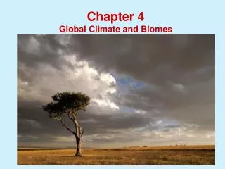
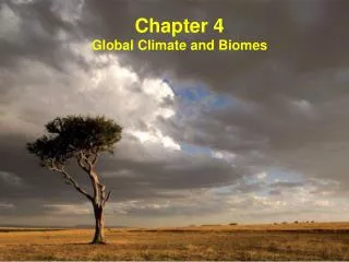
Climate and Biomes. What is a Biome?. Remember that an ecosystem consists of all the biotic and abiotic factors interacting in a place. Biomes are ecosystems with similar biotic and abiotic characteristics. What is a Biome?.

E N D
What is a Biome? Remember that an ecosystem consists of all the biotic and abiotic factors interacting in a place. Biomes are ecosystems with similar biotic and abiotic characteristics.
What is a Biome? The different biomes can be spread around the globe, but similar biomes tend to be located in areas with similar climate and other abiotic characteristics.
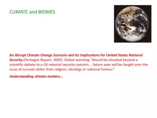
One of the main abiotic factors that distinguish different biomes is their climate. Climate: the average weather conditions in an area over an extended period of time. (e.g., temperature, precipitation, seasons, etc)
Climate is different than weather. Weather: the day to day changes in temperature, precipitation, wind, etc. Weather is hard to predict, but climates are generally stable and predictable.
Why do we have so many different climates around the world? A region’s climate is determined by many factors including latitude, altitude, topography, the tilt and rotation of the Earth, convection currents in the atmosphere and oceans, and seasonal changes.
One of the main factors that determines a region’s climate is its latitude. Latitude: a measure of a place’s distance North or South of the Equator.
Latitude ranges from 0o at the equator, to 90o at the poles. Latitude is actually a measurement of the angle from the center of the Earth to a point on its surface, relative to the Equator.
In general, as latitude increases temperaturedecreases. For example, Juneau, Alaska (58o N) has a much colder climate than Miami, Florida (28o N).
Temperatures differ between latitudes because the Earth is a sphere. Sunlight that strikes the equator (low latitude) is very concentrated, delivering a lot of heat to a small area. The same amount of sunlight striking near the arctic circle (high latitude) is spread out over a larger area and that area therefore receives less heat.
Because of this fact, the globe can be divided into 5 climatic zones: • The North Polar Zone (The Arctic) • The North Temperate Zone • The Tropics • The South Temperate Zone • The South Polar Zone (Antarctic)
The Polar zones (AKA the Frigid Latitudes) range from 66.5o-90o (both North and South). The Polar zones are the coldest areas on Earth.
The Polar zones are defined as those latitudes where the sun does not set for at least one 24 hour period per year.
This phenomenon occurs on the solstices and is known as the midnight sun.
The Temperate zones (AKA the Tepid Latitudes) range from 23.5o-66.5o (both North and South) The Temperate zones have a high degree of seasonal variation and diverse climates, from relatively warm conditions in the lower latitudes, to sub-arctic conditions in the higher latitudes.
The Subtropicslie within the temperate zones at latitudes below 38o (both North and South) In general, climate in the subtropics is much warmer and has less seasonal variation than the rest of the temperate zones. Many of the world’s deserts are located at subtropical latitudes.
The Tropics(AKA the Torrid Latitudes) range from 23.5o N (the Tropic of Cancer) to 23.5o S (the Tropic of Capricorn) The tropics are the warmest areas of Earth and have little to no seasonal variation in temperature (although some areas have wet and dry seasons).
The tropics are defined as those latitudes where the sun passes directly overhead on at least one day per year.
Tropical regions near the Equator have abundant precipitation year round, making it possible for tropical rainforests to thrive.
The Earth is not only spherical, it is also tilted on its axis. Axis: an imaginary line running through the North and South Poles. The Earth rotates on its axis from West to East.
Seasons change as the Earth orbits the sun because of this axial tilt. Depending on the time of year, either the Northern or Southern Hemisphere will be tilted in the direction of the sun and receive more light. More sunlight means longer days and warmer weather.
On the Winter Solstice(December 21) the sun shines directly above the Tropic of Capricorn and we have the shortest day in the Northern Hemisphere.
On the Summer Solstice(June 21) the sun shines directly above the Tropic of Cancer and we have the longest day in the Northern Hemisphere.
During the Vernal (spring) Equinox(March 21) and Autumnal (fall) Equinox(September 22) the Northern and Southern Hemispheres receive equal light. On the equinoxes, the sun shines directly above the equator and day and night are of relatively equal length in both hemispheres.
Between March and September, the Northern Hemisphere receives more light, and hence we have the seasons of spring and summer.
Between September and March, the Southern Hemisphere receives more light, and hence we have the seasons of fall and winter.
Climate also includes precipitation. Precipitation: condensed water that falls from clouds (usually as rain or snow). Precipitation usually occurs where warm, moist air meets cooler air.
Convection is important to understanding precipitation. Convection: the phenomenon where warmer, less dense fluids (both liquids and gases) rise and colder, more dense fluids sink. Convection causes convection currents that transfer heat energy through water and air.
Warmer air also spreads out from the equator towards the poles as cooler air from the poles moves towards the equator. This explains why precipitation occurs in predictable bands of latitude.
Near the Equator, masses of warm, moist air continually rise and form abundant precipitation. Around 30o latitude (the “horse latitudes”), dry air descends, absorbing moisture and resulting in dry conditions and little precipitation. Many of the world’s deserts occur at these latitudes.
On either side of 30o latitude in the subtropics, distinct wet and dry seasons occur. In the temperate zones, warmer air from the subtropical regions meets cooler air from the polar regions and there is precipitation in all seasons.
Finally, cool air descends at the polar regions and they receive little precipitation.
Convection also causes ocean currents to form in water as cooler water near the poles sinks and is replaced by warm water flowing from the Equator. Ocean Currents: are continuous, directed movements of ocean water that can regionally affect climate.
The climate of an area is also influenced by its topography. Topography: the surface features of an area (elevation changes due to hills, canyons, cliffs, etc)
Altitudeis one aspect of topography that influences climate. Altitude: a measure of distance above sea level. Altitude is also known as elevation.
As altitude increases, temperature decreases. This is because the thin, lower pressure air at higher elevations can carry less heat. (The less dense air at high altitudes also has less Oxygen, making it more difficult to breathe and exert yourself)
Increasing altitude has a similar effect on ecosystems as increasing latitude. Areas at higher elevations are colder and may have different biomes than lower elevations at the same latitude.
This effect is most dramatic in the Andes Mountains of South America near the equator. Here there are tropical rainforests at the lowest elevations and snow capped peaks similar to polar ice at the highest elevations over 6,000 meters.
Topography can also affect precipitation. When winds blow moist air up the side of a mountain, the air cools as it rises and releases precipitation. This creates a rain shadow on the other side of the mountain.
Rainshadow: the dry, leeward side of a mountain that receives little precipitation Windward: the side of a mountain the wind blows towards Leeward: the side of a mountain the wind blow away from Many deserts form in the rain shadow of mountain ranges.
One way to quantify the effects of climate on the biotic characteristics of biomes is to measure Net Primary Productivity. Net Primary Productivity: The amount of biomass remaining after cellular respiration. NPP is a way of measuring how much life an ecosystem supports.
In general, biomes in warmer, wetter climates have higher NPP and greater biodiversity than colder, drier climates. This is because all organisms require water and more species are adapted to warm conditions than to cold conditions.