Download
1 / 38
380 likes | 485 Views
Opportunity & Asset Mapping Webinar. Opportunity Mapping Technical Assistance Webinar

E N D
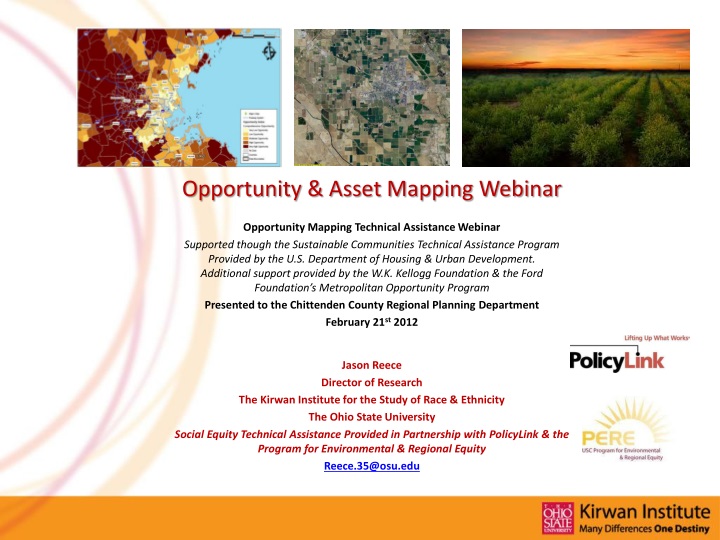
Opportunity & Asset Mapping Webinar Opportunity Mapping Technical Assistance Webinar Supported though the Sustainable Communities Technical Assistance Program Provided by the U.S. Department of Housing & Urban Development. Additional support provided by the W.K. Kellogg Foundation & the Ford Foundation’s Metropolitan Opportunity Program Presented to the Chittenden County Regional Planning Department February 21st 2012 Jason Reece Director of Research TheKirwan Institute for the Study of Race & Ethnicity The Ohio State University Social Equity Technical Assistance Provided in Partnership with PolicyLink & the Program for Environmental & Regional Equity Reece.35@osu.edu
Opportunity “Biologists often talk about the “ecology” of an organism: the tallest oak in the forest is the tallest not just because it grew from the hardies acorn; it is the tallest also because no other trees blocked its sunlight, the soil around it was deep and rich, no rabbit chewed through its bark as a sapling, and no lumberjack cut it down before it matured. We all know that successful people come from hardy seeds. But do we know enough about the sunlight that warmed them, the soil in which they put down roots, and the rabbits and lumberjacks they were lucky enough to avoid?” • Malcolm Gladwell “Outliers”
Community & Access to Opportunity: Profound Impacts on Human Development, Health & Well Being
Development of Our Opportunity Community Model and Opportunity Mapping
Previous Opportunity Mapping Projects • Chicago (2004) (Leadership Council for Metropolitan Open Communities) • Baltimore, MD (2005) (Thompson v. HUD – MD ACLU) • New Orleans (2005) • Cleveland (2006) (Presidents Council of Cleveland) • Austin, TX (2007) (Green Doors) • African American Male Study (six region study) (2007) (W.K. Kellogg Foundation) • Atlanta, Chicago, Detroit, Houston, Los Angeles, New York • Detroit, MI (2008) (MI Roundtable) • Massachusetts (2009) MA Law Reform Institute • Connecticut (2009) CT Fair Housing Center • New Orleans (2009) (Greater New Orleans Fair Housing Center) • Miami, Jacksonville, Orlando and Tampa Bay, FL (2009) (Miami Workers Centers) • State of Ohio (2010) State of Black Ohio Research Initiative • Seattle, WA (2010) (Northwest Justice Project) • Portland, OR (2010) (Urban League) • California (Multiple Sites) (2010) (The California Endowment) • Jacksonville, FL (2011) (The Jacksonville Children’s Commission) • San Francisco Bay Region (2011) • Merced County, CA (2011) (The California Endowment) • Gulf Coast of Mississippi (2011) (Gulf Regional Planning Commission) • Galveston, TX (2011) • Columbus, OH (2011) (Columbus Community Development Collaborative) • Greater New Orleans (Greater New Orleans Foundation)
Why use mapping to support community advocacy? • Internal Capacity Building • Creating a “common space” for dialogue and group learning • To provide an entry point for starting consensus building or collaborative discussions among diverse stakeholders • Developing collective narratives about “place” • To target resources and build internal capacity • To provide a local resource to identify areas of greatest need in communities and assess “gaps” where need is not being met by on-going advocacy efforts, local initiatives, investments or policy initiatives. • To help build local organizational capacity in understanding opportunity challenges and needs
Why use mapping to support community advocacy? • External Capacity Building • Raising awareness (building external capacity) • To raise attention and awareness • To identify solutions to remedy barriers to opportunity • To call for systems change from various stakeholders
Impact “From an institutional perspective, involvement with this project has required us as an organization to reach out to potential partners we have not interacted with before. We have developed relationships with organizations working on issues such as smart growth, health disparities and education which have helped to inform and direct our fair housing work.” • -Erin Boggs, Deputy Director, Connecticut Fair Housing Center “We have program outcome data on every program we fund, but we have never had a way to show impact upon a population or neighborhood. Opportunity mapping is a powerful tool that demonstrates the value of our work in a graphic and easy to understand way….our city budget continues to shrink but as we go forward we’ll be working on ways to refocus some of our investments.” • -Linda Lanier, Executive Director/CEO, Jacksonville Children’s Commission
Impact “Within legal services, the mapping data is the foundation for a new place-based advocacy that seeks to bring intensive and comprehensive legal resources and social services to change outcomes in several low-opportunity zip codes or neighborhoods.” • -Fran Fajana, Director of the Race Equity Project, Massachusetts Law Reform Institute “The story of how our maps were created resembles the children’s story Stone Soup, in which a hungry community started out with nothing but a pot of water with stones and ended up with a rich soup that fed everyone because each person contributed something. Creating these maps was a community building experience that promises to have benefits that go beyond the maps themselves.” • –Andree Tremoulet, Ph.D. Housing Services Specialist, Washington County, OR, Department of Community Development
Our Disclaimers • We must use census geographies to represent neighborhoods or communities (these are not always accurate representations) • The opportunity index shows the relative distribution of how places along the coast rank in comparison to each other on a number of data based indicators • The map and the index only represents what the indicators utilized and data collected presents – interpretation and use of the map must be a locally driven activity • Data cannot capture everything, but we use as much data as we can gather to represent conditions
Opportunity Mapping & SCI • The U.S. Department of Housing and Urban Development has developed a national opportunity index, measuring conditions along the Gulf Coast (its mandatory to use an opportunity index in sustainable communities planning activities) • We have been working with the local consortiums in several SCI regions to develop a locally created opportunity index, to better represent the local input, to generate a more accurate opportunity map and to realize capacity building and engagement benefits from the process • Opportunity to utilize HUD data with other local data to create a robust opportunity map
How do you map opportunity?(Technical Perspective) • Step 1: Selecting indicators • Multiple indicators clustered around particular opportunity topics (education, economy, health and safety etc.) • Step 2: Locating data • Step 3: Analyzing the data and created a composite map for each opportunity topic • Step 4: Combining all the topical maps to create a final opportunity map
Identifying and Selecting Indicators of High and Low Opportunity • Established by input from Kirwan Institute and direction from the local steering committee • Based on certain factors • Specific issues or concerns of the region • Research literature validating the connection between indicator and opportunity • Central Requirement: • Is there a clear connection between indicator and opportunity? E.g. Proximity to parks and Health related opportunity
Mapping Communities of Opportunity: Methods and Indicators • How do you map opportunity? • Data representing community conditions was gathered for neighborhood (census tracts) across the region • Data for all indicators of community conditions was aggregated to the census tract level and analyzed to create a comprehensive opportunity index for the census tracts (neighborhoods) throughout the region • Significant geoprocessing involved • Geographic transformation • No weighting of variables (although indicators are analyzed in three separate categories – and these are averaged) • The opportunity index is then mapped and census tracts are broken into quintiles based on their opportunity score • Very Low, Low, Moderate, High, Very High • 1/5 of tracts clustered into each category based on final opportunity score
Methodology:Calculating Z Scores • Z Score – a statistical measure that quantifies the distance (measured in standard deviations) between data points and the mean Z Score = (Data point – Mean)/ Standard Deviation • Allows data for a geography (e.g. census tract) to be measured based on their relative distance from the average for the entire region • Raw z score performance • Mean value is always “zero” – z score indicates distance from the mean • Positive z score is always above the region’s mean, Negative z score is always below the region’s mean • Indicators with negative effect on opportunity should have all the z scores adjusted to reflect this phenomena
Methodology:Calculating Opportunity using Z Scores • Final “opportunity index” for each census tract is the average of z scores (including adjusted scores for direction) for all indicators by category • Census tracts can be ranked • Opportunity level is determined by sorting a region’s census tract z scores into ordered categories (very low, low, moderate, high, very high) • Statistical measure • Grounded in Social Science research • Most intuitive but other measures can be used • Example • Top 20% can be categorized as very high, bottom 20% - very low
Methodology:Averaging Z scores • Z score averages assume equal participation of all variables toward “Opportunity Index” calculations • No basis to provide unequal weights • Issue of weighting should be considered carefully • Need to have a strong rationale for weighting • Theoretical support would be helpful • Arbitrary weighting could skew the results
Opportunity Index & Indicators(Example from an SCI project) Comprehensive Opportunity Index
Opportunity Indicators and Development of the Opportunity Map Comprehensive Opportunity Map: Representing Five Sub-Index Maps (And 22+ Individual Indicators)
How do you map opportunity?(Process Perspective) • A hybrid of data driven analysis and mapping combined with extensive community and stakeholder engagement • Various ways to engage stakeholders and the public • Driven by a locally led advisory group (who can act as data liaisons, assist in “ground truthing” maps, and in designing analysis) • Stakeholder or community participatory forums • Outreach to media and communications • Use of online interactive mapping tools • We also sometimes supplement the analysis with asset mapping and trend analysis (understanding shifts in opportunity in the regional landscape) • Working with SCI consortiums we have prepared specialized indicators which have emerged out of committee work related to the sustainability planning process
Linking Mapping, Data & Capacity Building to Understand and Support Food Security in Mississippi
Linking Mapping, Data & Capacity Building to Understand and Support Food Security in Mississippi
Methodology Issues/Concerns for this Effort • Indicator selection • …and relevance to your community (buy in from consortium on indicators used) • Geographic scale (slightly different approach for more rural communities) • Process is critical – engagement and local buy in • Painful geographies! • Schools – one of the most important domains to analyze but always difficult to assess • Working with upcoming HUD data – integrating your work with HUD analysis • Supplement data (consider participatory mapping and other subtopic analysis – which can work its way back into the map)
Considerations in Rural Areas • Need to go deeper in respect to units of geographic analysis • Block groups or blocks • Indicators and analysis should reflect the unique rural characteristics of the community • More data challenges with ACS and margins of error with traditional census data • Smaller geographies allow the possibility to do creative and important participatory work and local data collection
Want to Learn More?Resources & Reference Materials • Mapping for Social Justice • The Kirwan Institute Study: • Utilizing GIS to Support Advocacy and Social Justice • More on Opportunity Mapping • The Kirwan Institute Reports • Communities of Opportunity: A Framework for an Equitable & Sustainable Future • The Geography of Opportunity: A Review of Opportunity Mapping Research Initiatives • All Available on-line at: kirwaninstitute.org
Want to Learn More?Resources & Reference Materials • Mapping & Advocacy – Two recent articles from Clearinghouse Review • Jason Reece and Eric Schultheis. Poverty’s Place: The Use of Geographic Information Systems in Poverty Advocacy. Clearinghouse Review Journal of Poverty Law and Policy. January-February 2009. • Maya Roy and Jason Reece. Poverty’s Place Revisited: Mapping for Justice & Democratizing Data to Combat Poverty. Clearinghouse Review Journal of Poverty Law and Policy. July/August 2010. • To access, visit Clearinghouse Review at: • www.povertylaw.org/clearinghouse-review