Download
1 / 31
310 likes | 435 Views
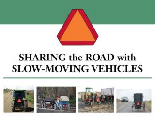
基於救難車行踪偵測之迴避引導系統 Avoiding guiding system for emergency vehicles with GPS and moving prediction. Adviser : 柯開維教授 Speaker : 張文諸. Outline. Introduction System Architecture System Design Conclusion Demo. Introduction. 大多數的 GPS 定位系統應用在車輛的定位與導航上,且都只有單向傳輸系統,這樣的應用很有限 。

E N D
基於救難車行踪偵測之迴避引導系統Avoiding guiding system for emergency vehicles with GPS and moving prediction Adviser :柯開維教授 Speaker :張文諸
Outline • Introduction • System Architecture • System Design • Conclusion • Demo
Introduction • 大多數的GPS定位系統應用在車輛的定位與導航上,且都只有單向傳輸系統,這樣的應用很有限。 • 使用GPS搭配手機行動通訊網路,建置一套完整的LBS系統。 • 使得用路人能明確知道救難車的位置,並提供迴避警示,達到兩方的車輛都能在安全且快速的交通上行駛。
Introduction 系統道路示意圖
Introduction • GPS 取得目前自己的位置、方向、速度及時間。 • 行動可攜裝置 智慧型手機Android 平台。 • 行動通訊 GPRS、3G及WiMAX。
System Architecture • VLR 視為一個Server端,提供系統登錄資訊。當登錄時增加資料欄位,並向HLR記錄資訊。 • HLR 記錄資訊,提供車輛location management與handoff management服務。
System Architecture HLR與VLR運作圖
System Architecture • Server功能 • 維護Client服務範圍 • 發佈救難車位置資訊訊息 • 一般Client • 判斷救難車距離、行進方向給予迴避警示 • Show 出兩者間地圖 • 語音播報 • 特殊Client • 傳送位置相關資訊
System Design • Server Android 用戶端 Web 伺服器 MySQL 資料庫 Server運作圖
System Design • 欄位 • 一般使用者 • 救難車使用者
System Design • GPS格式 • $GPGGA,161229.487,2423.2475,N,12158.3416,W,1,07,1.0,9.0,M, , , ,0000*18 GPS格式輸出表
System Design • 方向之取得 GPS每隔一秒更新一次當前地點資訊,每一點的座標和上一點的座標一比較,就可以知道前進的方向。
System Design N W E 。 。 180 0 S 判斷θ角度
System Design • 速度之取得 兩點位置求距離 Latitude 1:起點緯度 Longitude 1:起點經度 Latitude 2:終點緯度 Longitude 2:終點經度 R:6378.7(km)(地球半徑)
System Design • 球體兩點距離公式 • 速度 v = d / t
System Design • 距離之判斷 當收到緊急救難車座標資訊時,必須先對本車與緊急救難車兩車之間的距離做出判斷,我們以1公里為有效距離。800公尺、500公尺、300公尺、100公尺內做報區隔。
System Design • 行進方向之判斷 救難車的行進方向,與本車行進方向是否相等,加上記錄上一次兩者的距離與這次距離做比對,兩者距離越來越靠近則屬於此案例。 擋住之前車示意圖
System Design • 將交會之車輛 記錄上一次兩者的距離與這次距離做比對後越來越靠近;且兩者行進方向不為反方向,代表不是對向車道且越來越近者,屬於此案例。再依兩者座標之△X與△Y之關係,判別左相會與右相會之來車。 將相會之車輛示意圖
System Design • 不必處理車輛 對向之車輛 不會相會之車輛
System Design • 時間補償距離修正 補償距離修正示意圖
System Design • 假設T為本車定位時間與由Server端傳送之緊急救難車之定位時間差。 • V為由Server端傳送緊急救難車之車速。 • B為緊急救難車行走距離。 • D為兩車算出之距離。 • D’為實際距離。
System Design • B為救難車之車速乘以網路傳輸所需的時間。 • 在同方向沒有角度情況下可算出以下公式。 行進同方向距離修正
System Design 將相會之左側車輛 將相會之右側車輛
System Design • 救難車之行進方向與本車之行進方向夾角θ,再算出B代入下列公式算出D’實際距離。
System Design • 我們也設計一套公式去判斷漸行漸遠的車輛 漸行漸遠之車輛
Conclusion • 我們建置了一套系統,利用GPS衛星定位與透過行動通訊的傳輸,達到行踪偵測救難車的位置,提供給其他駕駛人參考作迴避警示。 • 本系統雖然可以行踪偵測救難車的位置,並提供其他駕駛人迴避警示。但這算是單向傳輸,如果可以達到雙向傳輸,當駕駛人把雍塞路段告知這些緊急的救難車,讓救難車在規劃路徑時做為參考,避開目前雍塞的路段,則整個系統運作將更為完善。
Demo • 展示影片