Download
1 / 21
210 likes | 319 Views
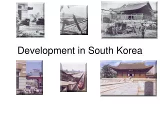
Development of GI Policy in South Korea. 2013. 9. 26. Byongnam Choe KRIHS. E-mail : bnchoe@krihs.re.kr. Contents. Introduction NGIS Master Plans Development of GI Policy Concluding Remarks. Introduction. History of GI Production. Cadastral map (1912). Topographic map (1/25000).

E N D
Development of GI Policy in South Korea 2013. 9. 26. Byongnam Choe KRIHS E-mail : bnchoe@krihs.re.kr
Contents Introduction NGIS Master Plans Development of GI Policy Concluding Remarks
History of GI Production Cadastral map (1912) Topographic map (1/25000) Land Survey Project NGIS project 1861 1910 1946 1965 1995 1974 Topographic map (1/5000) Topographic maps produced by U.S Army Dadongyeojido Digital map
Dadongyeojido • Measure on foot (Chosun Dynasty) Map Legend 3.8m • Producer: Jungho Kim • Year: 1861 • Measurement method: on foot • Scale: 1:216,000 • Printing: Woodblock printing • No. of woodblocks : 121 • Entire size: 3.8mX6.7m • Map Books of 22 volumes. • Size of the book: 20cmX30cm 6.7m 48km 32km Source : 문경옛길박물관
: The National 2002 - : The 3rd / 4th 1987-96 1996-02 1st/2nd : The 1st/2nd Government Informatization Project E-government Project Computerization Project - Informatization of business process - Enforcement of e - government service - Digitalization of administrative data - Definition of core national service areas - Development of ubiquitous computing - Electronic issue of civil service document 2004 - : I T 839 Strategy - Strategies for developing IT industry 1989 : Road Facility Register(Taegu) : 1990 Water Supply Facility(Gwangju) - Digitalization of spatial data(map) Stages of National Informatization 1990s First decade of 21st 1980s • INFORMATIZATION • S/W, Data • Business process • Many users within organization • Convergence • Information service • Inward and outward service • Citizen and business • COMPUTERIZATION • Hardware • Unit task • Limited users within department 1980s Non- spatial Spatial : st nd 1995-00 The 1 NGIS Project 2001-05 : The 2 NGIS Project - Informatization based on spatial data - Internet information service to the public - Digitalization of spatial data(map) rd 2006-09 : The 3 NGIS Project - Information service based on spatial data
Backgrounds ofNGIS • A few local governments & public organizations used GIS in the early 90’s • => Data duplication, difficulty in sharing data • Issues such as environment pollution, infrastructure deterioration, natural disaster, and accident • => LNG explosions in ‘94.12 and ‘95.4 • => Lowered national competitiveness • Insufficient technological capability of the private sector • => Government-led investments for GIS applications
Milestones of NGIS Projects • 1995. 5 : the 1st NGIS Master Plan • 1995 – 2000 : The creation stage of GIS bases • 2000. 1 : Enactment of the NGIS Law • Projected Investment (billion KRW) : 278.7 • 2000. 12 : the 2nd NGIS Master Plan • 2001 – 2005 : The spread stage of GIS applications • Projected Investment (billion KRW) : 455.0 • 2005. 12 : the 3rd NGIS Master Plan • 2006 – 2010 : The advanced stage of GIS applications • 2008. 5 : Enlargement from 1 Department to 4 • 2009. 5 Enactment of the NSDI Law • Projected Investment (billion KRW) : 1,394.0 • 2010. : the 4th NGIS Master Plan
Summary of NGIS Projects Underground facility information management system(1996 - ) Land management information system(1998 - ) Korea land information system(2004 - ) Parcel-based land information system(1998 - ) Geographic information clearinghouse(1999 - ) Urban planning information system(2001 - ) Korea planning support system(2006 - ) National spatial information system(2007 - )
Production of Digital Map Digitizing Topographic Maps • Rural areas : 1 / 5000 (existing maps) • Mountain areas : 1 / 25000 (existing maps) • Urban areas : 1 / 1000 (new) Digitizing cadastral maps and thematic maps • Cadastral maps (existing maps) • Mountain areas : 1/3000, 6000 • Urban and rural area : 1/500, 600, 1000, 1200 • Thematic maps (existing maps) • Land use : 1/1200 – 1/25000 • Geology : 1/25000 • Ecology : 1/25000
Investment of NGIS Projects Total Applications DB Trend(total)
Framework of NGIS Master Plan • National competitiveness • Improved productivity of administrative works/information services for citizens • =>better quality of life/new business opportunity Goal of the Master Plan • GI Technology Development • GIS Tool • GI Convergence • GI Content Business • Public Informatization • Based on GI • Application Systems • LMIS, UFMIS, KOPSS • Basic environment • for Sharing GI • Digital Map • Standardization • Distribution System • GI Technology(R&D) • Human Resource Training • Strategy Researches Plan for Individual Project
Stages of GI Policy Service integration(GI convergence) Application facilitation SDI establishment
Paradigm Shift of GI Policy • From government supply-basis to user demand-basis • From public sector application to private sector application • From single topic application to cross-cutting application • From simple material management to decision-making process support • From individual application of an organization to value network at the national-level
Mechanism of GI Policy • GI Policy in circulating structure consisting of causal relationships among different variables
Issues of GI Policy • SDI establishment as the key of GI policy • Demand-driven development of baseline GI (framework data) as core of SDI policy • Important to see “forest” and “wood” simultaneously • Need to understand the entire mechanism
고맙습니다. Thank You