Download
1 / 45
450 likes | 908 Views
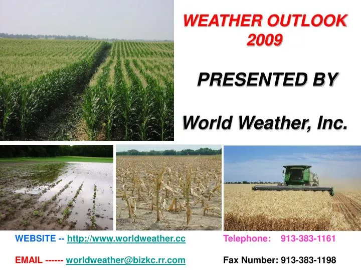
WEATHER OUTLOOK 2009 PRESENTED BY World Weather, Inc. . WEBSITE -- http://www.worldweather.cc Telephone: 913-383-1161 EMAIL ------ worldweather@bizkc.rr.com Fax Number: 913-383-1198.

E N D
WEATHER OUTLOOK 2009 PRESENTED BY World Weather, Inc. WEBSITE --http://www.worldweather.ccTelephone: 913-383-1161 EMAIL ------ worldweather@bizkc.rr.comFax Number: 913-383-1198
The Most Recent 30 Days Of Weather Has Included Abundant Precipitation From Eastern Kansas And Missouri To Wisconsin And Michigan. The Wet Weather Has Delayed Planting Progress And Wet Weather That Occurred Additionally Over This Same Region Since April 30 Has Further Saturated The Ground And Induced Greater Flooding. The Wet Weather Bias Is Further South Than Expected Because Of Persistent Cool Weather And These Trends May Be Around For Another Few Weeks. There Will Be Some Brief Periods Of Improved Weather In Which Planting Can Proceed. Data From NWS
Despite Recent Flooding In A Part Of The U.S. Delta, The Area Has Not Had As Much Rain As One Might Imagine. Rainfall Has Actually Been Below Average In The Past 30 Days. That Contrasts With Southern Georgia, Northern Florida And Southeastern Alabama Where Rainfall Has Been Well Above Average Limiting Some Fieldwork And Warranting Drier Weather. More Recent Weather Has Provided Much Drier Conditions To The Southeastern States And The Excess Moisture Of The Past Is Gone. Data From NWS
Drought In South Texas Is Very Serious And Acreage Was Notably Reduced In The Region Minimizing The Impact Of On-going Dryness. Moisture Deficits From The Past Two Months Are Not Very Impressive In West Texas And A Single Storm Could Fix The Drier Bias Instantly. However, 6-Month Moisture Deficits In West Texas Are More Significant Leaving Subsoil Moisture And Water Tables Below Average. Timely Rain Is All That Most Producers Would Like To Have. The Texas Blacklands And Upper Coast Have Been Wetter Than Usual.
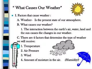
KEY INFLUENCES ON 2008-09 WEATHER • SUNSPOTS • ENSO – La Nina/El Nino • PACIFIC DECADAL OSCILLATION (PDO) • LONG TERM CYCLES
SUNSPOT CYCLE SINCE 1700s Sun Spot Numbers Sun Spot Numbers
El Nino Neutral PDO Neutral AMO Neg. QBO El Nino Positive PDO Neutral AMO El Nino Positive PDO Neutral AMO Neg. To Pos. QBO La Nina Negative PDO Neutral AMO Summer Precipitation In Years Following A Sunspot Minimum Have Tended To Be Wet In Illinois And Missouri While Normal Rainfall Occurs Often In South Dakota And Minnesota. Neutral ENSO Negative PDO Positive AMO
El Nino Neutral PDO Neutral AMO Neg. QBO El Nino Positive PDO Neutral AMO El Nino Positive PDO Neutral AMO Neg. To Pos. QBO La Nina Negative PDO Neutral AMO One Of The Largest And Strongest Correlations For Years Following A Sunspot Minimum Is A Tendency For Cool Summers In The Northern Half Of The Nation. Neutral ENSO Negative PDO Positive AMO
KEY INFLUENCES ON 2008-09 WEATHER • SUNSPOTS • ENSO – La Nina/El Nino • PACIFIC DECADAL OSCILLATION (PDO) • LONG TERM CYCLES
SEA SURFACE TEMPERATURE ANOMALIES 7-Day Average Centered on April 22, 2009 NOAA Sea Surface Temperatures In The Eastern Pacific Ocean Have Been Warming Back To A More Normal Range After Two Years Of Coolness.
upwelling Eastward Moving Warm Water In The Subsurface Equatorial Pacific Ocean May Lead To El Nino Like Conditions Later This Summer. Once A Kelvin Wave Passes Scientists Will Watch Water Temperatures For Signs Of Additional Warming. If The Trend Continues The Potential For El Nino Will Rise Greatly.
El Nino La Nina Other Years In Which La Nina Was Weakening Led To Weak El Nino Conditions By Late In The Year With Only 1974-75 Reverting Back To La Nina Conditions. There Are Some Forecasters Who Believe The Parallel With 1974-75 Is Stronger Than With Other Patterns, But Changing Sea Surface Temperatures Suggest It Will Be Hard (Not Impossible) For La Nina To Return This Year.
FORECAST PROBLEM NUMBER ONE Is El Nino Coming Or Will We Move Into Neutral ENSO Conditions For The Balance Of This Year. El Nino La Nina
NOAA’s CFS Model Accurately Predicted The Return Of La Nina This Winter And Now It Is Suggesting Neutral ENSO The Remainder Of Spring And Weak El Nino Conditions Late This Year.
JULY - SEPTEMBER EL NINO PRECIPITATION BIAS Below Normal Above Normal Cotton Areas That Might Be Impacted By El Nino Include India, China, Central Africa, Australia South America And Parts Of The United States. The Impacts Would Be Highly Variable.
TEMPERATURE TRENDS FOR NEUTRAL ENSOYEARS COOL COOL COOL WARM WARM WARM W WARM WARM WARM W The Odds Favor Neutral ENSO Conditions This Spring And Possibly Early This Summer. The Anomalies Shown Above Are Typical Of ENSO Neutral Summers. Remember ENSO Is Not The Only Factor Controlling Summer Weather. A Close Watch On The Sunspot Bias, PDO And AMO Is Also Warranted.
PRECIPITATION TRENDS FOR NEUTRAL ENSOYEARS D W W W W W W D W WET WET WET DRY WET D DRY DRY W DRY DRY D D D W D DRY W W DRY WET WET W D DRY W D W W W The Odds Favor Neutral ENSO Conditions This Spring And Possibly Early This Summer. The Anomalies Shown Above Are Typical Of ENSO Neutral Springs. Remember ENSO Is Not The Only Factor Controlling Summer Weather. A Close Watch On The Sunspot Bias, PDO And AMO Is Also Warranted.
PRECIPITATION AND TEMPERATURE TRENDS FOR EL NINO YEARS COOL COOL COOL W C WARM weak event weak event weak event WET WET WET WET DRY DRY WET WET WET DRY WET DRY WET WET WET weak event weak event weak event “If” El Nino Develops Later This Year These Are The Anomalies That Would Likely Result. The Odds Of El Nino Conditions Occurring Before July Are Very Low. Remember El Nino Is Interacting With Other Atmospheric Patterns Which Leaves Room For Some Deviations From Trend.
PRECIPITATION AND TEMPERATURE TRENDS FOR EL NINO YEARS W W C C WARM W weak event weak event weak event DRY DRY WET DRY DRY W DRY WET WET DRY DRY WET WET WET DRY DRY weak event weak event weak event “If”El Nino Evolves This Year It Is Most Likely To Occur In Late Summer Or Autumn. These Are The Anomalies That Might Associate With Such An Event. Remember El Nino Is Interacting With Other Atmospheric Patterns Which Leaves Room For Some Deviations From Trend.
KEY INFLUENCES ON 2008-09 WEATHER • SUNSPOTS • ENSO – La Nina/EL Nino • PACIFIC DECADAL OSCILLATION (PDO) • LONG TERM CYCLES
PHASES OF PACIFIC DECADAL OSCILLATION (PDO) Positive Or Warm Phase Negative Or Cool Phase Sea Surface Temperatures Sea Surface Temperatures Winter Season Winter Season
Warm Negative PDO Warm COOL Warm Warm COOL COOL Warm Warm Warm Warm Warm Neutral ENSO
KEY INFLUENCES ON 2008-09 WEATHER • SUNSPOTS • ENSO – La Nina • PACIFIC DECADAL OSCILLATION (PDO) • LONG TERM CYCLES
PALMER DROUGHT INDEX AUGUST 2008 AUGUST 2007
Palmer Drought Index April 25, 2009 Today’s Palmer Drought Index Is Most Similar To That Of 1973 And Less Like That of 1991. The Moisture Abundance Is Unlike Any Of The Years That Preceded Midwest Dryness Implying That Dryness in 2009 May Be A Difficult Accomplishment.
TOO WET?
Last Week Coolest & Driest East Wet And Cool Conditions Are Expected In Many Areas Over The Next 30 Days With The Wettest Conditions Shifting North In June. The Northern Plains Will Experience Some Improving Weather This Month.
Weather In The Midwest So Far This Spring Has Remained Wetter Further South Than Originally Predicted. The Change Resulted From Stronger And More Persistent Cold Air Surges And A Persistence Of The Feature Will Perpetuate Some Planting Delays Deep Into May. Areas Shown In Yellow On The Map Above Will Encounter Some Additional Periodic Planting Delay In May, But Will Likely See Improved Field Progress Potential Late In The Month And On Into June. The Northern Plains Will See Some Periods Of Improving Weather In May, But Will Likely Turn Wet Again In June.
Neutral ENSO Conditions Will Prevail For A While And There Is Some Potential For El Nino Like Conditions To Evolve Later In The Year. That Means Naturally Prevailing Weather Patterns Will Take Control Of The Nation. Those Prevailing Patterns Include A Wet Weather Bias In The Northern Plains And Timely Rainfall In Many Other Areas. The Restricted Early Summer Rainfall In The Central Plains And Lower Midwest Will Not Be Nearly As Threatening As Suggested Because Of Timely Rainfall And An Absence Of Persistent Hot Weather. Late Summer Will Trend Cooler And That Will Generate More Routine Showers And Thunderstorms For Much Of The Nation’s Crop Region. The End Result Will Be Mostly Fine Summer Crop Development With The Possible Exception Of The Cooler Than Usual Conditions.
Some Of The Features That Will Stand Out This Summer Include The Potential For Cooler Than Usual Temperatures In Many Northern And Central Crop Areas And The Timeliness Of Showers And Thunderstorms. A Reduction In Tropical Cyclones Impacting The Southeastern States Is Now Being Suggested Due To The Possible Development Of El Nino Late In The Year.
Florida, Alabama, Georgia And The Carolinas May Be More Frequently Influenced By Tropical Cyclone Activity In 2009 Than Other U.S. Coastal States. Texas May Also Be Impacted, But To A Lesser Degree Of Significance. Late August Through Mid-September Will Be Stormiest. Tropical Cyclone Numbers May Be Reduced If El Nino Evolves
2008-09 WORLD OUTLOOK
The Latest Vegetative Health Index Continues To Favorable Crop Conditions Except in Shanxi Where There Is A Little Plant Moisture Stress Under Way. Rain Has Been Abundant In Eastern China’s Crop Areas The Past Two Months. Soil Conditions Are Rated Mostly Favorable, Although There Are Some Dryness Issues In A Small Part Of Shanxi And Hebei. The Northeastern Provinces Have Been Especially Wetter Than Usual Recently Favoring Summer Crop Production Potentials.
Soil Conditions Are Not Far From Normal In Eastern China’s Main Agricultural Areas. However, There Is Some Dryness, Especially In The Southeastern Provinces, Which Is Typical Of La Nina Years. Dryness In The Korean Peninsula And Neighboring Areas Of Northeastern China Should Not Last Long In The Spring, But May Return During The Summer.
China’s Late Spring Is Expected To Be A Little Cooler Than Usual In The Northeastern Corner Of The Nation While Warmer Than Usual In Some Northwestern Crop Areas East Of Tibet. Rainfall Will Be Less Than Usual In East-Central Parts Of The Nation, But There Will Still Be Timely Rainfall To Support Crops. Summer 2009 Will Be Seasonably Moist Over Eastern Portions Of The Nation, But Some Western Crop Areas Will Be A Little Drier Than Usual. There May Also Be Some Pockets Of Dryness In The Far Northeast. Temperatures May Be A Little Cool In East-Central Parts Of The Nation.
India’s Monsoon Rainfall Will Be A Function Of ENSO. El Nino Conditions Are Possible Late This Summer And If They Do Emerge, Late Season Rainfall In India Will Decrease Below Average. The Start Of The Rainy Season Is Expected To Be Just Fine And Crops Should Perform Relatively Well. The Best Rain Amounts And Coverage Will Occur If El Nino Fails To Evolve.
VEGEGATIVE HEALTH INDEX COMPARISON TO LAST YEAR April 26, 2009 Big Changes In Cotton Field Conditions Have Occurred This Year Over Those Of Last Year. Uzbekistan, Tajikistan, Kazakhstan, Turkmenistan And Turkey Are All Experiencing Better Rainfall And Soil Moisture This Year Over That Of Last Year. The Implication Of This Is Better Crop Development Potential, Although Planting Has Likely Been Slowed By The Wet And Mild Bias. April 27, 2008 NOAA NOAA
April 26, 2009 A Large Part Of Europe And The Western CIS Grain And Oilseed Production Region Is Experiencing A Decline In Early Spring Weather Conditions Relative To That Of Last Year At This Time. However, Changes Are Expected In Many Areas Over The Next Few Weeks. Notice The Big Improvement In Crop Conditions For Turkey, Uzbekistan, Turkmenistan And Neighboring Areas. April 26, 2009 CHANGE IN VEGETATIVE HEALTH INDEX FROM LAST YEAR
CHANGE IN VEGETATIVE HEALTH INDEX FROM LAST YEAR Bahia Mato Grosso Africa “Franc Zone” April 26, 2009 From NOAA April 26, 2009 Central African Republic Will Need Better Rain This Season As Will Parts Of Texas. Dryness In Argentina, Paraguay And Center South Brazil Will Favor Harvest Progress. Rain In Bahia May Hurt Fiber Quality And Mato Grosso Is Starting To Dry Down. April 26, 2009
WEATHER OUTLOOK 2009 PRESENTED BY World Weather, Inc. WEBSITE --http://www.worldweather.ccTelephone: 913-383-1161 EMAIL ------ worldweather@bizkc.rr.comFax Number: 913-383-1198