Download
1 / 21
210 likes | 215 Views
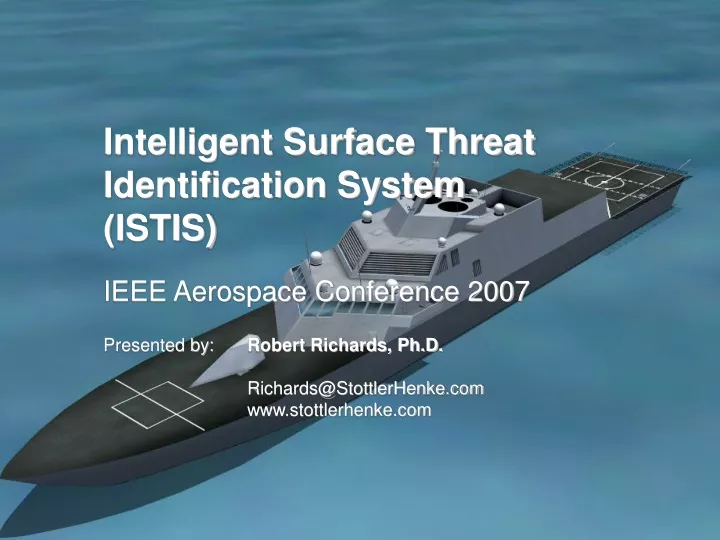
Intelligent Surface Threat Identification System (ISTIS). IEEE Aerospace Conference 2007. Presented by: Robert Richards, Ph.D. Richards@StottlerHenke.com www.stottlerhenke.com. Objectives. Improve Littoral ID Process, quality, and efficiency Better ID estimations from available data

E N D
Intelligent Surface Threat Identification System (ISTIS) IEEE Aerospace Conference 2007 Presented by: Robert Richards, Ph.D. Richards@StottlerHenke.com www.stottlerhenke.com
Objectives • Improve Littoral ID Process, quality, and efficiency • Better ID estimations from available data • Sooner ID determinations • Prevention of ID “Surprises” • Better use of scarce ID resources • Investigate littoral, surface ID techniques • Implement in the Intelligent Surface Threat ID System (ISTIS)
Related Projects • Intelligent Identification Software Module (IISM) • LCS Undersea Threat Assessment • TAO ITS and ITS authoring tool • GRTS TAO ITS • Navy Tactics Representation and Execution System (TRES) • Visual Intelligent Behavior Authoring (SimBionic) • Advanced Early Warning Real-Time Advisory System (AEW/RTAS)
Motivation:Current Identification Problems • Wide variation in ID abilities • Knowing whose-who even after ID information received • Track Split/Merge • Maintaining Competing Hypotheses for a track • Classified Automatic Track ID Problems • Remembering Track History (both short and long-term) • Analyzing behavior/correlations • Correlating new tracks with previous tracks • Knowing/Executing Optimal ID Procedures • Quickly Assessing Threat
AI Techniques • Truth Maintenance • Case-Based Reasoning • Behavior Transition Networks (BTNs) • Fuzzy Logic • Pattern Recognition/Learning • Constraint-Based Planning, Scheduling, and Resource Optimization • Knowledge Elicitation / Cognitive Task Analysis • Expert Systems
Example of Density of Contacts that Need Monitoring and Assessing
ISTIS Capabilities • Intelligent Tactical Memory: • Track attributes (position, velocity, ID information, History) • Associate previous tracks with new track information. • Complete track history (track merge or ID swap) • Past Relevant Tracks/Patterns used to recommend/warn • DefinableID, Threat Assessment, & Notification Criteria • Intelligent Track History Analysis(position/velocity/proximity/interactions/behavior correlations) to estimate associations & hostile intentions • Multiple Competing Hypotheses for ID (type/owner country) with Hierarchy of possible ID values (type, color/country)
ISTIS Capabilities (More & Re-stated) • Merge-Split Processing for Radar Merges and Track Fades and Reasoning through Multiple Hypotheses • Maneuver Correlation Detection • Surface ID Processing, Fusion, and Behavior Analysis • Action Recommendation based on Heuristics • Route Planning to ID a Set of Contacts and/or Search an Area • Ability of Tactical Personnel to Edit and Change ID, Alerting, and Recommendation Behaviors in Real-time
ISTIS Track Information, Recommendations, and Alerts Display
Demonstration • Strait of Malacca • Alerts: Leaving commercial lanes / intercepting • Merge-Split: automatic reasoning backward and forward • Multiple hypothesis / Hierarchical reasoning • Intercept/formation maneuver correlations • Heading and UAV recommendations • Immediate Threat alert • Demo video
Conclusion • ISTIS is an AI system that improves the Littoral ID Process, quality, and efficiency by • Better ID estimations from available data • Tracking ambiguous signals • storing and handling past target data • Sooner ID determinations • Prevention of ID “Surprises” • assessing threat levels & notifying users of alert conditions • Better use of scarce ID resources • filtering out insane data • keeping track of multiple track hypotheses based on the fusion of evidence from multiple sources • Capable today and continuing to be enhanced • Lockheed Martin (a LCS Builder) is partner • Interested in other potential users or partners
Intelligent Surface Threat Identification System (ISTIS) IEEE Aerospace Conference 2007 Presented by: Robert Richards, Ph.D. Richards@StottlerHenke.com www.stottlerhenke.com