Download
1 / 2
20 likes | 29 Views
Precaster is a Taiwan Laser Distance Meter Manufacturer since 1977, Weu2019ve been in the surveying and measuring field over 40 years; We know measuring a little more and it is proud and fun to bring our ideal gauges to you and redefined the NEW BENCHMARK OF MEASURING.

E N D
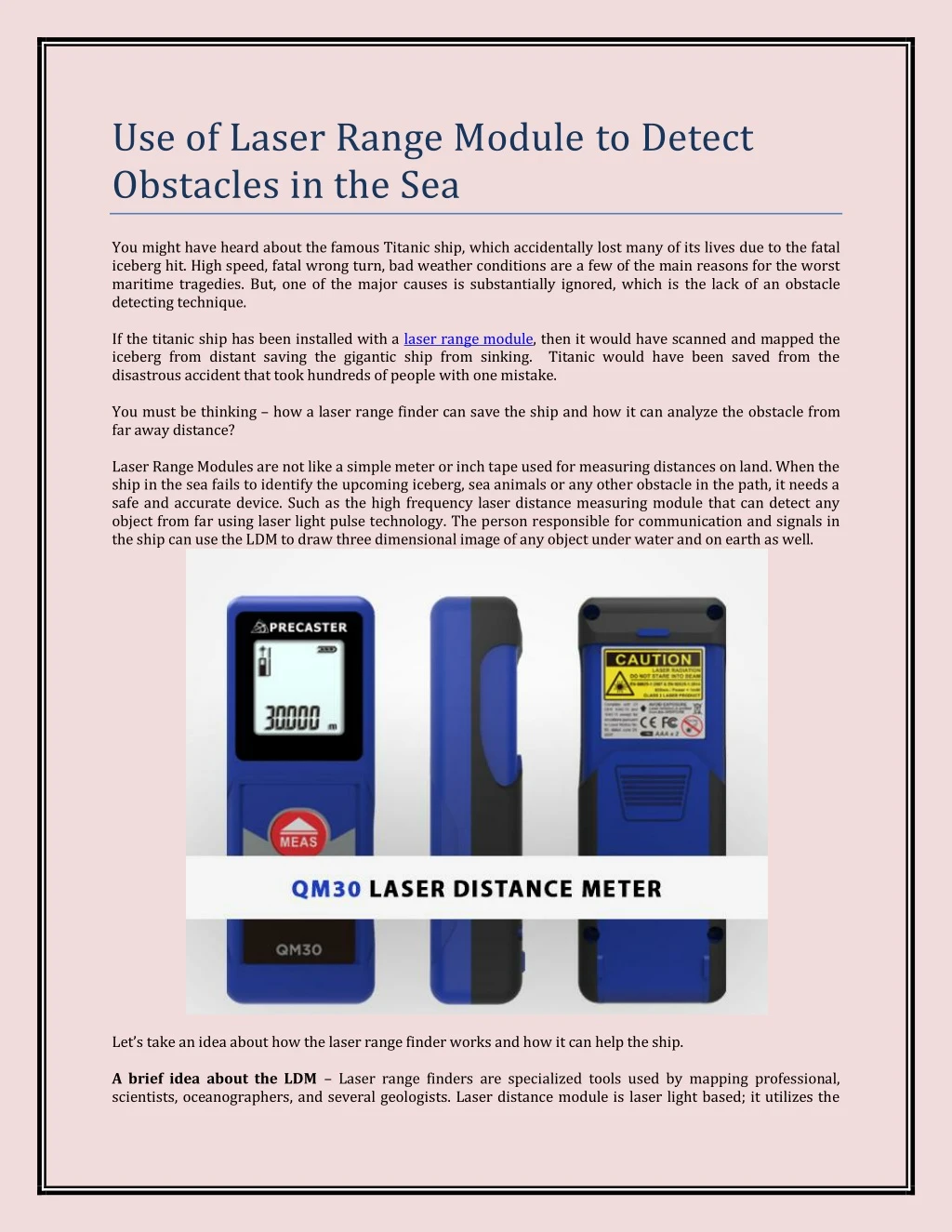
Use of Laser Range Module to Detect Obstacles in the Sea You might have heard about the famous Titanic ship, which accidentally lost many of its lives due to the fatal iceberg hit. High speed, fatal wrong turn, bad weather conditions are a few of the main reasons for the worst maritime tragedies. But, one of the major causes is substantially ignored, which is the lack of an obstacle detecting technique. If the titanic ship has been installed with a laser range module, then it would have scanned and mapped the iceberg from distant saving the gigantic ship from sinking. Titanic would have been saved from the disastrous accident that took hundreds of people with one mistake. You must be thinking – how a laser range finder can save the ship and how it can analyze the obstacle from far away distance? Laser Range Modules are not like a simple meter or inch tape used for measuring distances on land. When the ship in the sea fails to identify the upcoming iceberg, sea animals or any other obstacle in the path, it needs a safe and accurate device. Such as the high frequency laser distance measuring module that can detect any object from far using laser light pulse technology. The person responsible for communication and signals in the ship can use the LDM to draw three dimensional image of any object under water and on earth as well. Let’s take an idea about how the laser range finder works and how it can help the ship. A brief idea about the LDM– Laser range finders are specialized tools used by mapping professional, scientists, oceanographers, and several geologists. Laser distance module is laser light based; it utilizes the
laser beam of the second class to measure the distance between the object and receiver. A narrow beam of laser light is sent towards the object, time of flight calculates the time taken by the laser beam to return back to the sender, and the UART screen maps out and displays the image on the device screen. This is just an overview of best LDM devices; for better understanding you need to collect information about laser pulse technology. Laser Pulse Technology and its aspects– The laser pulse technology provides the backbone for laser distance measuring modules. Laser pulse technology is dependent on laser light beams that emit light rays coherently through an optical amplification process and help in measuring long distances. However, laser light moves in a continuous pattern which increases the chance of any error in calculation. That’s why; in an LDM the laser beams are modified to pulsed laser format to reduce any jamming and distortion in the path. A pulsed laser beam has higher optical frequency and different bandwidth. Pulsed lasers are extremely short, which is why it can travel a long distance in the shortest time interval and comes back too. There are several other factors which combine together, as such pulse duration, pulse energy, pulse repetition rate and more, which helps a laser range module produce fast and accurate results in time. When you combine a ship’s monitoring and controlling system to the laser distance measuring module, the above mentioned things will come together to find a disturbance in the route travelled. You can easily identify the problem; find a solution in minimum time and save your ship from sinking in the sea. Contact Us Precaster Enterprises Co. LTD. Address: No. 204, Sec. 2, Fuxing Rd., South Dist. State & City: Taichung, Taiwan Zip Code: 40252 Phone: +886-4-2223 6000 Email: contact@precaster.com.tw Website: www.precaster.com.tw/eng/