Download
1 / 20
200 likes | 414 Views
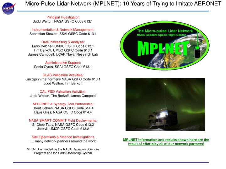
Micro-Pulse Lidar Network (MPLNET): 10 Years of Trying to Imitate AERONET. Principal Investigator: Judd Welton, NASA GSFC Code 613.1 Instrumentation & Network Management: Sebastian Stewart, SSAI GSFC Code 613.1 Data Processing & Analysis: Larry Belcher, UMBC GSFC Code 613.1

E N D
Micro-Pulse Lidar Network (MPLNET): 10 Years of Trying to Imitate AERONET Principal Investigator: Judd Welton, NASA GSFC Code 613.1 Instrumentation & Network Management: Sebastian Stewart, SSAI GSFC Code 613.1 Data Processing & Analysis: Larry Belcher, UMBC GSFC Code 613.1 Tim Berkoff, UMBC GSFC Code 613.1 James Campbell, UCAR/Naval Research Lab Administrative Support: Sonia Cyrus, SSAI GSFC Code 613.1 GLAS Validation Activities: Jim Spinhirne, formerly NASA GSFC Code 613.1 Judd Welton, Tim Berkoff CALIPSO Validation Activities: Judd Welton, Tim Berkoff, James Campbell AERONET & Synergy Tool Partnership: Brent Holben, NASA GSFC Code 614.4 Dave Giles, NASA GSFC Code 614.4 NASA SMART-COMMIT Field Deployments: Si-Chee Tsay, NASA GSFC Code 613.2 Jack Ji, UMCP GSFC Code 613.2 Site Operations & Science Investigations …. many network partners around the world MPLNET is funded by the NASA Radiation Sciences Program and the Earth Observing System MPLNET information and results shown here are the result of efforts by all of our network partners!
Nighttime Morning Afternoon Level 1 MPLNET Signals from NASA Goddard Nighttime Morning Afternoon MPLNET Data Products Micro-Pulse Lidar Network (MPLNET) 00:00 12:00 00:00 12:00 00:00 May 2, 2001 May 3, 2001 Time UTC Asian aerosol entrained within boundary layer Tropospheric Aerosol from Asia Altitude (km) PBL Growth PBL Decay Stratified PBL Well Mixed PBL Stratified PBL Well Mixed PBL MPLNET Data Products: Level 1 NRB Signals, Diagnostics (near real time, no quality screening) Level 1.5 Level 1.5b: Aerosol, Cloud, PBL Heights and Vertical Feature Mask Level 1.5a: Aerosol Backscatter, Extinction, Optical Depth Profiles and Lidar Ratio (near real time, no quality screening) Level 2 Operational Products Under Development (beta data available upon request) (not real time, quality assured) All data are publicly available in netcdf format. Errors included for all data products. Data policy same as AERONET. We are a federated network, individual site providers deserve credit. near real time: 1 hour or 1 day
MPLNET Data Products: Cirrus Detection for AERONET AOD Evaluation Susceptibility of Aerosol Optical Thickness Retrievals to Cirrus Contamination during the BASE-ASIA Campaign J. Huang, N.C. Hsu, S.C. Tsay, M.-J. Jeong, B. Holben, E.J. Welton
MPLNET Processing Micro-Pulse Lidar Network (MPLNET) Level 0, Raw Lidar Signal (counts/time): Calibration “Constant” (range only, varies w/ time) Afterpulse Laser – Detector Crosstalk (unique to transceiver design) Laser Pulse Energy Overlap (up to 4 – 6 km, Long due to transceiver design) Dark Counts Detector Deadtime Level 1 Signal: Level 1.5 and 2.0 Products:
MPLNET Level 0 Calibrations Deadtime provided by detector manufacturer. Considered fixed for lifetime of detector. Laser energy and standard deviation measured in real time and stored in raw data file. Solar background counts obtained from data between 45 – 55 km effective range, stored in raw data file. The optical alignment of the MPL is checked (and fixed) in lab prior to deployment using our collimator (far field transmit/receive path). Ideal temperature of instrument recorded. The following calibrations must be performed periodically and are rigorously evaluated: Dark count (initial calibration, then monthly) Afterpulse (initial calibration, then monthly) Overlap (initial calibration, evaluated several times per year) Calibration constant (generated daily from AERONET, evaluated throughout year) Dark Count: Lid on telescope, Laser energy off, record data for ~10 min Afterpulse: Lid on telescope, Laser energy at nominal setting, record data for ~10 min
MPLNET Level 0 Calibrations: Dark Count & Afterpulse Total Signal Afterpulse Darkcount
MPLNET Level 0 Calibrations: Overlap & Calibration Constant AERONET AOD used to calculate calibration constant in molecular zone The telescope temperature recorded during the calibration becomes the “set-point” temperature for operations. Deviations from this value change the overlap shape. We are testing athermal telescopes as a solution to the temperature-overlap problem
MPLNET Level 1 Data: Operations MPL Maintained by on-site personnel Must follow MPLNET specifications/protocol Climate controlled environment, goal to achieve +- 2° C centered on set point temp Some sites have special window wash and shutter mechanisms (maintain window quality, shade from sun in tropics at noon) Afterpulse and darkcount calibrations performed monthly Data transferred to NASA GSFC daily/hourly via FTP. Push or Pull. Higher level products are retrieved daily and monitored weekly. Q/C performed at Level 2
MPLNET Level 2 Data: Manual Assessment of Data Screens Data that are qualified are stored as L2, sunphotometer constrained results The calibration values from these data are interpolated and used to generate a continuous calibration function for the assessment period. These are used to generate L2 the continuous, gridded aerosol products.
Example Comparisons from study (25 Days total). Also surveyed past 7 field campaigns of such work. Summary of Study Results: MPLNET among best performers MPLNET MPL ARM Neph/PSAP AATS The Micro Pulse Lidar Network (MPLNET): Validation Altitude (km) Altitude (km) Conclusion: state-of-the-art techniques remain 15 - 20% uncertain MPLNET meets or exceeds that target range Extinction 1/km AOT Validation of MPLNET Aerosol Products: numerous MPL comparisons with AATS since 1997 How well do state-of-the-art techniques measuring the vertical profile of tropospheric aerosol extinction compare? B. Schmid, R. Ferrare, C. Flynn, R. Elleman, D. Covert, A. Strawa, E. Welton, D. Turner, H. Jonsson, J. Redemann, J. Eilers, K. Ricci, A. G. Hallar, M. Clayton, J. Michalsky, A. Smirnov, B. Holben, and J. Barnard, J. Geophys. Res., 111, D05S07, doi:10.1029/2005JD005837, 2006. • Aerosol Extinction & Optical Depth profiles compared in comprehensive study: • MPLNET (column AOT anchored to AERONET) • MPL from ARM • Airborne Ames Sunphotometer (AATS) • Airborne in-situ (nephelometer & absorption photometer) • Airborne cavity ring-down system (Cadenza) • Ground-based Raman lidar (CARL) • AATS used as truth • AATS is most direct measure of AOT profile • AATS Column AOT within 2% of AERONET Tim Berkoff is working on Lunar AOD capability with Cimel sunphotometer (examine our nighttime retrievals) Would like to initiate lidar comparisons in the Washington DC – Baltimore region AATS-14 shown above