Download
1 / 29
290 likes | 305 Views
Identification and Depiction of Submerged Rocky Features in HCells for Application to NOAA Charting Products. Cathleen Barry, NOAA Pacific Hydrographic Branch Kurt Brown, NOAA Pacific Hydrographic Branch Peter Holmberg, NOAA Pacific Hydrographic Branch

E N D
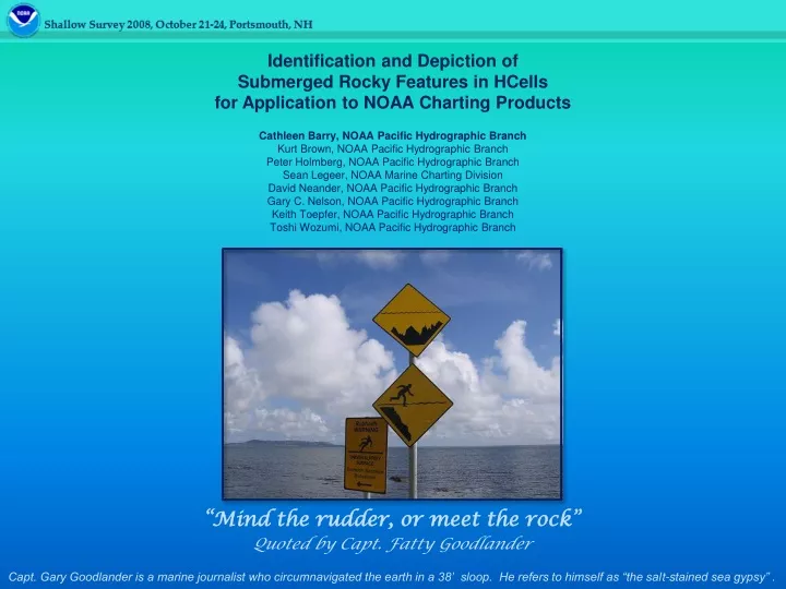
Identification and Depiction of Submerged Rocky Features in HCells for Application to NOAA Charting Products Cathleen Barry, NOAA Pacific Hydrographic Branch Kurt Brown, NOAA Pacific Hydrographic Branch Peter Holmberg, NOAA Pacific Hydrographic Branch Sean Legeer, NOAA Marine Charting Division David Neander, NOAA Pacific Hydrographic Branch Gary C. Nelson, NOAA Pacific Hydrographic Branch Keith Toepfer, NOAA Pacific Hydrographic Branch Toshi Wozumi, NOAA Pacific Hydrographic Branch “Mind the rudder, or meet the rock” Quoted by Capt. Fatty Goodlander Capt. Gary Goodlander is a marine journalist who circumnavigated the earth in a 38’ sloop. He refers to himself as “the salt-stained sea gypsy” .
WHAT DO WE DO AT PHB? What do we do? We produce HCells! What is an HCell? An S-57 .000 “base cell file” containing all of the new survey and chart information necessary for updating or creating a new ENC and raster chart product. HCell
OUR ALASKA WORK AREAS Southwest, South central and Southeast Alaska
WHY ARE ROCKS AND ROCKY AREAS A CONCERN FOR PHB? The switch from Single Beam Echo Sounders to use of Multibeam and Lidar flooded PHB with more features to process than ever before. Lidar rock features against chart 17405, 1:40,000. This view shows 737 Lidar rocks and 8 Lidar islets.
THE ISSUES & THEIR SOLUTIONS TWO ISSUES… PHB identified two distinct aspects to the problem: (1) Improper characterization of rocky features, and inconsistent characterization between field units. (2) An overabundance of rocky features from Multibeam and Lidar surveys; TWO SOLUTIONS (1) Standardization of Practices—Define parameters for ledges and reefs, rocky foul areas, and rocky seabed areas. Distribute guidance to our in-house surveying units and contractors. (2) Reduction in the Number of Individual Rock Features—Generalize areas with numerous discrete rock point features into foul and rocky areas. OUR GOAL Reduce ping to chart time and improve the chart product for multiple users
STANDARDIZED DEFINITIONS • Ledges and Reefs: Intertidal (MHW to 0) • Foul areas: Offshore of 0, to a depth where most rocks become submerged • Rocky seabed areas: In depths where most rocks are submerged rock is high point of ledge ledge foul with rocks rocky seabed area 19 38 rky 11 islet is high point of ledge 65 12.2 Rk 32 17 18 49 12 MHW foul limit MLLW “0” mostly submerged rocks mostly exposed rocks
STANDARDIZED DEFINITIONS rocky seabed reef foul rky rocky seabed ledge Raster Chart ENC
THE ISSUES & THEIR SOLUTIONS TWO ISSUES… PHB identified two distinct aspects to the problem: (1) Improper characterization of rocky features, and inconsistent characterization between field units. (2) An overabundance of rocky features from Multibeam and Lidar surveys; TWO SOLUTIONS (1) Standardization of Practices—Define parameters for ledges and reefs, rocky foul areas, and rocky seabed areas. Distribute guidance to our in-house surveying units and contractors. (2) Reduction in the Number of Individual Rock Features—Generalize areas with numerous discrete rock point features into foul and rocky areas. OUR GOAL Reduce ping to chart time and improve the chart product for multiple users
REDUCTION IN FEATURES H11350, Eastern Prince William Sound, Galena Bay
EXAMPLES OF ROUGH OR ROCKY SEAFLOOR AREAS H11350, Eastern Prince William Sound, Galena Bay, Valdez chart 16707, 1:40,000
EXAMPLES OF ROUGH OR ROCKY SEAFLOOR AREAS H11391, Port Bainbridge, Prince William Sound, Alaska, chart 16702, 1:40,000
EXAMPLES OF ROUGH OR ROCKY SEAFLOOR AREAS H11391, Hogg Bay, Port Bainbridge, Prince William Sound, Alaska, chart 16702, 1:40,000
EXAMPLES OF ROUGH OR ROCKY SEAFLOOR AREAS H11391, Swanson Bay, Port Bainbridge, Prince William Sound, Alaska, chart 16702, 1:40,000
EXAMPLES OF ROUGH OR ROCKY SEAFLOOR AREAS Approaches to Newport, Oregon, detail of reef near channel entrance.
EXAMPLES OF ROUGH OR ROCKY SEAFLOOR AREAS Approaches to Coos Bay, Oregon, Gregory Pt, Baltimore Rk and Mussel Reef.
DELINEATING ROCKY SEABED AREAS FROM SURFACES Multiple single resolution surfaces with all color ranges altered to 1.33 – 156.95m Combined Surface color range 1.33 – 156.95m
6.46 4.8 DELINEATING ROCKY SEABED AREAS FROM SURFACES The rocky seabed may be delineated by the hydrographer or cartographer, and navigationally significant rock features may be selected.
EXAMPLES OF DELINEATED ROCKY SEABED AREAS H11392, Port Bainbridge, Prince William Sound, Alaska, chart 16683, 1:40,000
THE “SHALLOW SURVEY 2008” PROJECT • PHB created an HCell with rocky seabed areas using the Reson Shallow Survey 2008 dataset Shallow Survey 2008 HCell
BUILDING THE SHALLOW SURVEY 2008 HCELL • New Hampshire’s rocky terrain is similar in some respects to SE, SW and South Central Alaska
ROCKY NATURE OF SHALLOW SURVEY SEABED IS CONFIRMED IN CARIS HIPS • 2-D slice, CARIS HIPS subset editor, showing rocky terrain
BUILDING THE SHALLOW SURVEY 2008 HCELL Shallow Survey 2008 data set against Portsmouth Harbor chart 13283, 1:20,000, Chart soundings in feet, HCell soundings in meters
THE COMPLETED HCELL IN CHART UNITS The completed HCell in charting units (feet), with depths, rock point features (for high points only), rocky seabed area objects and bottom characteristics (copied from the ENC).
THE HCELL APPLIED TO THE ENC • The completed HCell applied to the ENC, soundings and heights in feet.
CONCLUSIONS • Rocky seabed topography of Alaska and the Pacific coast is recognizable in navigation surfaces. • Identification and delineation of rocky seabed areas at the earliest stage of processing in the field is encouraged if it will save time in the field. • If the practice is adopted to apply rocky seabed areas to the chart it should be for all surveys in a region. (To avoid the dangers of a lack of rocky seabed areas appearing to indicate the absence of rocky features to the mariner.) • Before these practices can be wholly implemented, more guidance is needed. • Some considerations for which parameters may be appropriate are: • Is the surface rocky (lumpy) or is it hard? • What is the scale of the chart being compiled to? • How well defined is the feature? • What is the density/concentration of submerged rock features in the area? • What is the height of a submerged rock relative to the surrounding seafloor? • What is the distance of a submerged rock from a nearby feature of similar or lesser height; • What is the bathymetric coverage in the area (size and proximity of data gaps)
WHAT IS THE ROLE OF PACIFIC HYDROGRAPHIC BRANCH? • At PHB, we work with NOAA Ships Fairweather and Rainier, and contractors, too. Ship’s personnel acquire data and package it up as depths (surfaces) and features for PHB. PHB prepares the survey materials for application to the chart. (We create HCells.) Marine Charting Division uses the materials provided by PHB to update the ENC and the raster charts, or creates new charts. US West Coast and Alaska Seattle, Washington Silver Spring, Maryland