Download
1 / 21
300 likes | 592 Views
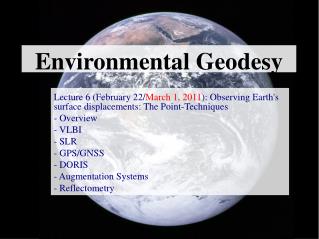
Geodesy and Datums. Michael A. McAdams Geography Dept. Fatih University Istanbul, Turkey. Is the earth round?. Well...all the globes are round..so it must be... It must be flat because..I have never seen the earth curve It is not flat, but more like an elispse

E N D
Geodesy and Datums Michael A. McAdamsGeography Dept.Fatih UniversityIstanbul, Turkey
Is the earth round? • Well...all the globes are round..so it must be... • It must be flat because..I have never seen the earth curve • It is not flat, but more like an elispse • It depends on what you mean by round. It is a sphere, but not a perfect one.
Another view of the earth Türkiye
Istanbul from Space You are here
Fatih University You are here
Some questions? • Geodesy is the science of measuring and monitoring the size and shape of the Earth and the location of points on its surface. (NOAA website: http://www.oceanservice.noaa.gov/education/kits/geodesy/welcome.html ) • Why is it used? • To obtain accurate measures on the surface of the earth • Who uses it? • Surveyers, remote sensing specialists, GIS technicians, geographers, archeologists, anyone concerned with spatial analysis • What is the difference between a geod and a datum? • A datum is the specifications to construct a geod or at least a part of one
The Elements of Geodesy: The Figure of the Earth • The Earth's shape is nearly spherical, with a radius of about 3,963 miles (6,378 km), and its surface is very irregular. • Mountains and valleys make actually measuring this surface impossible because an infinite amount of data would be needed. • It would take you many lifetimes to measure every crevice, valley, and rise. You could never complete the project because it would take too long. • http://www.oceanservice.noaa.gov/education/kits/geodesy/geo03_figure.html
Members of a 1922 geodetic survey expedition. Until recent advances in satellite technology, namely the creation of the Global Positioning System (GPS), geodetic surveying was an arduous task best suited to individuals with strong constitutions, and a sense of adventure.
Different Abstractions of the Earth • http://www.oceanservice.noaa.gov/education/kits/geodesy/media/supp_geo03a.html
Abstractions of the Earth’s surface • SphereSimular to a ball or what we think of as a globe. It discounts the irregularities in the earth’s surface such as mountaing ranges and canyons • ElipsoidLooks like an egg with a bulge in the middle. More accurate than a sphere. • GeodBased on the elevation and earth’s gravatational pull. It is the most accurate description of the surface of the earth.
What is a datum? • A datum is as a set of spatial information that acts as a foundation for other data, just like concrete acts as a foundation for the structure of a building, including all the furnishings and decorations inside. • Without a datum there would be nothing to securely support other spatial information, such as digital elevations, land use, or population. • There are two types of datums, horizontal and vertical
Horizonal and Vertical datums • the horizontal datum is a collection of specific points on the Earth that have been identified according to their precise northerly or southerly location (latitude) and easterly or westerly location (longitude). • The vertical datum is a collection of specific points on the Earth with known heights either above or below mean sea level. Near coastal areas, mean sea level is determined with a tide gauge. In areas far away from the shore, mean sea level is determined by the shape of the geoid. http://www.oceanservice.noaa.gov/education/kits/geodesy/
Global Positioning System (GPS) • Using the Global Positioning System (GPS), every point on Earth can be given its own unique address -- its latitude, longitude, and height. The U.S. Department of Defense developed GPS satellites as a strategic system in 1978. But now, anyone can gather data from them. • GPS is a constellation of satellites that orbit approximately 11,000 miles above the Earth and transmit radio wave signals to receivers across the planet. By determining the time that it takes for a GPS satellite signal to reach your receiver, you can calculate your distance to the satellite and figure out your exact location on the Earth. Sound easy? In fact it is a very complicated process. For the GPS system to work, you need to have incredibly precise clocks on the satellites and receivers, and you must be able to access and interpret the signals from several orbiting satellites simultaneously. Fortunately, the receivers take care of all the calculations. • http://www.oceanservice.noaa.gov/education/kits/geodesy/geo09_gps.html
Conclusion • Geodesy is an important for accurate measurements of the earth • Geods, elipzoids and spheres are abstractions of the earth • Datums are the measurements or data that directs the contruction of an elipzoid, sphere or geod • If accuracy is important (i.e., GPS) the mixing or non-transformation of datums can be perhaps the difference between life or death if using it for navigation purposes Datums, projections and coordinate systems are related issues, as will be discussed in the next lecture
Some Other References • Datums, who needs ‘em anyway?http://www.esri.com/news/arcuser/0401/datum.html • Geodesy Overview by Peter Dana:http://www.colorado.edu/geography/gcraft/notes/datum/datum_f.htmlGeodesy Tutorial by NOAA:http://www.oceanservice.noaa.gov/education/kits/geodesy/welcome.html