Download
1 / 30
300 likes | 306 Views
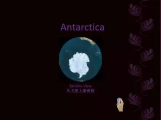
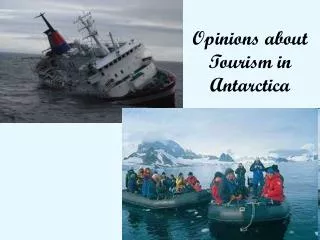
Multiple ways of Learning about Antarctica with Cybercartography. Sebastien Caquard, Peter Pulsifer and D.R. Fraser Taylor. Overview of the presentation. What is cybercartography?. The cybercartographic atlas of Antarctica. Alternative ways of learning with cybercartography.

E N D
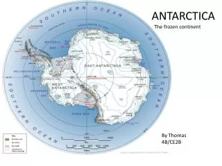
Multiple ways of Learning about Antarctica with Cybercartography Sebastien Caquard, Peter Pulsifer and D.R. Fraser Taylor
Overview of the presentation What is cybercartography? The cybercartographic atlas of Antarctica Alternative ways of learning with cybercartography
What is cybercartography? • A large research project: “Cybercartography & the New Economy” • Directed by Prof. D.R.F. Taylor • 2.6 M$ funded by Social Sciences and Humanities Research Council of Canada (SSRHC) • 4 years (started 01/2003) • About 50 people from different disciplines
What is cybercartography? • Cybercartography is multiple: • - Multidisciplinary (Geo / Psycho / Sciences cog / Literature) • - Multi partners (e.g. Atlas of Canada, Industry Canada, SCAR) • - Multimedia • Multisensory • Multi users (general public, policy makers, scientists) • - Multi topic (beyond geographical topics)
What is cybercartography? • Outcomes expected • 2 Cybercartographic Atlases (Antarctica & Trade) • Research (proofs of concept) • (e.g. Internet Cartography / Open Standards Cartography / Interoperability / Formal Ontologies / Multimedia Cartography / Archiving digital data / Understanding the User (UNA) / Usability / Multisensory / Sound maps / Art and Cybermaps / Technologies for the Blind / Situational Awareness in Virtual Spaces / Navigation in Informational Spaces / Cognitive Theories / Learning Theories / Multidisciplinary / Gaming and engagement / Hypertext and live hypernarrative) => Combination production/research for education
Multiple ways of learning The Cybercartographic Atlas of Antarctica
The Cybercartographic Atlas of Antarctica • A comprehensive atlas of Antarctica • Designed for High school students • To communicate scientific information • In an engaging manner • Using elements of cybercartographic • As well as to develop critical perspectives
The Cybercartographic Atlas of Antarctica • A multidisciplinary approach • Human factor psychology: User Interface design • Geography (+ sciences): Content development • Computer science: Computer model development • English literature / Art : Critical perspective • Cognitive sciences / Psychology: Evaluation
Image by A. Parush - HOTLab - 2005 The Cybercartographic Atlas of Antarctica Analyze the needs (Education and Psychology) • Designed based on the UNA • The user/student is central • Iterative process: analysis, development, evaluation
The Cybercartographic Atlas of Antarctica Develop the content (Geography / Scientists) • - Following UNA and curriculum • Compiling scientific information (modules: e.g. exploration) • Using some elements of cybercartography (e.g. multimedia) • Multi-authors
The Cybercartographic Atlas of Antarctica Develop the technology (Computer sciences / Geomatics) • - Interoperability • Module interconnected • Open source technology • Follow the UNA - Highly interactive - Easily usable - Easy to update => Developing an atlas framework
The Cybercartographic Atlas of Antarctica A first prototype:
The Cybercartographic Atlas of Antarctica Evaluation: usability testing • Assess navigation, terminology, features and functionality • 7 undergraduate students • Rapid learning curve • Problem with Key UI (e.g. terminology, association map/text, web page model) • Not very engaging => Overall recommendations to improve the EFFECTIVENESS
Alternative ways of learning Improving the engagement: Developing a mod game • Modification and repurpose of an existing game • Teach about (1) Antarctica environment; (2) global warming ; (3) scientific process • Different perspectives • Engaging manner Game developed by J-P Fiset - GCRC - 2004
Alternative ways of learning Live hypernarrative • Narrative + Hypertext + Live elements • Content and structure determined by live information • Standard Java Server Pages • Engaging story to learn about Antarctica
Alternative ways of learning Prototype developed by R. Biddle - HOTlab - 2004
Alternative ways of learning Mod game / Live hypernarrative: • - Engaging way to access information • High level of interaction • Providing changing/multiple perspectives • Different ways of learning (Affective/Incidental) => Complementary to the effectiveness of the atlas
Conclusion • Multiplicity of cybercartography: • Different ways to present info beyond traditional cartography • Different ways to access info (e.g. maps, game) • Different ways of learning (Effective / Affective / Incidental) • Better adapted to the diversity of the students (MI theory) • Better adapted to the Internet environment • Better adapted to develop critical thinking
Conclusion • Remaining challenges • Integrate proofs of concept in the atlas design (e.g. live hypernarrative as the introduction of the atlas) • Evaluation: How do we evaluate affective learning? • Reconsider the way of teaching with cybermaps: how can we capture users attention in the Internet environment?