Download
1 / 30
300 likes | 405 Views
Catalog of Worldwide Test Sites for Sensor Characterization. March 13, 2009 Gyanesh Chander GEO Task: DA-09-01a_2 Lead SGT, INC.*, contractor to the U.S. Geological Survey (USGS) Earth Resources Observation and Science (EROS) Center, Sioux Falls, SD

E N D
Catalog of Worldwide Test Sites for Sensor Characterization March 13, 2009 Gyanesh Chander GEO Task: DA-09-01a_2 Lead SGT, INC.*, contractor to the U.S. Geological Survey (USGS) Earth Resources Observation and Science (EROS) Center, Sioux Falls, SD *Work performed under USGS contract 08HQCN0005 Telephone: 605-594-2554, E-mail: gchander@usgs.gov
Outline • Introduction • Site Selection Criteria • Online Test Site catalog • CEOS Reference Standard Test Sites • Summary • Proposed Future Plans
Context • With television, weather channels, Google Maps™ mapping service, and other day-to-day uses, satellite imagery has clearly become part of mainstream information society • Nevertheless, for most operational remote sensing applications, critical issues remain with respect to the: • Reliability of supply • Consistent data quality • Plug-and-play capability • Consistent data quality implies the adherence of data to appropriate standards of fidelity to the underlying physical quantities (reflectance, temperature, etc.) that they measure • These well-calibrated data then assure the accuracy and enhance the intercomparability that enables the use of advanced Earth observation technologies to address societal benefits
Scope of test sites • Test sites are central to any future QA/QC strategy • Test sites provide a convenient means of obtaining information to verify sensor performance • Test sites are the only practical means of deriving knowledge of biases between sensors • Test sites allow, at some level, a means of bridging anticipated data gaps caused by lack of measurement continuity, due to lack of co-existent in-flight sensors
Need for a Global, Integrated Network of Calibration Sites • User communities increasingly rely on information products from multiple satellite sensors • Better calibration can result from more postlaunch calibration involving standardized measurement protocols, instrumentation, and processing • Field measurements remain resource-intensive activities • Less expensive complementary approaches can provide more frequent calibration updates and enable the monitoring of sensor performance trends, even without surface measurements • Future global monitoring systems, using increasingly complex constellations of satellites with multiple sensors, such as the Global Earth Observation System of Systems (GEOSS), will amplify the need for this initiative to address global societal benefits
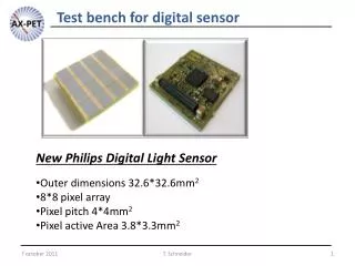
Characteristics of sensors which can benefit from test sites • Gain • Stability • MTF • Uniformity (Flat field) • Stray light (Adjacency effects) • Polarization • Spectral • SNR • Algorithms • Geolocation • Camera model • Band-to-band • Internal Geometry • Temporal effects
Well-Established Site Selection Criteria • High spatial uniformity over a large area (within 3%) • Minimize misregistration and adjacency effects • Surface reflectance greater than 0.3 • To provide higher SNR and reduce uncertainty due to atmosphere • Flat spectral reflectance • Reduce uncertainties due to different RSR • Temporally invariant surface properties (within 2%) • To reduce BRDF, spectral, surface reflectance effects • Horizontal surface with nearly lambertian reflectance • Minimize uncertainty due to different solar illumination and observation geometry • At high altitude, far from ocean, urban, and industrial areas • Minimize aerosol loading and atmospheric water vapor • In arid regions with low probability of cloud cover • Minimize precipitation that could change soil moisture
Online test site catalog • The layout is set up to help the user quickly locate the needed information available on the site • Drop-down menus list locations so the user may go straight to a specific site • A map with clickable links provides another way to go to sites • The maps include a world map, where the user selects a continent, and a map of each major continent • Each of the calibration site pages contains the same fields for easy review • These fields include location, terrain elevation, center latitude/longitude, WRS-2 path/row, size of usable area, owner, researcher, purpose, description, support data, suitability, and limitations • Other features include • A small image of the globe depicting the position of the site • Satellite images of the test site • Previous/next button • Sample Landsat images and Google KMZ files
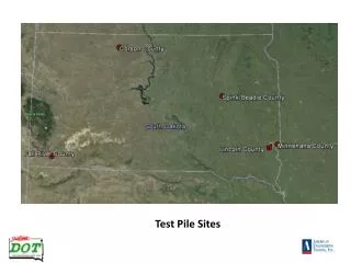
Ground Control Points (GCP) 72 GCPs selected over Morrison, CO area 51 GCPs selected over Brookings, SD area
CEOS Reference Standard Test Sites • The IVOS sub-group members established a set of CEOS reference standard test sites • Based on the decision from the CEOS IVOS-19 meeting, there are 8 instrumented sites and 5 pseudo-invariant sites
CEOS Reference Standard Test Sites • The CEOS instrumented sites are provisionally being called “Landnet” • These instrumented sites are primarily used for field campaigns to obtain radiometric gain and these sites can serve as a focus for international efforts, facilitating traceability and cross-comparison to evaluate biases of in-flight and future sensors in a harmonized manner • The pseudo-invariant desert sites have high reflectance and are usually made up of sand dunes with low aerosol loading and practically no vegetation • Consequently, these pseudo-invariant reference standard test sites can be used to evaluate the long-term stability of a sensor and to facilitate cross-comparison of multiple sensors
“Instrumented” Sites (Total=8) Railroad Valley Ivanpah Lspec La Crau Dunhuang Negev Tuz Golu Dome C
“Pseudo-Invariant” Sites (Total=5) • Libya 4 • Mauritania 1/2 • Algeria 3 • Libya 1 • Algeria 5 Libya 4 Mauritania 2 Libya 1 Algeria 5 Algeria 3
Questionnaire for information regarding the Cal/Val test sites
Summary • The test site catalog provides a comprehensive list of prime candidate terrestrial targets for consideration as benchmark sites for the postlaunch radiometric calibration of space-based optical sensors • The online test site catalog provides easy public Web site access to this vital information for the global community • The incompleteness of available information on even these prime test sites is an indication that much more coordination and documentation are still needed to facilitate the wider use of calibration test sites in remote sensing
Proposed Future Plans • Gather complete site characterization data and information • Define core measurements (eg. Instruments) • Develop protocols and fund pilot projects • Create an operational network of land sites (“Landnet”) • Encourage agencies to acquire, archive, and provide data to the Cal/Val community over CEOS sites • Use radiometric gain and stability as an immediate priority • Develop online calibration data access infrastructure • Create tools to identify the potential co-incident image pairs (NASA SEO) • Integrate the catalog into the CEOS EO Cal/Val portal • Establish traceability chain for primary site data & “best practice” guidance on site characterization and its use