Download

1 / 15
150 likes | 245 Views
Minnesota DNR GIS Service Delivery and Governance. Tim Loesch GIS Section Manager. Wildlife Tracking - Wolves. 191 miles (red) 157 miles (black). Camp Ripley. GIS Service Delivery and Governance. Background Long established GIS program in DNR

E N D
Minnesota DNRGIS Service Delivery and Governance Tim Loesch GIS Section Manager
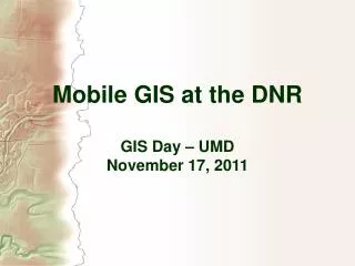
Wildlife Tracking - Wolves • 191 miles (red) • 157 miles (black) Camp Ripley
GIS Service Delivery and Governance • Background • Long established GIS program in DNR • High number of users (200+ArcGIS, 900+LandView) • All reaches of the State • 100+ Offices throughout the state • Good connectivity (generally) • Mobile work-force • Spectrum of applications • Forestry, Fisheries, Wildlife, Land Records, Invasive species, Law Enforcement, Emergency Response, Land Restoration, Flood prevention, Dam Safety, Protected waters, recreation
GIS Service Delivery and Governance • DNR in Minnesota • Central Office (St. Paul) • Administrative Regions • Northwest, Northeast, Central, South • 120 Offices • High Speed WAN
GIS Service Delivery and Governance • GIS Section • Support Natural, Cultural and Recreation resource management • Provide infrastructure, training and support to DNR Business units • Technology Integration • GIS integrates business units • Support the DNR Website
GIS Service Delivery and Governance • DNR GIS Team • Part of DNR Management Resources • Common Service Delivery Unit • MIS, Fleet, Facilities Management, Safety, Purchasing • Unit within DNR MIS Program • Three GIS Service Areas • Operations • User Support • Professional Services
GIS Service Delivery and Governance Management Resources Fleet Safety MIS Mtrls Mgmt Prof. Services Networks GIS Data/Apps GIS Project Management GIS User Support GIS Operations Organization
GIS Service Delivery and Governance • Funding • Shared Services Governance Board • DNR Senior Managers and Commissioners Office • IT Governance Sub-Group • DNR Operations Managers • MIS Service Level Agreement • Defines Services Provided and Associated Costs • Costs are assessed to business units yearly based on established indexes • Recommendations forwarded to Shared Services Board • IT Service Level Agreement
GIS Service Delivery and Governance • Shared Services Governance Board • HR • IT • OMBS • OCO • Facilites • Fleet $ • GIS Indices Include: • Installed ArcGIS Software • LandView overhead fee • Existing Business Application resource requirements • GIS Governance
GIS Service Delivery and Governance • Day-to-Day Interaction • DNR IT Liaisons • DNR Business Unit IT specialists • Advise Business Unit Managers on IT issues • Meet quarterly with MIS Program Managers • Share information • Develop Department Standard Practices • Identify areas of common interest • People appreciate knowing what’s going on
GIS Service Delivery and Governance • GIS Operations • Develop and maintain GIS Infrastructure • Server hardware and software • Data Resource Sites (DRS) • DNR Data Deli • Technical Assistance • Data Modeling • Programming • Data services • Software and Data Licensing • Staffing • Section Manager – IT PM • Spatial Data Administrator - ITS4 • GIS Application Programmer – ITS4, ITS3 • Spatial Data Technician – OASI • Student Worker
GIS Service Delivery and Governance • GIS User Support • Provide User and Site Support • DNR Field Staff, Regional Directors, Commissioner’s Office • Software installation and setup • Develop, Maintain and Deliver GIS Training and Information • Tip Sheets and user guides • Annual GIS User Group Meetings • “What’s New in GIS” Newsletter • GIS Web site • Fee-based Training classes • Small Project Work • Non-fee based • < 40 hours • Maps and reports • Staffing • Regional GIS Coordinator (4 – ITS3)
GIS Service Delivery and Governance • Professional Services • Fee for service work for DNR Business units • Governance Funding does not cover all costs • Approximately 25% of annual budget • Have done work for other State Agencies • Project requirements > 40 hrs • Programming • Database Design • Cartography • Data Development QA/QC • Rates $80, $55, $38 / hour • Staffing: • Project Manager – (1 - ITS3) • All GIS staff contribute in some way
GIS Service Delivery and Governance • Recent Projects • Forest Inventory Module – Field Data Recorder • DNR Land Records Upgrade • State LiDAR Mapping Project • Furbearer Data Entry • Parks and Trails Data QA/QC • Hydrology data maintenance
GIS Service Delivery and Governance • Future Work Efforts • Service oriented map and data delivery • Shared Common GIS Infrastructure (DRS2) • Mobile and Smartphone Applications • Enhanced Public access to High Quality Cartographic Services • Print-on-Demand