Download
1 / 40
420 likes | 448 Views
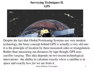
Patel Dixit K. (130400106054) Patel Dhruv P.(130400106051). TECHNIQUES IN BASIC SURVEYING. Civil Engineering department Sankalchand Patel college of Engineering, Visnagar. Basic ideas.

E N D
Patel Dixit K. (130400106054) Patel Dhruv P.(130400106051) TECHNIQUES IN BASIC SURVEYING Civil Engineering department Sankalchand Patel college of Engineering, Visnagar
Basic ideas • Surveying - the creation of a scale representation of the ground surface - is a basic activity in many areas of environmental management. • A survey will be one of of two types: • Primary survey - to establish the position of objects in three dimensions when no previous information exists • Secondary survey - to add extra information to existing data or to measure changes over an interval of time
Basic ideas • The task of three dimensional position fixing is normally broken into two parts: • Determining plan position • Determining elevation
Basic ideas • Each of these determinations may be either: • absolute - made in terms of a fixed co-ordinate system • relative - made in terms of local co-ordinates which may later be converted to absolute co-ordinates if required. • The majority of surveys carried out for environmental management are thus secondary relative surveys
Plan Position Fixing • The plan position of a station can be established in a number of ways:
By reference to the apparent positions of astronomical objects when viewed from that station • This method gives the absolute location of the station in terms of latitude and longitude, which can be converted to local systems such as the National Grid.
By the measurement of the angles between lines of sight to the unknown station from other known positions • By the intersection of lines of sight from the unknown station to other objects whose positions are already known • These two methods both rely on the simple Euclidean geometry of the plane. (Hence the term plane surveying). The first procedure is termed triangulation and the second resection.
The basic principle of triangulation Measured angle Measured angle B A Baseline
The basic principle of resection Known position Known position Measuredangle Unknown position Measuredangle Measuredangle Known position
By measurement of distances between the unknown station and other objects of known positions • This last method includes a number of particular cases:
measurements of offset distances from a base line. • trilateration - the distance equivalent of triangulation. • tacheometry - an optical method of distance measurement along a known bearing
The basic principle of trilateration Measured side Measured side B A Baseline
Plane Surveying: Theory • Plane surveying relies on the basic concepts of Euclidean geometry, and in particular the properties of triangles. • The most important (for our purposes) of these are:
Plane Surveying: Theory • The internal angles of a triangle sum to 180 • The sides of an equilateral triangle are equal and the internal angles are all 60° • The base angles and opposing sides of an isosceles triangle are equal
60º The equilateral triangle All sides equal in length All angles equal (= 60º) 60º 60º
The isosceles triangle Two sides equal in length Two angles equal a a
Plane Surveying: Theory • If the respective angles in two triangles are equal then the triangles are similar and their sides are all in the same proportion • If two triangles have two angles and one side equal (or vice versa) then they are congruent and all their other respective angles and sides are equal. • Two triangles are also congruent if all their sides are equal.
Similar triangles have corresponding angles equalbut are of differing size
Conguent triangles are identical • two angles and one side equal • two sides and one angle equal • all three sides equal
Plane Surveying: Theory • Congruent triangles are unique - you cannot draw two different triangles from the same set of measurements • This means that a complete set of survey data must define the positions of objects uniquely.
Plane Surveying: Theory • Any closed polygon can be subdivided into a series of contiguous triangles • These properties are repeatedly used in the procedure of triangulation in which stations are surveyed in a pattern of contiguous triangles.
Any closed polygon can be subdivided into contiguous triangles These should be chosen to make as many of the triangles asclose to equilateral as possible
Plane surveying: practical aspects • In practice, most plane surveys are carried out in a straightforward way following an established sequence: 1. A reconnaisance survey will establish the dimensions of the area, relative levels, significant features, accessibility, obstacles etc
Plane surveying: practical aspects 2. Establish an accurate baseline by measurement from existing survey points, natural features, buildings etc. If none are available then the baseline must be fixed by absolute methods. 3. Establish as required any further controlpoints by triangulation or trilateration from the base-line.
Plane surveying: practical aspects 4. Incorporate detail by tacheometry, traversing, tape & offset or whatever other method is appropriate. 5. The intermediate stations should where appropriate be cross-checked with the control points by resection and all traverses should be closed at a control point. 6. Inaccessible detail should be incorporated by triangulation or plane tabling from the ends of the baseline.
ILLUSTRATION OF THE USE OF OFFSETS Baseline
Plane surveying: practical aspects 7. If a topographic survey is being undertaken, levelling traverses should be carried out around the survey stations and the baseline tied to the local benchmark by a closed traverse. 8. The use of a theodolite or total station will enable both the position and the elevation of stations to be found simultaneously by combined tacheometry and triangulation or by trilateration
THE “CHAIN” SURVEY How to establish relative plan positions
Chain survey • Simplest of all survey techniques • Relies on linear measurements; slopes >3o require some adjustment to technique • Usually requires a clear line of sight • The triangles used should be equilateral or approximately so
Terminology • Trilateration is the measurement of sides of a triangle • whereas triangulation refers to the measurement of the angles of the triangle
Basic equipment • Ranging poles • Survey pegs and ‘arrows’ • Chain & tape measure or other distance measuring instrument • Plumb line • Compass
Chain survey components • Base line: the longest line • Chain /survey lines • Survey stations • Offset lines
Order of events • “Range out” survey stations with ranging rods • Establish base line and measure accurately • Measure remaining distances between other survey stations • Measure offset lines whilst measuring between survey stations
Sloping ground • If the ground slopes by more than about 3°, this must be allowed for in the survey. • The measured distances are thus slant distances and must be corrected to true horizontal distances. • This requires that the vertical angle between the stations is known
Sloping ground • For an approximate survey, it may be sufficient to step up or downhill using a series of horizontal and vertical lines • If the drop is measured at the same time, some estimate of the slope profile can be obtained
Chain surveying (“stepping”) a w b x c y z
Sloping ground • If stepping is not appropriate, more sophisticated methods must be used to measure the slant distance and the vertical angle simultaneously • Requires optical sighting equipment: usually either a clinometer, Abney level or theodolite
Correcting for horizontal distance:the “hypotenusal allowance” correction factor = xy - yz = xy(1 - cosa) x h a y z