Download
1 / 10
110 likes | 345 Views
THREE-PHASE DISTRIBUTION POWER FLOW WITH A GEOGRAPHIC INFORMATION SYSTEM. INTRODUCTION. A software for computing three-phase distribution power flow(1 , 2, 3) has been integrated with a Geographic Information System (GIS) FLUDIS GIS

E N D
THREE-PHASE DISTRIBUTION POWER FLOW WITH A GEOGRAPHIC INFORMATION SYSTEM
INTRODUCTION • A software for computing three-phase distribution power flow(1, 2, 3) has been integrated with a Geographic Information System (GIS) FLUDIS GIS • It takes into account : Lines, transformers, shunt var elements and loads modeled by a load window considering load composition. • FLUDIS GIS has been used for analysis and planning of distribution systems.
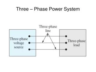
POWER FLOW IN DISTRIBUTION SYSTEMS • EDS normally operate in radial configurations. • It makes necessary to consider power flow analysis with convergence characteristics (speed and reliability). • Some methods: • Ladder • Current Summation • Power Summation (computationally efficient) Maximum error = 10-4
Load and loses modeling User profiles (location, time) - industrial, - residential, - holiday, etc. - Series leakage impedance - Shunt core loss function • - Overhead and underground. • - Neutral and grounded Load window Lines: Eq. imp. Transformers Residential winter load
FLUDIS GIS • FLUDIS GIS: Software for planning design and operation study of electrical distribution systems. • FLUDIS GIS inegrates software modules in MapInfo, Delphi and MS SQL. • Basic features: • Open: input and append data • Data base management • Modular • Power flow computing. • Network drawing facilities. • File manager capabilities. • Load forecasting :FUTURA.
FLUDIS GIS (II) • FLUDIS GIS has been tested in real networks without problems. It supports until 5000 nodes. • Data in GIS should be logically complete. • With lines with O Km. NO problem Power Summation method.
FLUDIS GIS (III) • Power flow example : Power by phase, load factor, separate losses
FLUDIS GIS (IV) • Network data can be actualized when desired without conflicts. The load flow always uses data form the updated Data Base. • FLUDIS GIS is used for planning and design: • It incorporates a package for optimal allocation of shunt elements (size, place and control). • FLUDIS GIS is also linked with FUTURA, a load forecasting package.
Load forecasting • An hybrid system for electric load forecasting using CBR and expert system called FUTURA is connected to FLUDIS GIS
CONCLUSIONS • We report FLUDIS GIS. • Integration of the GIS and a three-phase distribution load flow program. • Transformer and line losses are identified. • State of the Art tool for the analysis, design and planning of electrical distribution systems