Download
1 / 26
260 likes | 383 Views
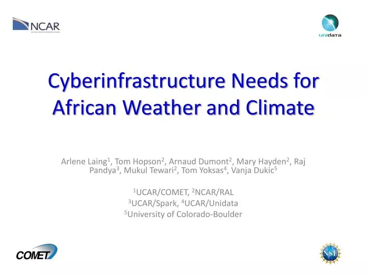
Cyberinfrastructure Needs for African Weather and Climate. Arlene Laing 1 , Tom Hopson 2 , Arnaud Dumont 2 , Mary Hayden 2 , Raj Pandya 3 , Mukul Tewari 2 , Tom Yoksas 4 , Vanja Dukic 5 1 UCAR/COMET, 2 NCAR/RAL 3 UCAR/Spark, 4 UCAR/Unidata 5 University of Colorado-Boulder. Motivation.

E N D
Cyberinfrastructure Needs for African Weather and Climate Arlene Laing1, Tom Hopson2, Arnaud Dumont2, Mary Hayden2, Raj Pandya3, Mukul Tewari2, Tom Yoksas4, Vanja Dukic5 1UCAR/COMET, 2NCAR/RAL 3UCAR/Spark, 4UCAR/Unidata 5University of Colorado-Boulder
Motivation • Africa: Major heat source that drives global atmospheric circulation, tropical cyclone origin, primary source of mineral dust, most intense thunderstorms on Earth. • Society vulnerable to environmental hazards and climate change. • Need to share weather & climate information (observations, models, etc…) to serve society through : • Research • Education • Applications
NatCatSERVICE Natural catastrophes in Africa 1980 – 2009 Number of events Number Geophysical events(Earthquake, tsunami, volcanic eruption) Meteorological events (Storm) Hydrological events (Flood, mass movement) Climatological events(Extreme temperature, drought, forest fire) MunichRE
Science Challenges/Critical Needs • Data Access and Dissemination • Access to observations, numerical weather prediction models, and climate models • Ability to share data & improve analysis and prediction • Knowledge advance through research, education, and training • Collaborative research (atmosphere is everywhere) • Unidata (real-time data access, tools to analyze and integrate data) • COMET (interactive multimedia modules, virtual courses) • Application of meteorological and climatological information to societal needs, e.g., • Food Security (famine early warning systems), Public Health, Water Resource Management • Effective engagement of end-users • Guide research priorities, give feedback on data usage, collect and share data, and results
UCAR Africa Initiative (AI) Context:Managing Meningitis in the Sahel • Periodic epidemics occur in the dry season • Current vaccination strategy is reactive (i.e. contain epidemics, don’t prevent them) • World Health Organization (WHO) decides where to send emergency vaccines. • Even with this strategy, often less vaccines available than needed
Weather-meningitis link? • Nm. meningitidisepidemics observed in dust season and end with onset of rainy season • Can humidity forecasts help identify regions where epidemic will end naturally, so that scarce vaccines can be moved elsewhere? Adapted from Greenwood, 1999 • Nm. meningitidis epidemics are observed to occur in the dust season and end with the onset of the rainy season • Can humidity forecasts help identify regions where the epidemic will end naturally, so that scarce vaccines can be moved elsewhere?
UCAR AI Objectives and Strategies • Predict epidemic end by: • Verifying Greenwood hypothesis linking meningitis season end and humidity • Leveraging existing meteorological forecasts • Characterize risk factor by: • Surveying 222 households for knowledge, attitudes and practices • Testing disease models against atmospheric, demographic, and epidemiological data • Characterize economic impact by: • Surveying 74 households for Cost of Illness • Inform reactive vaccination campaigns by: • Developing a useful Decision Information System that includes archived and real-time data and analysis tools
Relative Humidity Impact on Meningococcal Meningitis • Risk = f(Relative Humidity) • Probability of crossing alert threshold • Hopson and Dukic found that knowing the RH two weeks ago improves accuracy in predicting an epidemic by ~25%1 • Coupled with a two week forecast, this indicates an improved ability to anticipate a roll-off in epidemic 4 weeks in advance High Epidemic Risk when Dry Low Risk when Wet
Relative Humidity Impact on Meningococcal Meningitis 16-Day ensemble RH forecasts Meningitis Belt Converted to probability of a meningitis alert 3 weeks in advance
Africa Decision Information System (ADIS) for Meningitis • WHO-initiated pilot project participants: • Benin, Nigeria, Tchad, Togo • WHO, Columbia/IRI, Lancaster U. (UK), UCAR • Web-based interface provides: • Ensemble forecast RH fields • Map of districts colored & sized by meningitis attack rate • Interactive display of district-level information including district-specific time series plots of ensemble RH forecasts • Access limited to project participants (privacy concerns)
UCAR AI Next Steps • Refine forecast products and web-based end-user interface from feedback from WHO pilot project participants • Finalize data processing workflow at UCAR • Transfer technology to African Centre of Meteorological Application for Development (ACMAD) – agreement in principle in-place • Train ACMAD personnel in use of technology transferred • Assist ACMAD personnel in use of freely-available data access and visualization tools from Unidata
Challenges in Technology Transfer • ACMAD computing infrastructure (important) • Scheduled for upgrade in near to mid-term • Consistently available, “clean” power (critical) • High-speed access to global Internet resources (critical); current capabilities (768 Kbps down, 256 Kbps up) limit ability to: • Access to high-volume TIGGE ensemble model forecasts • Access to global observational data • Serve relevant datasets • Provide products online
Meteorology Research and Education • Advances require access to variety of data: • Satellite Products (exponential increase in volume) • Global numerical weather prediction products • Initialize customized regional models • Apply to societal needs (e.g., meningitis vaccine guidance) • Regional numerical weather prediction products • Tailor to regional/local needs • AMDAR (observations from commercial flights) • Aid aviation forecasting, improve aviation safety record • Air quality sensor data • Regional/local data to assimilate into numerical models
Advances with new data, data sharing, and use in numerical models • New upper air soundings • Resuscitated stations • Data shared with European Center for Medium-range Weather Forecasting (ECMWF) • Improve temperature, wind predictions Fink et al. 2011
NWP Forecast skill scores continue to improve Most of Africa not yet benefitting because of lack of capacity
Aerosols in Africa • Biomass Burning • Open burning • Cooking • Dust • Health • Climate Interactions Emissions Climate Climate Emissions Christine Wiedinmyer, NCAR
Climate Fire: Future Fire Krawchuk et al. PLoSONE, (2009)
2011Cumulative Daily Rainfall and Percentiles for Niamey Airport Station 13.483N - 2.167E Rainwatch: Climate Analysis & Food Security in Niger • Climate studies applied to disaster mitigation • U of Oklahoma & Niger • Ongoing updates of rainfall anomaly to Niger’s government Courtesy: Peter Lamb
Why Satellite Remote Sensing? EUMETSAT funded EUMETCast satellite downlinks in all African Weather Service offices
The Impending Data Deluge More Data, New Data Sources • EnvironmentalSatellites: • US:Both GOES-R and JPSS will have data rates 30-60 times the current • Europe:MSG 3rd generation and METOP • Raw data rate: 3 terabytes per day • Global, coupled models at a grid spacing of 1-5 km, integrated for multi-decades • NCAR Global WRF model for use in Weather and Climate research • TIGGE • New initiatives…
At Unidata: Tools and Support Are Central • Enhance and distribute software developed by others • Meteorological display and analysis tools from UW-Madison (McIDAS-X), National Weather Service/NCEP (GEMPAK, AWIPS-II), etc. • Remote access technologies: OPeNDAP (U of RI, NASA, and others), ADDE (UW-Madison) • Develop software in-house • Widely used tools for managing scientific data(e.g., LDM, netCDF, UDUNITS, data decoders, etc.) • Java-based tools (IDV Framework built on top of VisAD) for 2D and 3D visualization and next-generation, collaborative data analyses • Build systems from software we support • Internet Data Distribution (IDD) system • THematicRealtime Environmental Data Distributed Services (THREDDS) • Support software use via training, consultation, bug fixes, and upgrades
COMET: Education and Training via Distance Learning & Residence Courses • Interactive, multimedia training using case scenarios, based on sound science and guided by innovative instructional design • Provide modern conceptual framework for analyzing and forecasting major atmospheric features (e.g., tropical waves, jet streams, monsoon onset/migration) • Web-based – train large numbers of people; similar learning outcomes as residence at less cost • Virtual international courses for specialized training, requires high capacity band width for animations & interactive visualization tools
Weather Research & Forecasting (WRF) model EMS: WRF on a desktop Personal Tiles Personal tiles are subsets of larger, high-resolution data sets that have been packaged specifically for EMS real-time modeling • Provides the highest resolution initialization data tailored to a user’s domain • Only fields necessary for model initialization are provided • Dedicated data servers with restricted access • As much as 99% reduction in file size and bandwidth usage! • Process is entirely dynamic – no user configuration necessary http://strc.comet.ucar.edu/software/newrems/ Robert Rozumalski, NWS Think Globally, Model Locally
Global data set WRF EMS WRF EMS Personal tile for model initialization A single global 0.5 deg GFS file size ~55.5mb WRF Domain WRF Domain EMS Personal tile size ~1.47mb at full 0.5 degree resolution! Global data set Think Globally, Model Locally Robert Rozumalski, NWS
Implications for leveraging CI • Enhancing connections to user communities • For input into research priorities • For application of research results • For data collection • Supporting interdisciplinary, data-intensive research via data integration systems • Enabling modeling with bandwidth and hardware • Supporting training via Distance Learning • Facilitating collaboration via long-distance communications
Acknowledgements • NCAR is supported by the National Science Foundation • COMET is primarily funded by NOAA • Unidata is primarily funded by the National Science Foundation Contact Information Arlene Laing, laing@ucar.edu Tom Hopson, hopson@ucar.edu Arnaud Dumont, dumont@ucar.edu Mary Hayden, mhayden@ucar.edu Raj Pandya, pandya@ucar.edu MukulTewari, mukul@rap.ucar.edu Tom Yoksas, yoksas@unidata.ucar.edu VanjaDukic, Vanja.Dukic@colorado.edu