Download
1 / 51
520 likes | 769 Views
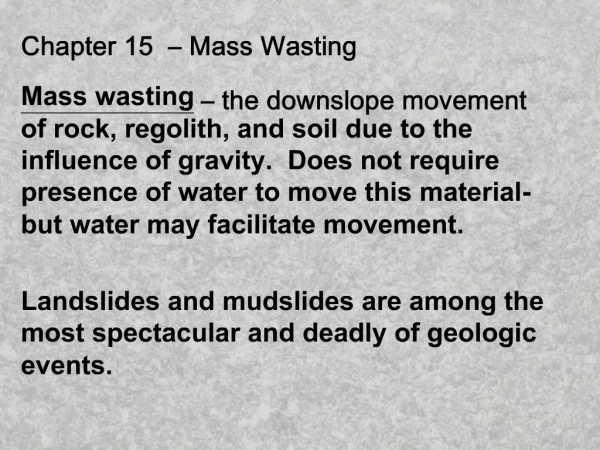
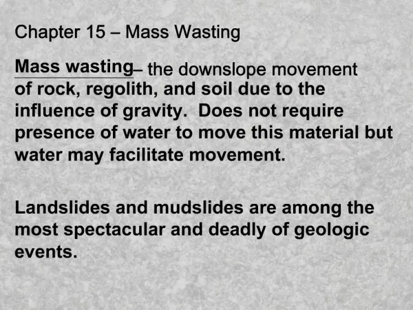
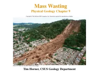
Chapter 8 Erosion Ahamdi And Chapter 13 Mass Wasting Dynamic Earth, An Introduction to Physical Geology Skinner, Porter and Park College of Sciences Library: 550 S628 2004 C3. Slope Failures. Slumps : is a type of slope failure in which a downward and

E N D
Chapter 8 Erosion Ahamdi And Chapter 13 Mass Wasting Dynamic Earth, An Introduction to Physical Geology Skinner, Porter and Park College of Sciences Library: 550 S628 2004 C3
Slope Failures Slumps: is a type of slope failure in which a downward and outward rotational movement of rock or regolith occurs along a curved concave-up surface Rock Falls and Debriz Falls: The free falling of detached bodies of bedrock from a cliff or steep slope Rock Slides and Debriz Slides: sudden downslope movement of the detached mass of bedrock along an inclined surface Slurry Flow: is a moving mass water saturated sediment Sediment Flow Granular Flow: is the mixture of sediment, air and water. Weight of flowing sediment Is supported by grain to grain contact
Slope Failures Slumps Rock Falls and Debriz Falls Rock Slides and Debriz Slides
Solifluction: Very slow downslope movement of saturated soil and regolith Sediment Flow Slurry Flow: Debriz Flow: Downslope movement of Unconsolidated regolith, the greater part being coarser than sand Mudflow: a rapidly moving debriz flow with a water content sufficient to make it highly fluid. Granular Flow: Creep and Colluvium: the imperceptibly Slow downslope movement of regolith. Steeply inclined rock strata are sometimes bent over in the downslope direction just below the ground surface Earth Flow: granular flows having a velocity of about 1 cm/day To 100 m/hr, may be active for several days Grain Flow:movement of dry or nearly dry granular sediment with air filling the pore space (in dune sands) Debriz Avalanches: A large rapidly moving debriz avalanche Constitutes a huge mass of falling rock and debriz that break up, pulverizes on impact, and then continue to travel downslope, often for great distances
Sediment Flow
The Effective Factors on Mass Movement: 1- Moisture Content: Plastic limit, Liquid limit 2- Topography: Slope, aspect orientation 3- Kind of Clay Minerals : Montmorillonite, Illite, Chlorite 4- Intensive factors: Fault, Soluble material content of Formation, Human effect
Gully: An extensive deep erosional canal with vertical walls, Narrow width and head cut that always has V shape section Their impacts: 1- Soil degradation, 2- Destroying the utilities and 3- filling of reservoirs and dams in downstream 4- drainage of groundwater 5- Preventing the spreading of surface runoff and GW recharge
Gully: The intensifying agents: Schumm and Hadley (1951): 1- Over grazing 2- Decreasing of vegetation cover 3- Increasing the surface runoff due to climate change 4- Runoff Concentration due to human activities 5- The soluble material content of the formations Thamson (1946): 6- Its upstream slope 7- Precipitation more than 13 mm in 24 hr 8- soil particle size of less than 0.005mm 9- Formation solubility Ghoddusi(1373) 10- Soil Horizons characteristics
Gully: The intensifying agents: 11- Geological Formation 12- Kind of soil 13- Slope percent: Plain surface 6.1 times of the slopped surface 14- Land use 15- Elevation of gully head
Gully Formation Mechanisms: 1- Creation of a topographic depression on the plain surface (Artificial or Natural and due to vegetation cover ) 2- Concentration of surface runoff in it 3- Dissolution, piping and creation of under ground conduits 4- Collapsing of the roof of pipes and creation of Gully with vertical wall
Gully is formed when the balance is changed in natural channels: Passing discharge Channel Capacity Size Shape Increase in Channel erosion decrease in Channel width Channel Depth Hydraulic radius Smoothness of channel bed (No Vege.) Decrease in channel slope (intense cutting on head) >>
Unbalance condition is due to: 1- Kind of Formations, soils and Land use: Loass Marl and Gypsum formations, Sodic soils, Soil horizons, Urbanization, Agriculture and Decrease in soil organic material, 2- Intensity and frequency of precipitation: Climate change 3- Geomorphology: Artificial change in surface slopes, Artificial concentration of flow 4- Vegetation Cover: Over grazing, Cutting the Forests
Lateral erosion and improvement of Gullies : GROUNDWATER -Seepage of groundwater with high hydraulic gradient -High pore pressure and low effective pressure on gully walls -Washing of soluble material in soil and decrease of cohesive force between particles Features: Piping erosion on walls, deep rills SURFACE WATER -Direct insertion of surface runoff or stable surface flow to the gully from its lateral boundaries Features: indentation on wall edges
Dimensional analysis of Gullies: Finding the correlation between the gullies dimensions and dimensional characteristics: Length Depth Width Volume Upstream area
They are controlled by : Tillage, Construction of artificial canals Improving vegetation cover