Download
1 / 31
330 likes | 1.46k Views
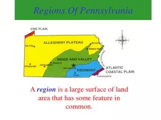
Regions of Pennsylvania. CHAPTER 1. PA’s Borders. 1 Great Lake Lake Erie. 1 River Delaware River. 6 States New York New Jersey Ohio West Virginia Maryland Delaware. Shares a border with 6 states , 1 Great Lake , and 1 river. The Mason-Dixon Line.

E N D
Regions of Pennsylvania CHAPTER 1
PA’s Borders 1 Great Lake • Lake Erie 1 River • Delaware River 6 States • New York • New Jersey • Ohio • West Virginia • Maryland • Delaware Shares a border with 6 states, 1 Great Lake, and 1 river
The Mason-Dixon Line The border marked between PA and Maryland Very important during the Civil War All states north of the line were called “The Northern States” All states south of the line were called “The Southern States”
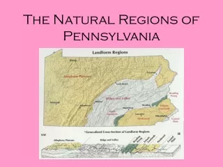
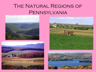
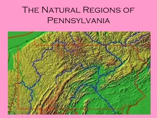
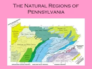
Physical geography – studying about the Earth’s surface and its features features – climate, people, cities, landforms, plants, and animals Region – a large surface of land area that has some feature in common.
Atlantic Coastal Plain Delaware River and Philadelphia
Land Formation Plain Plain – flat land Rich soil for good crops, but not much farming Philadelphia is the largest city
Climate Avg Temp Jan – 31 F Avg Temp July 76 F Avg rainfall 44 in per year Avg snowfall 15-30 in per year
Interesting Facts Located in SE PA Phila. Is a port city - ships come and go to import and export goods Part of ocean millions of years ago
Piedmont Amish Country, Lancaster County
Land Formation Gentle Rolling Hills Piedmont – the land at the base of a mountain Longest growing season in PA Lancaster – make and send goods around the country Amish – people who farm without modern equipment because of their religious beliefs
Climate Avg Temp Jan – 30 F Avg Temp July 74 F Avg rainfall 43 in per year Avg snowfall 15-30 in per year
Interesting Facts Starts W of Philly Best soil in the USA Many different animals and crops Many factories that process foods
Ridge and Valley Perry County, South of Newport
Land Formation Ridge and Valley ridge – hills and mountains in a narrow chain valley– the land, lower, between two ridges Soil in the valleys are excellent for grazing cattle and growing crops
Climate Avg Temp Jan – 25 F Avg Temp July 71 F Avg rainfall 30-44 in per year Avg snowfall 30-65 in per year
Interesting Facts Only 100 miles wide Each ridge and valley has a separate name The GREAT VALLEY runs its entire length Allegheny Mountains on Western border
Allegheny Plateau PA Grand Canyon
Land Formation Plateau plateau – land that is higher than its surrounding area Many rivers. Streams, and thick forests Pocono Mountains
Climate Avg Temp Jan – 26 F Avg Temp July 72 F Avg rainfall 30-44 in per year Avg snowfall 30-65 in per year
Interesting Facts W of Ridge and Valley More than half of PA PA 2nd largest city - Pittsburg Mt. Davis – highest point in PA
Erie Lake Erie
Land Formation Plain Borders Lake Erie, one of the Great Lakes City of Erie is a port city
Climate Avg Temp Jan – 24 F Avg Temp July 69 F Avg rainfall 44 in per year Avg snowfall 65-100 in per year
Interesting Facts NW PA Was once part of Lake Erie PA 3rd largest city - Erie In a snowbelt region – get a lot of snow in the winter because it is near a lake
State Symbols State Seal State Coat of Arms
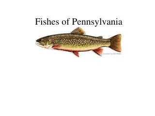
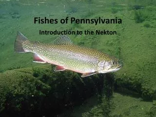
State Symbols State Flower: Mountain Laurel State Fish: Brook Trout
Project Check List PARAGRAPH • Climate • Landforms • Population • Major city • Interesting facts MAP • 5 regions labeled • 5 landforms, labeled • Water – 2 forms • 3 major cities (port city, capital, and any other • 6 border states – labeled • Map key • Title (same as group name)