Download
1 / 29
290 likes | 581 Views
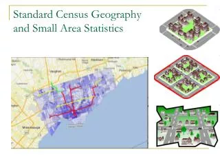
Understanding Census Geography. Lisa Neidert NPC Workshop : Analyzing Poverty and Socioeconomic Trends Using the American Community Survey June 22 – June 26, 2009. Census Geography. Geographic Areas: with 1-year and 3-year data. Geographic Areas: with 1-year and 3-year data.

E N D
Understanding Census Geography Lisa Neidert NPC Workshop: Analyzing Poverty and Socioeconomic Trends Using the American Community Survey June 22 – June 26, 2009
What’s available in the ACS for single year data: via maps • Maps showing counties and places for each state (or the nation) • http://www.census.gov/acs/www/Products/users_guide/acs_2007_reference_maps.htm
States where all counties are over 20,000 • Connecticut • Delaware • District of Columbia • New Hampshire • New Jersey • Rhode Island
What geographies are available in the 2005-2007 ACS http://www.census.gov/acs/www/acs-php/2005_2007_beginner_users_guide.php
Geographical Areas (Texas):Covered in 2005-2007 • ACS 2005-2007 Geographical Areas
What’s available in the ACS: via Look-up tables • Geographic entities available for 1-year data (2007) • Geographic entities available for 3-year data (2005-2007)
Not ready for prime-time: census tracts and zip codes • Need 5-year estimates file • 2005 – 2009 • Available 2010 • Annual updates thereafter • 2006 – 2010 • 2007 – 2011, etc. • Test site available • – selected counties (34) • Selected profiles (demographic, social, economic, housing)http://www.census.gov/acs/www/AdvMeth/Multi_Year_Estimates/overview.html#noteforusers
Zip codes • Not census geography • However, big demand for zip code data • Census Bureau builds ZCTAs via census blocks • ZCTA FAQs • http://www.census.gov/geo/ZCTA/zctafaq.html • Fun resource • http://en.wikipedia.org/wiki/Zip_code
What are PUMAs? • Public Use Microdata areas • Combination of population geographies that sum to at least 100,000 population. • In rural areas, several counties will form a PUMA. In an urban area, a county will be subdivided into multiple PUMAs. • PUMAs do not cross state boundaries
PUMAs. . . . • PUMAs do not have good comparability over time (1990, 2000). • PUMA geographies for the ACS are the same as the 2000 boundaries • PUMAs are reasonable substitutes for counties • Smallest geography available in the microdata.
PUMAs • Can be valuable for bypassing geographic restrictions when one wants national information at the county level • Create pseudo counties based on a cross-walk between PUMAs and counties
PUMAs via Maps • Reasonable tool for rural parts of a state • Somewhat unwieldy for urban areas • Multiple maps per state http://usa.ipums.org/usa/volii/2000pumas.shtml
PUMAs via text • Describes PUMA composition • By: • County • County subdivision • Place • Census tract • http://usa.ipums.org/usa/volii/2000pumas.shtml • http://www.psc.isr.umich.edu/dis/data/ref/PUMA/SUPERPUMA-2000-5pct.html
Metropolitan areas • Defined by Office Management Budget (OMB) • http://www.census.gov/population/www/estimates/metrodef.html • Historical Definitions • http://www.census.gov/population/www/estimates/pastmetro.html • Researcher is free to follow own definitions • Census Bureau follows OMB definitions