Download
1 / 54
540 likes | 771 Views
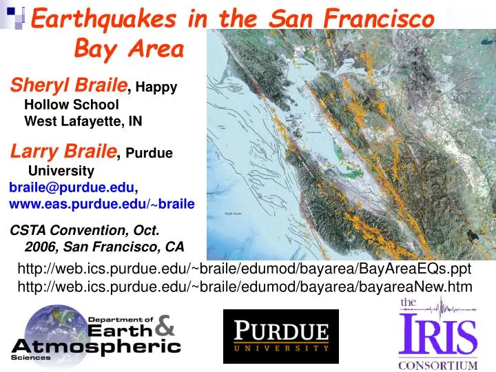
Earthquakes in the San Francisco Bay Area. Sheryl Braile , Happy Hollow School West Lafayette, IN Larry Braile , Purdue University braile@purdue.edu , www.eas.purdue.edu/~braile CSTA Convention, Oct. 2006, San Francisco, CA.

E N D
Earthquakes in the San Francisco Bay Area Sheryl Braile, Happy Hollow School West Lafayette, IN Larry Braile, Purdue University braile@purdue.edu, www.eas.purdue.edu/~braile CSTA Convention, Oct. 2006, San Francisco, CA http://web.ics.purdue.edu/~braile/edumod/bayarea/BayAreaEQs.ppt http://web.ics.purdue.edu/~braile/edumod/bayarea/bayareaNew.htm
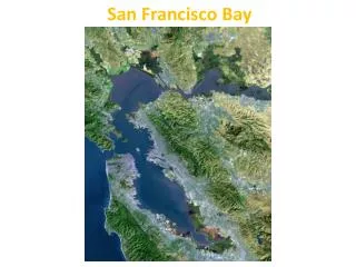
2004 USGS Map: Earthquakes and Faults in the San Francisco Bay Area
http://wrgis.wr.usgs.gov/docs/gump/zulanger/bayarea/landsat.html
Old version (1990 map/satellite image): http://web.ics.purdue.edu/~braile/edumod/bayarea/bayarea.htm New version (2004 map): http://web.ics.purdue.edu/~braile/edumod/bayarea/bayareaNew.htm
The 1906 San Francisco Earthquake (M~7.8) Photo by G.K. Gilbert
The 1906 San Francisco Earthquake (M~7.8) ~3 m right lateral offset on the San Andreas fault
The 1906 San Francisco Earthquake (M~7.8) San Andreas fault at Earthquake park near Tomales Bay (road to Point Reyes) http://www.seed.slb.com/en/scictr/watch/seismology/pt_reyes.htm Today 1906
The 1906 San Francisco Earthquake (M~7.8) San Andreas fault at Earthquake park near Tomales Bay (road to Point Reyes) http://www.seed.slb.com/en/scictr/watch/seismology/pt_reyes.htm Damaged Barn (subsequently razed) Offset Fence
The 1906 San Francisco Earthquake (M~7.8) San Francisco after the Earthquake and fire.
The 1906 San Francisco Earthquake (M~7.8) San Francisco after the Earthquake and fire.
The 1906 San Francisco Earthquake (M~7.8) Comparison of fault lengths for selected significant events on the San Andreas.
San Andreas Fault – A Right-Lateral Strike-Slip Fault What is the relative motion? Why is it called right-lateral?
The 1906 San Francisco Earthquake (M~7.8) San Francisco bay area geology.
The 1906 San Francisco Earthquake (M~7.8) Near-surface sediments shear wave velocity – an indicator of site response for earthquake shaking.
http://www.abag.ca.gov/cgi-bin/pickmapx.pl Site response map
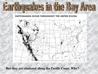
Earthquakes in California Nevada area 1973 – 2006 M3+ The Seismic Eruption software http://www.geol.binghamton.edu/faculty/jones/
Earthquakes in California Nevada area 1973 – 2006 M3+
Earthquakes in California Nevada area 1973 – 2006 M3+ Close-up of Northern CA area Northern San Andreas Fault (area that slipped in 1906)
Earthquakes in San Francisco Bay area 1973 – 2006 M1+ Plotted with Seismic Eruption
Earthquakes in San Francisco Bay area 1973 – 2006 M1+ Plotted with Seismic Eruption (bayarea.hy4 file, 3434 events)
Earthquakes in San Francisco Bay area from significant U.S. earthquakes catalog 1805 - 1989 Plotted with Seismic Eruption
Digital satellite images of the San Francisco Bay area and major faults http://www.sfbayquakes.org/
http://pubs.usgs.gov/gip/2006/21/gip-21.pdf Earthquake resources
Earthquake hazards and damage Soft first story failure
Dec. 26, 2003 M6.6 Earthquake, Bam, Iran, ~80% of buildings destroyed