Download
1 / 65
650 likes | 1.26k Views
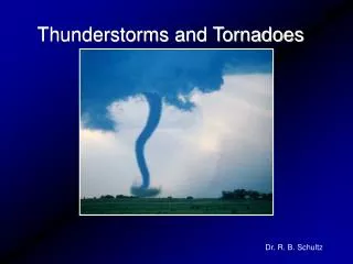
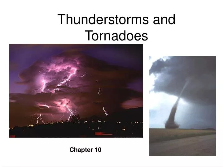
Thunderstorms and Tornadoes. Chapter 10. Chapter 10. Thunderstorms and Tornadoes. Interesting topic due to their violent nature Estimates - 2,000 storms occurring over earth at any given second! In this chapter: Types How they form Life cycle, lifetime Lightning and thunder Tornadoes.

E N D
Thunderstorms and Tornadoes Chapter 10 Chapter 10
Thunderstorms and Tornadoes • Interesting topic due to their violent nature • Estimates - 2,000 storms occurring over earth at any given second! • In this chapter: • Types • How they form • Life cycle, lifetime • Lightning and thunder • Tornadoes
Thunderstorms • Thunderstorms - storm which contains lightning and thunder • Many variations - may contain: • Strong surface winds (non-tornadic) • Heavy rain / no rain • Hail • In general, 2 things are needed to get a thunderstorm…...
Thunderstorms • 1) Warm, humid air rising • 2) Conditionally unstable environment • The trigger to get air rising is something we’ve talked about much of the semester already: • Heating at the surface • Fronts • Terrain • Convergence (surface) and/or divergence (aloft) • Usually a combination of these to get severe storms
Air Mass (Ordinary) Thunderstorms • These are the types we get in FL often during summer • Called “Air Mass” storms because they occur well away from fronts within an air mass. • What type of air mass?? Warm/humid?? • Maritime tropical (mT) usually • Usually weak and short lived • Don’t produce much hail or strong wind
Air Mass Thunderstorms • 3 distinct stages make up the life of an air mass t-storm: • 1) Cumulus stage • Warm, humid air rises and condenses into a cumulus cloud • May only last 10-15 minutes if the air is very moist where the cloud is building • Longer if air is dry
Air Mass Thunderstorms • 1) Cumulus stage • Large amounts of latent heat released • Air in cloud is warmer and continues to rise • Cloud continues to grow as long as air rises from below • No precipitation during this stage • Not enough time and updrafts keep drops from falling
Air Mass Thunderstorms • As the cloud grows, particles eventually get heavy enough to fall • drags air downward • Also, sides of the cloud evaporate as dry air is “entrained” • Cooling - heavier air • These 2 effects combine to form a “downdraft”
Air Mass Thunderstorms • 2) Mature Stage • Marked by the appearance of a downdraft • Now we have an updraft/downdraft couplet called a “cell” • Usually several cells within a storm • This is now the most intense stage of the storm
Air Mass Thunderstorms • 2) Mature Stage • Up/down drafts are most intense in the middle of the cloud • Heavy rain possible in this stage • An “anvil” top appears as the updrafts hit the tropopause
Mature Stage Anvil top
Air Mass Thunderstorms • 3) Dissipating Stage • Downdrafts choke out the updrafts • Cuts off the warm, moist air which is the energy supply for the storm • Light rain only
Air Mass Thunderstorms • Whole process lasts about an hour • Ultimately, the storm kills itself with downdrafts • However…..these cool downdrafts may act like mini-cold fronts as they hit the surface and spread out horizontally.
Multicell Thunderstorms • If new thunderstorms form due to downdrafts from air mass t-storms, they are called “multicell” thunderstorms • In fact, most ordinary storms are multicell storms (as are most severe storms) • That is, not very often will only a singular storm form
Multicell Thunderstorms Mature Stage Cumulus Stage Cumulus Stage
Severe Thunderstorms • These are the ones which produce: • Large hail, strong surface winds, heavy rain w/ flooding, and tornadoes • Technically (National Weather Service): • 3/4 inch hail and/or 50 knot wind gusts at the surface required to use term “severe” • One big difference from ordinary t-storms is that many severe storms have a tilted updrafts and downdrafts • Tilt keeps the downdraft from killing the storm
Severe Thunderstorms • Tilted updrafts are caused by “vertical wind shear” • Change in speed or direction of the wind w/ height • Both cause the storm to tilt Speed shear Directional shear
Severe Thunderstorms • Bottom line is that the storm can live for many hours • Updrafts can become so strong that they keep suspended particles (like hail) in the cloud long enough to become very large
Severe Thunderstorms • The combination of tilted up/downdrafts actually acts as a self feeding mechanism for the storm • Cool air hitting the surface acts like a plow which feeds warm air into the updraft
Features of Severe T-storms • Many interesting features of severe storms as downdraft air hits the surface • Remember we said the cool downdraft air acts like a mini-cold front? • Actually has its own name - “Gust front” or “Outflow boundary” • Cool air and gusty winds as it passes you on the ground • Can be seen on RADAR occasionally • Also causes some strange looking clouds to form as warm air is forced to rise over the cool air...
Features of Severe T-storms • Shelf cloud (arcus cloud): • Forms at the leading edge of the gust front as the warm air rises, cools, and condenses Cool Air Warm Air
Features of Severe T-storms • Occasionally, downdrafts can be very localized and spread out evenly in all directions • like water from a tap • Called a “downburst” • Or a “microburst” if winds only extend outward 4 km or less
Microbursts • Big time threat to aircraft • Have caused several airline disasters • At a), head wind causes extra lift • At c), tail wind causes loss of lift and sometimes pilot overcompensation as well
Supercells • Huge rotating thunderstorm • Eerie to look at • Updrafts over 100 mph inside • Hail the size of grapefruit • These are the storms that produce the most destructive of tornadoes
Supercells • Can be distinguished from other types of t-storms on radar by their movement • “Right movers” • Move to the right of steering winds aloft and other storms in the area • Common in the plains states • Rare in Florida but possible on occasion
Organized Thunderstorms • In some instances (like ahead of cold fronts), groups of storms can become extremely organized • Lines of storms extending nearly 1,000 miles • Termed “squall lines” • Damaging straight line winds
Organized Thunderstorms • “Dry lines” can also cause long lines of storms similar to squall lines • Dry lines are similar to fronts but represent only a change in moisture Sometimes called “dew-point fronts” • Ex. Temps in the 90’s on each side but dew-points 20’s one side 70’s other.
Organized Thunderstorms • Most frequent in eastern Texas, Oklahoma, and Kansas during spring and early summer • Where dry air from Mexico and the Southwest meets moist air from the Gulf of Mexico
Organized Thunderstorms • 2 things happen to form t-storms • 1) Moist and dry air masses converge (lifting) • 2) Warm, dry air from west side of line rides over the warm, humid air from the east (due to terrain) • This sets up a potentially unstable situation
Organized Thunderstorms • “Mesoscale Convective Complexes” • Large organized mass of thunderstorms • Can last for over 12 hours • Very important for agriculture in the plains • Supply a large amount of annual growing season rainfall
Distribution of Thunderstorms • 40,000 storms every day worldwide!! (14 million per year) • Greatest # in the southeast • Bullseye over central Florida • Smaller bullseye in central Colorado
Distribution of Hail Days • Hail maximum is in the central plains -- not central Florida • Huh???? • Why is this if the most t-storms are in Florida? • The storms in the plains are generally much stronger -- more severe weather
Lightning and Thunder • Lightning - an electrical discharge from • cloud to cloud, cloud to ground, cloud to air • 100 flashes per second worldwide! (8.5 million/day)
Lightning and Thunder • When lightning occurs, the air it travels through is heated • a) 540º F ? • b) 5,400º F ? • c) 54,000º F ? • 54,000º F (5x hotter than Sun’s surface!)
Lightning and Thunder • We know heating causes air to expand • Lightning heats the air so rapidly and to such a high temperature that it causes a shock wave to form - Thunder • Travels all directions from the flash at the speed of sound - 1,100 feet / second or ~1 mile in 5 seconds • So you can estimate how far away lightning is by counting the seconds between the flash and the thunder (flash gets to your eyes instantly) • 10 seconds = 2 miles away
Lightning and Thunder • The type of sound you hear also tells you something about the distance • Sharp “clap” = very close • “Rumbling” = further away • This type of noise is due to sound from different parts of the stroke reaching your ears • Includes sound which has been bounced off of objects (buildings, etc.) before it reaches you • So, what causes lightning in clouds? • It’s and electrical process so there must be some kind of charge separation (+ somewhere, - elsewhere)
Lightning • How clouds become electrified is not completely understood. • The most widely accepted theory is that electrification of clouds occurs due to: • interaction of ice & super-cooled water drops • Recall from earlier in the semester, a cumulonimbus (t-storm) cloud has 3 regions within itself...
Lightning • This setup is ideal for the cloud to become electrified • How it works: • Mature storm - hail, ice, graupel particles being moved around by the up/down drafts • In the middle of the cloud, these particles come in contact w/ super-cooled water which freezes upon them….. Ice Ice & super-cooled water Water
Lightning • As the freezing of water occurs (liquid to solid phase change), what happens in terms of latent heat? • Latent heat released • Result is that hail/graupel particles are a little warmer than surrounding ice crystals Ice Ice & super-cooled water Water
Lightning • Now here’s the kicker… • There is a net transfer of positive ions to the ice • So the hail/graupel is negatively (-) charged and the ice crystal positively (+) • charge separation • Ice is light weight so it gets blown to the top • Hail/graupel is heavier so it stays in the mid/lower part Ice Ice & super-cooled water Water
Lightning • So now the cloud has: • + charge on top • - charge in the middle • -/+ on the bottom • mostly - on bottom except where precipitation is falling • All of the negative charge in the mid/lower part causes objects below to become positively charged • As the cloud moves along, so does the charge at the surface (like a shadow) Ice Ice & super-cooled water Water
Lightning • The strength of the charge separation is called the “electrical potential gradient” • Greatest over tall objects • Trees, buildings, etc. • So don’t run for the cover of a tree outside! • When the electrical potential gradient becomes great enough, a lightning stroke forms Ice Ice & super-cooled water Water
Lightning • From the cloud base, lightning travels in a series of steps • About 50-100 meters each • 5/100,000 of a second pause in between each step • Initial step is called the “stepped leader” • Not usually visible • As it approaches the ground, a charge from the surface rushes up to meet it….
Lightning • As the charges meet, a very bright “return stroke” appears from the ground up to the cloud base • follows path of the stepped leader • the return stroke is what you see • Ever hear someone say lightning travels from the ground up?
Lightning • What about multiple flashes in the same place? • Often the “leader-return stroke” process happens several times in the same channel • However, after the first stroke, the leader is now called a “dart leader” • So, there’s only one stepped leader • Every leader thereafter is a dart leader • A 3 flash sequence would be • Stepped leader, return stroke, dart leader, return stroke, dart leader, return stoke
Lightning • How do we keep lightning from destroying things? • Like on the roof of the Love building, we have all kinds of expensive stuff • What we do is actually try to attract the lightning to some other object….
Lightning Rods • They are attached to an insulated conducting wire • Wire is attached to another metal rod buried in the ground • So, the charge goes into the ground, not into the equipment
Lightning • Final notes about lightning: • Florida has the most lightning deaths annually • Makes sense due to the fact that central Florida has the most thunderstorms (and tourists) annually