Download
1 / 43
440 likes | 659 Views
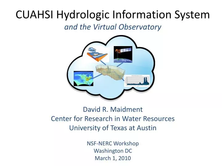
CUAHSI Hydrologic Information System and the Virtual Observatory. David R. Maidment Center for Research in Water Resources University of Texas at Austin NSF-NERC Workshop Washington DC March 1, 2010. CUAHSI Hydrologic Information System and the Virtual Observatory.

E N D
CUAHSI Hydrologic Information System and the Virtual Observatory David R. Maidment Center for Research in Water Resources University of Texas at Austin NSF-NERC Workshop Washington DC March 1, 2010
CUAHSI Hydrologic Information System and the Virtual Observatory • The cloud and web services • CUAHSI water data services • Building water data networks • Ways of using water data services
CUAHSI Hydrologic Information System and the Virtual Observatory • The cloud and web services • CUAHSI water data services • Building water data networks • Ways of using water data services
HIS Team and Collaborators • University of Texas at Austin – David Maidment, Tim Whiteaker, James Seppi, Fernando Salas • San Diego Supercomputer Center – Ilya Zaslavsky, David Valentine, Tom Whitenack, Matt Rodriguez • Utah State University – David Tarboton, Jeff Horsburgh, Kim Schreuders, Justin Berger • University of South Carolina – Jon Goodall, Anthony Castronova • Idaho State University – Dan Ames, Ted Dunsford, JiriKadlec
A Virtual Observatory for Catchments Accessing and synthesizing data and models …… Modeling Remote Sensing Weather and Climate Monitoring Catchment …… doing this in “the cloud”
What is “the cloud”?Networks of computers connected through the web ……. • Everything is a service • Data, models, visualization, …… • A service receives requests and provides responses using web standards (WSDL) • It uses customized web languages • HTML (HyperText Markup Language) for text and pictures • WaterML for water time series (CUAHSI) • GML for geospatial coverages (OGC) ….. supporting a wide range of users
How does the internet work? This is how it got started ….. Text, Pictures in HTML Web servers Mosaic browser …..this is how it works now Google, Yahoo, Bing Catalog Three key components linked by services and a common language Metadata harvesting Search Services Text, Pictures in HTML Web servers Firefox, Internet Explorer Server User
What has CUAHSI Done? Taken the internet services model ….. …..and implemented it for water observations data Catalog HIS Central Metadata harvesting Search Services Server User Time series data in WaterML HydroServer, Agency Servers HydroExcel, HydroDesktop, ...
CUAHSI Hydrologic Information System and the Virtual Observatory • The cloud and web services • CUAHSI water data services • Building water data networks • Ways of using water data services
Water Observations Data Water quantity Soil water Rainfall Water quality Groundwater Meteorology
Point Water Observations Time Series A point location in space A series of values in time
WaterML as a Web Language Discharge of the San Marcos River at Luling, TX June 28 - July 18, 2002 Streamflow data in WaterML language The US Geological Survey and other water agencies in the US have adopted WaterML
International Standardization of WaterML OGC/WMO Hydrology Domain Working Group (formed in December 2008) Design of WaterML 2.0 and testing in Interoperability Experiments OpenMI conceptual model should be included Meets 4 times per year (2 in Europe, 2 in US) + Hydrology Workshop at JRC, Ispra
NCDC Integrated Station Hourly Data Hourly weather data up to 36 hours ago 13,628 sites across globe 34 variables Published by National Climate Data Center and populated with weather observations from national weather services http://water.sdsc.edu/wateroneflow/NCDC/ISH_1_0.asmx?WSDL
USGS Instantaneous Data Real time, instantaneous data over the last 60 days 11188 sites, nationally for the US 80 variables Published by USGS National Water Information System
Corps of Engineers Water Observations Time series at Corps gages 2210 sites, mainly in Mississippi Basin 80 variables 4954 series Published by Corps of Engineers, Rock Island District to support their WaterML plugin to HEC-DSS http://www2.mvr.usace.army.mil/watercontrol/SOAP/WaterML_SOAP.cfc?wsdl
Reynolds Creek Experimental Watershed 1 data service 84 sites 65 variables 372 series 17.8 million data Published by USDA-ARS as part of an Idaho Waters project http://idahowaters.uidaho.edu/RCEW_ODWS/cuahsi_1_0.asmx?WSDL
Iowa Tipping Bucket Raingages Data Manager: Nick Arnold, IIHR
The CUAHSI Water Data Catalog 47 services 15,000 variables 1.8 million sites 9 million series 4.3 billion data Values . . . All the data is accessible in WaterML
Hydro Portal: Interconnection of data portalsbased on the OGC Catalog Services for the Web standard Customization of ArcGIS GeoPortal Extension 9.3.1 for WaterML web services data
Working Towards Common SemanticsUsing an Ontology to Reconcile Meanings of Variables • A hierarchy of concepts • Match variables to leaf concepts Physical Hydrosphere Chemical Uses EPA Substance Registry System for Chemistry Biological http://test.hydroseek.net/ontology/Ontology_heirarchy.html
CUAHSI Hydrologic Information System and the Virtual Observatory • The cloud and web services • CUAHSI water data services • Building water data networks • Ways of using water data services
WISKI Water Data Management Systemfrom the Kisters company based in Aachen, Germany Kisters has adopted the CUAHSI model for water data services
WISKI Data Systems in the UK and Ireland The technology to implement CUAHSI water data services in the UK is already deployed….
WISKI Data Systems in the UK and Ireland Surface water: 7696Rainfall: 13236Groundwater: 20184Effluent sites: 3658Water quality: 237Areal: 257 (for calculation of areal rainfall)Secondary gauging sites: 43 (for summarizing gaugings)Reservoirs: 239 46,000 sites
ICEWATER • Inland Northwest Research Alliance (INRA) Water Research Consortium - coalition of eight universities working in cooperation with the US Department of Energy • Boise State University • Idaho State University • Montana State University • University of Alaska Fairbanks • University of Idaho • University of Montana • Utah State University • Washington State University • ICEWATER – INRA Constellation of Experimental WATERsheds http://www.inra.org/ http://icewater.inra.org/
ICEWATER Data • Point Observations • Stream gages • Water quality sampling • Weather stations • Soil moisture • Snow monitoring • Groundwater level/quality • Spatially Distributed Data • Land use/cover • Terrain • Hydrography
ICEWATER CI Architecture • Each University establishes a HydroServer node • A central portal provides support services
CUAHSI Hydrologic Information System and the Virtual Observatory • The cloud and web services • CUAHSI water data services • Building water data networks • Ways of using water data services
How do you access WaterML web services? HIS Central Metadata harvesting Search Services Users Time series data in WaterML HydroServer, Agency Servers HydroExcel, HydroDesktop, ...
HydroExcel – one series at a timeSoil water data from Dry Creek Watershed
HydroDesktop – an Open Source HIS A web-based collaborative software design and development environment was set up on CodePlex.com. This site includes a discussion forum, wiki, source code repository and versioning system, and bug/issue tracking system. http://www.HydroDesktop.org
HydroDesktopA Hydrologic Information System integrates space, time and modeling OpenMI SQLite MapWindow http://www.hydrodesktop.org – an open source software development
Pipistrelle : OpenMI Model CompositionsDeveloped at Hydraulic Research Wallingford Map Window Database reader CUAHSI Components Database writer
A Question… Once you have a cloud….. …..what is the telescope you use to view it?
Some parting thoughts….. • The Virtual Observatory is a great idea! • WaterML is a standard for sharing water observations data • We in CUAHSI HIS would be happy to collaborate with the VO team • We would like to learn from what you do