Download
1 / 22
220 likes | 324 Views
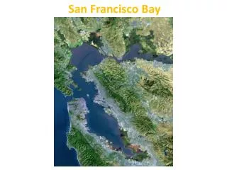
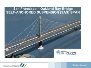
SAN FRANCISCO BAY OPERATIONAL FORECAST SYSTEM. Background and Planning Meetings Historical Perspectives Recent Perspectives Key Hydrodynamic Processes PORTS Suggested Approaches Next Steps Richard A. Schmalz July 19, 2010. Background and Planning Meetings.

E N D
SAN FRANCISCO BAY OPERATIONAL FORECAST SYSTEM Background and Planning Meetings Historical Perspectives Recent Perspectives Key Hydrodynamic Processes PORTS Suggested Approaches Next Steps Richard A. Schmalz July 19, 2010
Background and Planning Meetings October 9, 2009 CSDL Preliminary Planning Meeting IOOS/RA Reviews California Coastline USGS San Francisco Bay Modeling Review May 6, 2010 CSDL Follow-up Planning Meeting FVCOM User Workshop Review California Current System Modeling Review AGU Ocean Sciences Meeting Abstract Reviews
Historical Perspective NOS 1979-1980 Circulation Survey Report 7 R.T. Cheng, USGS retired, OFS—2d TRIM Customized windfield provided by F. Ludwig, Stanford University website semi-operational---R. Smith, USGS
Recent Perspectives • NOS Historical Circulation Survey Data Restoration CSDL Tech Note 9. • Movement towards 3d unstructured grids in recent model studies: unTRIM, SUNTANS, and FVCOM. • San Francisco Bay-Delta UnTRIM Model Calibration Report, California Department of Water Resources, December 2008.
Key Hydrodynamic Processes Upwelling/Downwelling dynamics—California Current (ROMS OSU and JPL models) Internal wave generation—nonhydrostatic SUNTANS and ROMS coupling (Fringer et al., Oceanography, 2006) Shelf-Bay interaction Salinity intrusion and Delta dynamics Wetting-drying of tidal flats in the northern Bay Inundation associated with coastal storms
USGS/NOS Real-time C/T Sensors Plans for USGS real-time C/T sensor network Proposed addition of PORTS C/T sensors at all PORTS water level gauges pending funding Cooperation with USGS in station location selection and maintenance of selected stations
VDATUM Grid in the vicinity of San Francisco Bay
Suggested Phase I Tasks • Use FVCOM Version 3.1 • Modify VDATUM California grid using SMS • Consider Apr-May 1979 and Sep-Oct 1980 for initial tidal and hindcast simulations
USGS/NOS Modeling Cooperative Efforts • Phase I consistent with recent unstructured grid modeling approaches, builds on VDATUM grid and bathymetry, and uses recovered historical NOS data employed by Ralph Cheng, USGS, for comparison of modeling results. • Unstructured modeling approach allows NOS FVCOM modeling approach to be coordinated with unTRIM modeling efforts by Jon Burau, USGS, Sacramento. • Assistance and cooperation in the development of the Delta inflow boundary conditions, particularly during the historical 1979-1980 hindcast.
Suggested Phase II Tasks • Extend the tidal and hindcast periods from April 1979 – October 1980. • Perform formal tidal and hindcast skill assessments. • Efforts underway with USGS: Ralph Cheng, Jeff Gartner, and Jon Burau to obtain CTD and current meter datasets.
Suggested Phase III Tasks • Transfer and couple San Francisco Bay FVCOM to shelf forecast models at NCEP • ETSS/G-NCOM • NOS West Coast Shelf Model • Perform formal skill assessment of NCEP coupled San Francisco Bay FVCOM nowcasts and forecasts
Next Steps • Review and edit NOS Circulation Survey Current, CT, and CTD datasets • Obtain historical water level data 1979-1980 • Obtain water level and PORTS current station HA results • Perform HA (15-day) on historical current data • Revise VDATUM grid and bathymetries • Develop additional water level, current, and density station locations--- initially measure conductivity at PORTS water level stations.