Download
1 / 16
160 likes | 435 Views
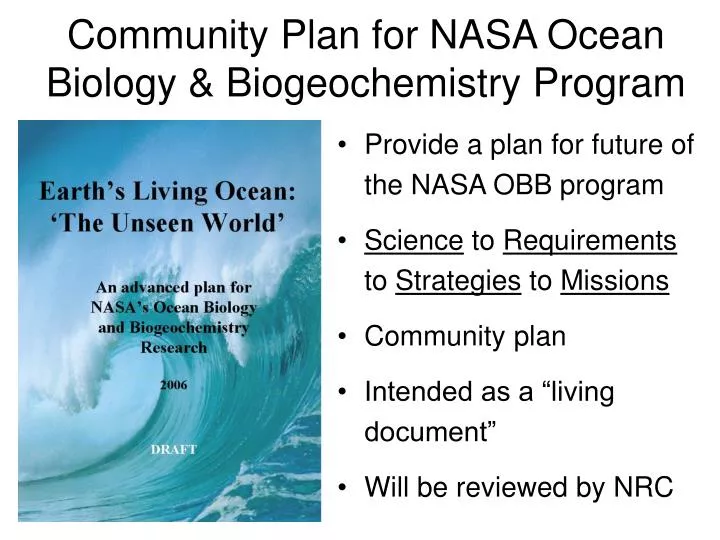
Community Plan for NASA Ocean Biology & Biogeochemistry Program. Provide a plan for future of the NASA OBB program Science to Requirements to Strategies to Missions Community plan Intended as a “living document” Will be reviewed by NRC.

E N D
Community Plan for NASA Ocean Biology & Biogeochemistry Program • Provide a plan for future of the NASA OBB program • Science to Requirements to Strategies to Missions • Community plan • Intended as a “living document” • Will be reviewed by NRC
Emerging Scientific Questions in Ocean Biology and Biogeochemistry Research • How are ocean ecosystems and the biodiversity they support influenced by climate or environmental variability and change, and how will these changes occur over time? • How do carbon and other elements transition between ocean pools and pass through the Earth System, and how do these biogeochemical fluxes impact the ocean and Earth’s climate over time? • How (and why) is the diversity and geographical distribution of coastal marine habitats changing, and what are the implications for the well-being of human society? • How do hazards impact the hydrography and biology of the coastal zone? How do they affect us, and can we mitigate their effects?
The Four OBB Scientific Questions • Ecosystems & Diversity • Carbon & Biogeochemistry • Habitats • Hazards
Ecosystems & Diversity,Carbon & Biogeochemistry, Habitats, Hazards • Relevance: • changing ecosystem structure, function, distribution on synoptic to climatic time scales • impact on higher trophic levels (e.g., fish, reptiles, birds, mammals) • Science: • Assessing biogeography in a multidisciplinary manner • Quantifying ocean productivity • Identifying plankton functional groups • Benefits to society: • Assessing ecosystem health, services • Understanding nutrient and carbon sinks/sources • Improving human welfare
Ecosystems & Diversity,Carbon & Biogeochemistry,Habitats, Hazards • Relevance: • Impacts and feedbacks of climate variability and change on biogeochemistry • Impacts of humans • Science: • Assessing primary producer biomass • Estimating carbon fluxes • Understanding climate controls • Benefits to society: • Assessing/verifying ocean carbon credit trading, mitigation strategies • Helping manage climate and adapting to change
Ecosystems & Diversity, Carbon & Biogeochemistry,Habitats, Hazards • Relevance: • Growing human population density & dependence on ocean resources • Changing coastal environments • Science: • Classification of regional marine habitats & coastal landscapes • Measuring impacts of land use • Understanding climate control • Assessing fisheries & shelf ecosystem resilience • Assessing red tides and coral reef health • Benefits to society: • Basis for ecosystem-based management • Improving human health, recreation, & commerce
Ecosystems & Diversity, Carbon & Biogeochemistry, Habitats,Hazards • Relevance: • Significant risk to human life and property • Protection of natural environments • Science: • Acute hazards: • Tsunamis & Hurricanes • Pollution • Harmful Algal Blooms • Chronic Hazards: • Ocean warming and sea level rise • Ocean acidification • Eutrophication • Benefits to society: • Forecasting of hazards • Disaster preparedness/security • Mitigation tools
Mission Themes/Science Requirements • Global separation of in-water constituents and advanced atmospheric corrections • High temporal and spatial resolution coastal measurements • Active assessments of plant physiology and functional composition • Mixed layer depth
Science Requirements Lead to Observational Strategies • Global Hyperspectral Imaging Radiometer • Geostationary Hyperspectral Imaging Radiometer(s) • Multi-Spectral High Spatial Resolution Imager • Portable Sensors from Suborbital Platforms • Variable Fluorescence Lidar • Mixed Layer Depth and Illumination Sensor • Ocean Particle Profiler and Aerosol Column Distributions
Decadal Survey Q’s Driven by Societal Needs* Air Quality: More reliable forecasts for effective urban pollution management Climate Prediction: Robust estimates of climate forcings for better forecasts, including local predictions of climate change effects Earthquake Warning: Identify active faults & predict likelihood of earthquakes for effective structural improvements & informed land-use decisions Ecosystem Services: Improved agricultural land-use & ocean productivity forecasts to improve planting & harvesting schedules & fisheries management Extreme Event Warnings: Better storm track forecasts & intensification predictions, volcanic eruption & landslide warnings for effective evacuation planning Freshwater Availability: Improved precipitation & drought forecasts for better management Human Health: Better infectious & vector-borne disease forecasts for control & response Improved Weather Prediction: Longer-term, more reliable forecasts Sea-level Rise: Better ocean temperature & ice-sheet volume change forecasts & feedback for effective coastal community planning
17 Recommended New Missions:“Minimal Yet Robust” 3D-Winds ACE CLARREO • NOAA & NASA missions launched from 2010-2020: • Seven “small” ($65M to $300 million, ~50% “error bar”) • Eight “medium” ($350M to $600M) • Two “large” ($700M & $800M, ~30% “error bar”) • NOAA: Transition 3 LEO “research” to “operational” • Extended vector winds, GPS radio-occultation, total solar irradiance • NASA: Implement 14 other missions • 2 GEO & 12 LEO • Four 2010-2013, Five 2013-2016 & Six 2016-2020 launches ASCENDS GACM DESDynI Geo-CAPE GPSRO GRACE-II XOVRM ICESat-II HyspIRI SMAP PATH SWOT SCLP & LIST
2013-2016 NASA Missions OBB #3 Multispectral High Spatial Resolution Radiometer OBB #1 Global Hyperspectral Imaging Radiometer OBB #2 Geostationary Hyperspectral Radiometer
Key Few science products Extensive science products Maturity Index * no known use for measurement measured operationally Quality Index * potential science return approaches limits on performance 1= 8= 1= 8= 1 2 3 4 5 6 7 8 Ocean Biology Heritage Missions/Measurement Progress Science 8 Instrument/ Mission GOCECP (2013 - ) 7 Satellite Satellite Climate Data Record Quality 6 Desired Trajectory SeaWiFS (1997 - ) Launch 5 Measurement Quality Index * Current trajectory Cal/Val MODIS (2002 - ) 4 VIIRS (2009 - ) Insufficient for Climate Data Record Programmatics CZCS (1978-1985) 3 Summary 2 * See definitions on next chart * NOTE: MODIS Aqua climate-quality ocean biology data have only been achieved because SeaWiFS data were available for comparison 1 Measurement Maturity Index