Download
1 / 20
210 likes | 320 Views
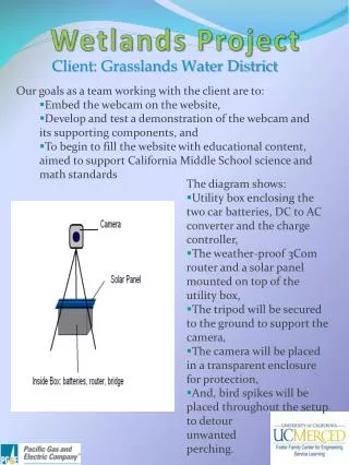
Elkhorn Slough Tidal Wetlands Project. December 8, 2006. Agenda. Scope of work Task integration Framework for projecting geomorphic change. Tidal Hydraulics Study (1992). Azevedo & Blohm-Porter Enhancement Plans (1991-1995). Stanford 3D Modeling (ongoing).

E N D
Elkhorn SloughTidal Wetlands Project December 8, 2006
Agenda • Scope of work • Task integration • Framework for projecting geomorphic change
Tidal Hydraulics Study (1992) Azevedo & Blohm-Porter Enhancement Plans (1991-1995) Stanford 3D Modeling (ongoing) Strategic Planning (2004–2006) ESNERR Initiates the TWP Task A: Literature Review of Management Actions Task B: Develop Restoration Alternatives Task C, D, E, & F Technical Analyses Selection of Preferred Alternatives Task G: Develop Conceptual Designs
Literature Review – California & Beyond Brown Marsh, SE Louisiana Essex marsh, SE coast of England
Peer Review Strategic Planning Team Working Group Working Group Modeling Team Science Panel Agency Panel Community Panel Develop / Refine Restoration Concepts • Use the existing planning process • Refine alternatives proposed in RFP
2 4 3 Previously Identified Concepts • No action • Restore historic tidal inlet • Reduce opening under Hwy1 • Reduce Parsons Slough tidal prism
Integrated Technical Analyses(Tasks C, D, E, & F) Task C Assess Inlet Stability Task D Hydrodynamic Modeling Task E Predict Future Morphology Task F Predict Future Habitat
Quantitative Analyses Guided by Conceptual Models • Provides an ‘intellectual roadmap’ for understanding & predicting changes • Highlights ‘cause-and-effect’ pathways useful during alternative analysis • Directs inlet analysis, computer-based modeling, and geomorphic projections
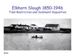
Natural Morphology of Elkhorn Slough Source: Elkhorn Slough Foundation 1854 USC&GS Survey Historical maps, photographs and surveys characterize the natural system
Inlet Modifications at Elkhorn Slough • New ocean inlet • Armored jetties • Maintenance dredging
Prediction of Future Morphology Step 1: Understand the Geomorphic System • Identify geomorphic units & sediment budget elements • Analyze how physical processes will change Step 2: Project Change • Predict change of each unit • Assess if sediment budget can accommodate cumulative effects Step 3: Integration with Other Tasks • Predicted morphology is bathymetry of modeling (Task D) • Planform map of units influences habitat (link Task F)
Source: CSUMB Seafloor Mapping Lab Prediction of Future Morphology Use information generated by the Reserve and others Source: Elkhorn Slough Foundation
5 6 7 6 5 7 Physical Changes Affect Habitat(Integration with Task E) Task C Assess Inlet Stability Task D Hydrodynamic Modeling Task E Predict Future Morphology Task F Predict Future Habitat Inlet closure affects exchange of nutrients, energy, … Changing tidal & salinity regimes affect vegetation Marsh plain elevation relative to tides controls hydroperiod
6/26/06 ? ? Elkhorn Slough Tidal Wetland PlanUndiked Tidal Marsh Areas - Likely Major Mechanisms of Tidal Habitat Loss and Changes Creation of Moss Landing Harbor Deeper estuarine mouth Groundwater overdraft (agricultural & urban dev.) Tectonic events Sea level rise ? ? ? Decreased marsh elevations Increased tidal volume, range, & velocities Increased tidal flooding (inundation) ? Decreased (organic) sediment production Decreased (mineral) sediment & freshwater supply • Loss of tidal • marsh (interior) • Plants physically • removed by sediment • erosion on the marsh • plain • Loss of tidal marsh (edges) • Plants physically removed by • bank erosion • Erosion of channel & tidal • creeks • Extended tidal creek network • Erosion of soft sediments • from mudflats & marsh plain • Loss of tidal marsh (interior) • Marsh elevation not keeping pace • with water levels exceeding plants • physiological constraints (drowning) • Plant death likely caused by • anoxic soil conditions • Plants more susceptible to • disease, etc. ? ? Decreased root biomass ? Diversion of the Salinas River (agricultural dev.) Elevated nutrient levels (agricultural & urban dev.) ? • Increased macroalgae abundance • Smothers plants • Reduced light availability
Wave Analysis for Inlet Sizing / Stability • Nearshore wave conditions estimated from offshore data and transformation coefficients • Use nearshore power for inlet stability analysis wave period wave period wave period Monterey Bay Wave Data Transfer Coefficients Inlet Wave Exposure wave direction wave direction wave direction