Download
1 / 39
390 likes | 597 Views
Neighborhood Walkability and Bikeability Andrew Rundle, Dr.P.H . Associate Professor of Epidemiology Mailman School of Public Health Columbia University. Neighborhood Walkability. A set of urban design characteristics that support pedestrian activity.

E N D
Neighborhood Walkability and Bikeability Andrew Rundle, Dr.P.H. Associate Professor of Epidemiology Mailman School of Public Health Columbia University
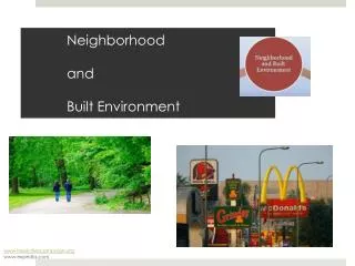
Neighborhood Walkability • A set of urban design characteristics that support pedestrian activity. • Low walkability neighborhoods are often discussed in reference to urban sprawl. • Low walkability is typified by: • Low population density • Poor access to public transit • Little pedestrian activity • Car dependence • Little mixing of residential and retail/commercial land uses
Census Tracts in New York City Median Area 0.18 Km2 10th - 90th Percentile Range 0.13 - 0.60 Km2
Zip Codes in New York City Median Area 3.58 Km2 10th - 90th Percentile Range 1.13 - 7.52 Km2
½ Mile Radial Buffer Median Area 2.03 Km2 10th - 90th Percentile Range 1.58 - 2.03 Km2
½ Mile Network Buffer Median Area 1.23 Km2 10th - 90th Percentile Range 0.81 - 1.37 Km2
New York Cancer Project • A 2000-2002 health survey of residents of New York City and the surrounding area, during which height and weight were measured. • 13,102 subjects were geocoded to addresses within New York City. • 92% of residential census tracts in the City are represented. • 37% overweight, 28% obese.
Adjusted Mean1 BMI and Population Density P for trend <0.001 • Adjusted for individual age, race, gender and education, neighborhood poverty, % Black, and % Hispanic.
Adjusted Mean1 BMI and Access to Public Transit P for trend <0.001 • Adjusted for individual age, race, gender and education, neighborhood poverty, % Black, and % Hispanic.
% Commuting by Transit Population Density Effect of Neighborhood Definition
Replication in a Second New York City Sample New York Cancer 2002 CHS Cohort Data Data Population Density -0.38* -0.39* (per 10K people/km2) Mixed Land Use -1.05* -0.77* (per unit change) Bus stops -0.04* -0.04* (per stop/km2) Subway stops -0.13* -0.08 (per stop/km2) % of commuters -3.95* -3.67* using public transit * P<0.05, adjusted for individual age, race, gender and education, neighborhood poverty, % Black, and % Hispanic.
Problem of Multi-colinearity • The indicators of neighborhood walkability that we have studied thus far all tend to be correlated with each other. • Transit is organized around where people live and around commercial space. • Population density and land use mix tend to co-exist. • So it is difficult to analyze all these indicators in a single statistical model.
NYC Neighborhood Walkability Index This walkability index combines data on population density, total commercial space and subway ridership. Square footage of commercial space Population density Subway ridership The walkability index score predicts pedestrian counts across the City (R=0.66, p=0.03)
Neighborhood Walkability and BMI for NYC Residents P for trend <0.001 • Adjusted for individual age, race, gender and education, and neighborhood poverty, % Black, and % Hispanic.
Active Transport and Neighborhood Walkability. • 2003 CHS respondents (N=9,802) were asked how frequently they walked or cycled a distance of 10 blocks or more. • Subjects linked to Zip codes of residence. • Neighborhood walkability index measured for each Zip code. • 44% reported no episodes of active transport of 10 blocks or more. • Data analyzed using Zero-inflated negative binomial regression.
Modified Frank et al., Neighborhood Walkability Index • Includes 5 urban design characteristics: • residential density; • intersection density; • land use mix for five types of land use - residential, office, retail, education, and entertainment; • subway stop density; • the ratio of retail building floor area to retail land area. • The index is the sum of the z-scores of each component.
Active Transport and Neighborhood Walkability. Adjusted for other variables in the table and for gender, age, race/ethnicity, education, income, nativity, employment status, martial status, family size, Zip code level poverty rate & % Hispanic.
Active Transport and Neighborhood Walkability. Adjusted for other variables in the table and for gender, age, race/ethnicity, education, income, nativity, employment status, martial status, family size, Zip code level poverty rate & % Hispanic.
Physical Activity and Neighborhood Walkability and Park Access. • In 2002-2005 CHS respondents were asked if they engaged in any recreational PA in the past month. • 71% reported engaging in some recreational PA. • In 2005 respondents were asked to report the number of hours per week they engaged in moderate or vigorous PA. • 42% reported zero hours. • Among those who were active the median was 15 hours per month.
Recreational Physical Activity, Neighborhood Walkability and Park Access. All OR adjusted for other variables in the table and for gender, age, race/ethnicity, education, income, nativity, employment status, martial status, family size, Zip code level poverty rate, % Hispanic, homicide rate, and park level litter index.
Moderate and Vigorous PA, Neighborhood Walkability and Park Access. All OR adjusted for other variables in the table and for gender, age, race/ethnicity, education, income, nativity, employment status, martial status, family size, Zip code level poverty rate, % Hispanic, homicide rate, and park level litter index.
Neighborhood Bikeability • A set of urban design characteristics that support cycling. • The primary dimension of bikeability is safety. • Bike lanes • Traffic calming • Physical or spatial buffers from traffic • The development of bikeability scales or indexes lags far behind the development of walkability indexes.
Bikeability Indicators Across 13,088 neighborhoods from the New York Cancer Study.
Bikeability Indicators Correlations between measures across 13,088 neighborhoods from the New York Cancer Study.
Neighborhood Bikeability and BMI Across 13,088 neighborhoods from the New York Cancer Study. • Adjusted for individual age, race, gender and education, and neighborhood poverty, % Black, and % Hispanic.
Neighborhood Bikeability and BMI Across 13,088 neighborhoods from the New York Cancer Study. • Adjusted for individual age, race, gender and education, and neighborhood poverty, % Black, and % Hispanic.
Neighborhood Bikeability and BMI Across 13,088 neighborhoods from the New York Cancer Study. • Adjusted for individual age, race, gender and education, and neighborhood poverty, % Black, and % Hispanic.
Neighborhood Bikeability and BMI Across 13,088 neighborhoods from the New York Cancer Study. • Adjusted for individual age, race, gender and education, and neighborhood poverty, % Black, and % Hispanic.
Neighborhood Bikeability and BMI Across 13,088 neighborhoods from the New York Cancer Study. • Adjusted for individual age, race, gender and education, and neighborhood poverty, % Black, and % Hispanic.
Neighborhood Bikeability and BMI Across 13,088 neighborhoods from the New York Cancer Study. • Adjusted for individual age, race, gender and education, and neighborhood poverty, % Black, and % Hispanic. • ** Additionally adjusted for population density and land use mix.
CPPW GPS and Accelerometer Study • Measure travel mode and route choice. • Measure activity and pedestrian patterns within the residential neighborhood. • Define individual’s activity spaces. • Evaluate how built environment characteristics being altered by NYC interventions affect pedestrian activity and total activity. • E.g. Street trees, Intersection safety, Bike lanes, Transit, Land use, Park development, Age Friendly Streets……
Interning For Rundle: Accelerometer Tracking Have completed four studies using accelerometry, two validation studies and two population studies
Plan for Analyses of GPS and Accelerometer Data • Across subjects: assess whether the built environment characteristics of the residential neighborhood predict pedestrian activity and total physical activity. • Across subjects: assess whether the built environment characteristics of the total activity space predict physical activity. • Within subjects: Assess whether built environment characteristics of blocks within the residential neighborhood predict walking route choice.