Download
1 / 20
200 likes | 213 Views
A review of the UK Met Office's seasonal forecasts for Europe, analyzing forecast methods, skill assessments, and future plans. Includes statistical and dynamical forecasting models.

E N D
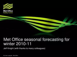
A Review of UK Met Office Seasonal forecasts for Europe (1-8 months ahead) Andrew Colman, Richard Graham Met Office Hadley Centre Exeter UK http://www.metoffice.gov.uk/research/seasonal/index.html Thanks also to Peter McLean, Margaret Gordon, Adam Scaife for providing some of the material presented
Statistical forecasting model Analysis of climate trends Research studies (e.g. PREDICATE, COAPEC, ENSO teleconnections) Dynamical forecasting models Analysis of current ocean observations Skill assessed by past performance of the forecast methods Inputs into the Met Office seasonal forecast (Met Office,ECWMF, EURO-SIP) Monthly conference: Climate Research/Ops Centre/Comms Forecasts from other centres
Statistical prediction, North Atlantic Oscillation Dynamical prediction from Sep05 Model studies 500hPa anomaly DJF05/06 Observed May 05 SSTA ‘tripole’ pattern robust – but too weak (40%) Verification HadAM3 temperature response to idealised (‘May05-like’) forcing Most-likely temperature category, DJF05/06 Correct sign predicted in 2 years out of 3 2005 Marked negative winter NAO predicted (-1.1) ‘fickle’ courtesy W. Norton Example: Winter 05/06 forecast: ‘…two-in-three chance of below-average temperatures over much of Europe…’
The outcome, DJF 2005/6 Observed Europe temperature anomalies Observed UK rainfall anomalies Met Office winter forecast 2005/6 The forecast A two in three chance of a colder-than-average winter for much of Europe. If this holds true, parts of the UK – especially southern regions – are expected to have temperatures below normal There is also an indication for a drier-than-average winter over much of the UK. • Customers: • public • government (Cabinet office, EA) • planners in utilities, transport, finance & insurance, defence, aviation, local authorities • 71% of public aware, 13% took action
Contents • Forecast Methods and tools • Calibration (of probabilities) • Correcting for Climate change trend • Skill Assessments • Future plans • Focus mainly on winter and temperature
Forecast Methods and Tools (for Europe) • 1.GloSea (Global Seasonal Forecast System) • HadCM3 Hadley Centre coupled ocean-atmosphere climate model adapted for seasonal forecasting • 2.5° x 3.75° x 19 level AGCM coupled with • (1.25° to 0.3°) x 1.25° x 40 level OGCM • 41 Member Ensemble is run out to 6 months ahead (once per month) • Initial conditions from 5 ocean surface wind stress perturbations x 8 SST perturbations + unperturbed member • 2.Statistical forecast of DJF NAO index from preceding May N Atlantic SST (Rodwell and Folland, Quarterly Journal of the Royal Meteorological Society, 2002, 128, 1413-1443) • Spring SST Anomalies are hidden by warm surface water in Summer but tend to re-emerge in Autumn when surface water cools
Forecast Methods and Tools (for Europe) • 3. Statistical forecasts of July-August Temperature from Winter and Spring N Atlantic SST (Colman and Davey I.J.Climatol. 19 513-536 ,1999) • 4. ENSO teleconnections (EG. Toniazzo and Scaife Geophys. Res. Let., 33, L24704, 2006) • 5 Corrections for climate trend (developed from Scaife et. al. Geophys. Res. Let., 32, L18715, 2005)
Additional tools • DePreSys (Decadal Prediction System) run once or twice per year out to 10 years • EUROSIP model (ECMWF, Meteo-France Met Office) Also run out to 6 months on a monthly basis • NCEP CPC Model , IRI forecast viewed on internet
Raw ensemble and calibrated probabilities Dynamical seasonal forecasts are usually produced as ensembles (Raw Ensemble) Probabilities are based on the proportion of ensemble member forecasts within given category Probabilities reflect uncertainty in initial conditions (used to distinguish ensemble members) but not non-linear errors in the model To correct for non-linear model error the probabilities needs to be calibrated using historical observed data. Raw ensemble probabilities are not calibrated. Linear Discriminant Analysis is our principal tool for combining and calibrating forecasts Discriminant equations are calculated from historical data like regression equations but the output is probabilities for a set of forecast categories Can take weighted mean of calibrated and uncalibrated probabilities to maximise skill. • vector of predictor values • predicted NAO index • GloSea ensemble T2m and precip - probability of category ‘t’ • generalised squared ‘distance’ from hindcast • predictor values when ‘t’ is observed • (takes account of skill)
Principles of linear discriminant calibration ‘skilful’ system Prob(abv) 1/d Prob(avg) 1/d Prob(blw) 1/d mean d Historical predictions eg 2 metre temperature at nearest grid-point to predicted location (plus statistical prediction for summer or winter) real-time prediction (e.g. single ensemble member) d mean d mean Predicted values when above-normal category observed Predicted values when near-normal category observed Predicted values when below-normal category observed
Example of different ways of weighting calibrated (discriminant) and raw ensemble probabilities ( from DJF 06/07 forecast of temperature anomaly sign) Raw Ensemble (0% calibrated) 67% calibrated 100% calibrated Raw Ensemble +NAO 67% calibrated+NAO 100% calibrated+NAO calib67+NAO+50%EN calib67+NAO+100%EN
Correcting for climate change trend • Trend correction needed because • GloSea model (and statistical predictions) do not include recent changes in radiative forcing • Requirement to express forecasts relative to historical climatologies eg 1971-2000 which may be significantly different to present due to climate change • Evidence of negative bias in recent forecasts Trend Correction Equation FTR=FA+ CL+ TC • FTR= trend corrected forecast • FA= Forecast anomaly • CL= Climatology (from which forecast anomaly is calculated) • TC= Trend correction (for greenhouse forcing)
Evidence of need for trend correction (from 2/3 calibrated predictions of Sept-Nov UK T2M as example) • With Correction • Without correction (0.15C per decade since 1975) • Similar results for other seasons FORECASTS FORECASTS WITH TREND OBSERVATIONS
HadCRUT3 observations (dashed) and HadAM3 (EMULATE) 18 member Ensemble mean simulated temperatures (solid) for Europe and trend estimate Linear approximation with “hinge” fit made to model simulations Trend also takes account of pre-1950 data and is a conservative estimate (assumes trend is always constant or increasing) 0.15C per decade trend since 1975 initially estimated by Scaife et al (2005. Geophys. Res. Let. 32, L18715) using HadAM3 ensemble mean simulated temperatures for N Europe (Observed trend not used because of NAO contribution) Trend curve extended backwards in time at 0.075C per decade Summer (JJA) trend in simulations similar to winter
Example probability forecast maps Calibrated GloSea; +NAO; +trend DJF T2m
ROC skill maps for 4 seasons from GloSea 2mT: 1 month lead MAM from Feb JJA from May SON from Aug DJF from Nov
ROC skill plots: Impact of adding trend correction to Winter (DJF) temperature forecasts from August 1959-2001 GloSea only; No trend correction Adding NAO, trend correction and raw ensemble weight improves skill GloSea + NAO; No trend correction Glosea + NAO; Trend corrected 100% Calibrated 67% Calibrated 50% Calibrated Raw Ensemble
Summary and future plans SUMMARY • The Met Office use primarily a dynamical seasonal forecast system (GloSea) which has some useful skill all year round • GloSea is supplemented with SST based statistical predictions for summer and winter which enhanced skill and lead to the successful winter forecasts of 2005-6 and 2006-7 • A correction for climate trend is now added which also enhances skill FUTURE PLANS • GloSea is due to be upgraded in the next 18 months with a version of the HadGEM3 model • The new GloSea should include variable radiative forcing, hence there should no longer be a need for trend correction. • PACE project is investigating European Winter predictability
Example T2m forecast for Sep-Nov from the combination of 3 different inputs: Observed (1-17 Sept), Medium range (18-30 Sept) and Glosea for Oct-Nov