Download
1 / 16
330 likes | 649 Views
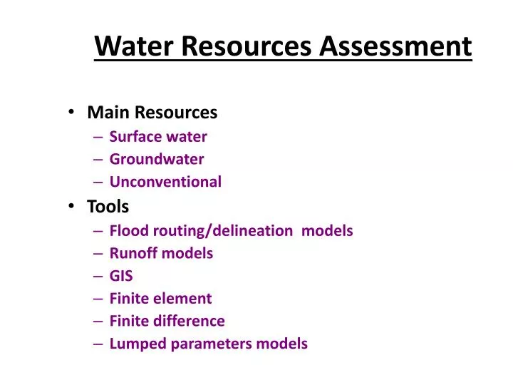
Water Resources Assessment. Main Resources Surface water Groundwater Unconventional Tools Flood routing/delineation models Runoff models GIS Finite element Finite difference Lumped parameters models. Q in. S. Q out. Surface Water. General Equation I(t) – O(t) = Δ S/ Δ t

E N D
Water Resources Assessment • Main Resources • Surface water • Groundwater • Unconventional • Tools • Flood routing/delineation models • Runoff models • GIS • Finite element • Finite difference • Lumped parameters models
Qin S Qout Surface Water • General Equation I(t) – O(t) = ΔS/Δt • Oin Inputs • Precipitation • Base flow • Oin Outputs • E/ET • Infiltration • Intakes
System Boundaries • Reservoir • Balance ΔS/Δt=(P*Ares+Qin)-(E*Ares+Qout) • Residence Time S/I(t) • Watershed ΔS/Δt=(P*A)-(ET*A+Qout)
Groundwater • Definitions • Saturated Zone: VWater=Vvoids • Unsaturated Zone: VWater < Vvoids • Moisture Content: VWater < Vtotal • Voids/Pores: allow the flow of water • Water Table: surface where the water pressure in the pores equals Zero • Porosity: n = Vvoids /Vtotal (~0 - 0.7) • Hydraulic conductivity [L/T]= represents how easily water can flow through formation • Gravel >50 m/day • Course Sand: K = 30-50 m/day • Fine sand: K = 10-30 m/day • Silt: K = 1-10 m/day • Clay: K < 1 m/day
Groundwater • Definitions • Formations types with respect to water bearing • Aquifer = permeable layer that contains and transmits water in large quantities • Confined • Unconfined • Aquiclude = impermeable layer that may contain water but transmissivity is very low • Aquitard = semi permeable layer that transmits water in the vertical direction only • Aquifuge = impermeable layer that neither contains nor transmits water
Clay calcareous sandstone, unconsolidated sands Eocene chalks and limestone marls, marine shales, and claystones General Cross Section of Gaza Aquifer
Intrinsic permeability Groundwater • Darcy
Groundwater • Average pore velocity • Problem: A tracer traveled 3 days and 6 hours between 2 wells that are 20 m apart. Water elevation difference between the wells is 0.5m, porosity n=0.15. Estimate v, q, K
Groundwater Balance Ss [1/L] = Specific Storage = volume of water that a unit volume of aquifer releases under a unit decline in hydraulic head S [dimensionless] = Storativity = volume of water that a unit surface area of aquifer releases under a unit decline in hydraulic head
Groundwater Balance • Pollutants transport mechanisms • Advection • Diffusion • Dispersion Mechanical dispersion coefficient Diffusion coefficient
Average Groundwater Level (PWA, 2005 Data)