Download
1 / 14
140 likes | 159 Views
Learn about contour lines and how they show elevation on maps. Discover the significance of rivers in reading contour lines and identifying elevations. Practice drawing contour lines with helpful examples.

E N D
What are contour lines? These
What do contour lines show? Elevation Map B – measured feet Map A What is the highest elevation on map A? Map B? 3500 feet 47 feet
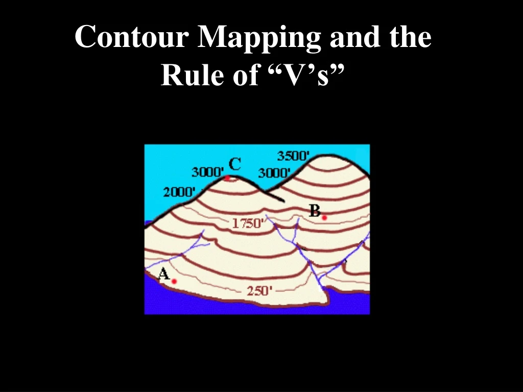
Reading a map with rivers Knowing which way a river flows is often the key to being able to label contours correctly. It helps you find direction. What happens to the contour lines in this picture when they cross a river? They bend to form an upside down “V”.
What does the upside down V mean? The point of the V is facing upstream. So you know the elevation is higher in the direction of the point.