Download
1 / 3
80 likes | 531 Views
Pendahuluan. Tujuan Instruksional Umum:. Setelah mengikuti kuliah dalam waktu 1 semester, peserta didik mampu memahami konsep dasar GIS , mampu mengoperasikan Software-GIS dan mampu menyusun contoh Proyek GIS sesuai dengan minat masing-masing. Tujuan Instruksional Khusus :

E N D
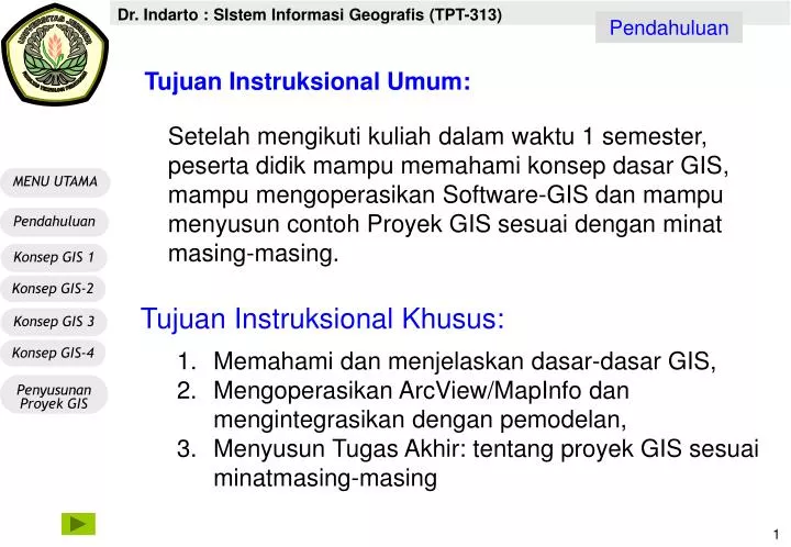
Pendahuluan Tujuan Instruksional Umum: Setelah mengikuti kuliah dalam waktu 1 semester, peserta didik mampu memahami konsep dasar GIS, mampu mengoperasikan Software-GIS dan mampu menyusun contoh Proyek GIS sesuai dengan minat masing-masing. • Tujuan Instruksional Khusus: • Memahami dan menjelaskan dasar-dasar GIS, • Mengoperasikan ArcView/MapInfo dan mengintegrasikan dengan pemodelan, • Menyusun Tugas Akhir: tentang proyek GIS sesuai minatmasing-masing
Proposal Aplikasi sesuai Pilihan Minat Sistem Informasi Geografis (GIS) Pemetaan Lahan & Penginderaan Jauh Matematika Dasar (Geomteri & trigonometri, aljabar, matrix) Pengetahuan Komputer (Access, Visual Basic, excel) Fisika Dasar (Optic,laser) Pendahuluan
Pendahuluan SUBTANSI KAJIAN: SISTEM INFORMASI GEOGRAFIS Tutorial & Tugas Akhir (6x) Handout 4: Dasar Penyusunan Proyek GIS(2x) Handout 3: Konsep GIS, Konsep GIS6, Konsep GIS7 Konsep Pemodelan Spasial, Interpolasi data & DEM(2X) Handout 2: Konsep GIS3 & Konsep GIS4 Sistem Proyeksi & Spatial database (2x) Handout-1: Konsep GIS1 & Konsep GIS2 DefinIsi, aplikasi, Sumber data, arah pengembangan(2x) Model data di dalam GIS