Download
1 / 122
1.23k likes | 1.45k Views
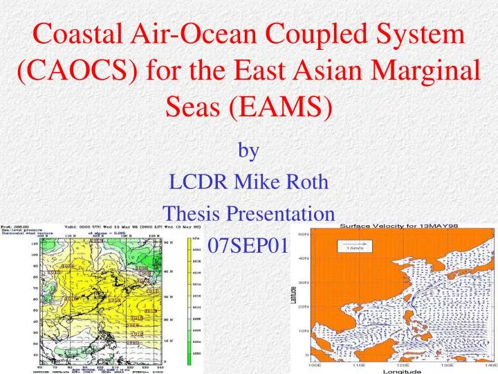
Coastal Air-Ocean Coupled System (CAOCS) for the East Asian Marginal Seas (EAMS). by LCDR Mike Roth Thesis Presentation 07SEP01. Significance. Focus of METOC support for the littoral region at the mesoscale level. Emphasis on Air-sea interaction.

E N D
Coastal Air-Ocean Coupled System (CAOCS) for the East Asian Marginal Seas (EAMS) by LCDR Mike Roth Thesis Presentation 07SEP01
Significance • Focus of METOC support for the littoral region at the mesoscale level • Emphasis on Air-sea interaction • EAMS is a critical operating area of the USN, especially 7th Fleet • The objective of METOC’s Coupled Ocean/Atmosphere Mesoscale Prediction System (COAMPS) developed by NRL
Purposes • To provide further support that CAOCS does perform well in simulating EAMS surface current circulation, SST structure, and SSS structure. • To provide support that CAOCS does perform well in simulating EAMS surface wind stress and low level atmospheric forcing.
Purposes (cont.) • Through analysis of CAOCS output: To show how the atmosphere and ocean behave in a way that cannot be described climatologically due to the small temporal scales of numerous mesoscale features present at the surface of the ocean and in the lower levels of the atmosphere even during a period following the onset of the summer monsoon. This will provide support regarding the usefulness of CAOCS over an uncoupled, climatologically forced ocean or atmospheric model.
Purposes (cont.) • Through analysis of CAOCS output: To show the significance of the air-sea interaction processes that occur between the lower atmosphere and the surface of the ocean and that CAOCS is indeed handling these air-sea interaction processes. • To emphasize the near-real time capability of CAOCS.
Purposes (cont.) • To show that CAOCS is an excellent tool for USN METOC community personnel because the accurate, near-real time model output will contribute to increased meteorological, oceanographic, and acoustic forecasting skill in a littoral environment.
The EAMS • The EAMS is comprised of: • Japan/East Sea (JES) • Yellow Sea/East China Sea (YES) • South China Sea (SCS)
The EAMS Russia China Bohai Sea Korean Peninsula Japan Gulf of Tonkin Taiwan Vietnam Philippines Gulf of Thailand Malaysia Borneo Indonesia Components of the the EAMS JES YS/ ECS (YES) SCS
Tatar Strait JES Soya Strait Vladivostok Hokkaido Tsugaru Strait Korean Peninsula Honshu Korean Strait Kyushu
JES • Viewed as a miniature prototype ocean: • Basin wide circulation pattern • Boundary currents • A Subpolar Front (SPF) • Mesoscale eddy activity Deep water formation
JES Currents • Tsushima Warm Current (TsWC) • Flows northward from the ECS through the Korean Strait • Carries warm water into the JES • Separates north of 35°N into eastern/western channels
JES Currents • Japan Nearshore Branch (JNB) • Flows northward as the eastern branch of the TsWC along the Japanese west coast
JES Currents • East Korean Warm Current (EKWC) • Flows northward as the western branch of the TsWC • Bifurcates at 37°N into an eastern and western branch • The western branch makes a cyclonic turn in the East Korean Bay
JES Currents • Liman Current and North Korean Cold Current (NKCC) • Flows southward from the Sea of Okhotsk through the Tatar Strait and along the Russian and North Korean west coast • Brings cold water into the JES
JES Currents • The Subpolar Front (SPF) • The southward flowing NKCC and the northward flowing eastern branch of the EKWC converge at approx. 38°N • The SPF stretches across the JES in a northeasterly direction and extends to the west coast of Hokkaido
Liao R. YES Han R. Yellow R. Yangtze R. Ryukyu Islands Taiwan Strait
YS quite shallow • Most water depth < 50 m • N-S oriented trench in central portion of YS • Broad/shallow continental shelf – water readily affected by varying atmospheric forcing (heating, cooling, wind stress) YES Bathymetry
E/W asymmetry: • Extensive shoals <20 m in western YS and and not in eastern YS • 50-m isobath > 100 km from Chinese coast but only 50 km from South Korean coast • Plays a crucial role in the shoaling of the MLD YES Bathymetry
Monsoon atmospheric forcing greatly alters SST and MLD depth: • Winter: • Cold northerly winds • SAT<SST • Surface heat lost from ocean to atmosphere resulting in upward buoyancy flux YES Thermal Structure
Winter (continued): • Thermal Forcing (cooling) and Mechanical Forcing (wind stress) generate turbulence • Mixing of surface water with deep water • Deepening of MLD that often extends to bottom YES Thermal Structure
Summer: • Warm southerly winds • SAT>SST • Strong downward net radiation • Leads to downward buoyancy flux • MLD shoals • Multi-layer structure (MLD, thermocline, and sublayer) YES Thermal Structure
YES Currents • Kuroshio Current (KUC) • Strong WBC • Flows northward along the shelf break in the southern ECS
YES Currents • Taiwan Warm Current (TWC) • Enters ECS through the Taiwan Strait • Flows northward inshore of the KUC.
YES Currents • Tsushima Warm Current (TsWC) • Flows northward from the KUC west of Kyushu and passes through the Korean Strait • Splits in the vicinity south of Cheju Island
YES Currents • Yellow Sea Warm Current (YSWC) • Flows northward beneath the surface into the YS • Brings warm water into the YS
YES Currents • Korean Coastal Current • Flows southward along the Korean Peninsula
YES Currents • Chinese Coastal Current • Flows southward around the tip of the Shandong peninsula and along the Chinese coast
Taiwan Strait SCS Luzon Strait Gulf of Tonkin Mindoro Strait Balabac Strait
Straits are relatively shallow except the Luzon Strait (sill depth = 2,400 m) • Broad shallows of the Sunda shelf in the S/SW • Continental shelf in the N extends from Gulf of Tonkin to the Taiwan Strait SCS Bathymetry Taiwan Strait Luzon Strait
Extensive continental shelves (< 100 m deep) in W and S • Deep slopes w/ almost no shelves in the E • Deep eliptical shaped basin in the center of the SCS extends to over 4,000 m • Numerous reef islands and underwater plateaus scattered throughout SCS SCS Bathymetry Taiwan Strait Luzon Strait
Complex dynamics involved in the flow of the SCS are related to: • geometry of the SCS • its connectivity with the Pacific Ocean • strongly variable atmospheric forcing • water exchange between the SCS/ECS via the Taiwan Strait SCS Currents Taiwan Strait Luzon Strait
SCS Currents • Kuroshio Current (KUC) – bifurcation regime Originates from the North Equatorial Current Flows northward as a WBC east of Luzon E Enters ECS through the Luzon Strait, bifurcates into northward and northwestward branches to the northeast of a cyclonic eddy that is located northwest of Luzon (NWL eddy)
SCS Currents • Kuroshio Current (KUC) – bifurcation regime The northward branch flows northward along the western coast of Taiwan E The northwestward branch makes a cyclonic turn around the NWL eddy
SCS Currents • Kuroshio Current (KUC) – loop regime • Originates from the North Equatorial Current • Flows northward as a WBC east of Luzon • Enters ECS through the southern Luzon Strait, loops around an anticyclonic eddy northwest of Luzon, and exits through the northern Luzon Strait E
SCS Currents • Winter upper ocean circulation • A southward coastal jet off the Vietnam coast and a cyclonic circulation throughout the SCS
SCS Currents • Summer upper ocean circulation • A northward coastal jet off the Vietnam coast and an anticyclonic circulation throughout the SCS
SCS Currents • SCS Eddies • Several cold core and warm core eddies are often found in the SCS • Generally, cold core are more common • Bottom topography is a key factor in their lifetime/trajectory
Atmospheric Forcing – Winter Monsoon November through March Siberian High over East Asia continent H JES Polar Front positioned north of the Philippines Equatorial Trough located south of equator YES YES Relatively stronger, cold, and dry NW/N/NE winds flow over the EAMS Polar Front SCS
Atmospheric Forcing – Transition Period Winter to Summer: March through May The Siberian High rapidly weakens in April Polar Front moves northward toward Korea Frontally generated events often occur in the YES during late April and May that cause highly variable winds, cloud amount, and precipitation (Mei-Yu Trough due to cyclonic shear between NE and SW). Yellow dessert sand is often carried into the YS by eastward migrating surface lows originating in Mongolia YS SST increases by 10°C An atmospheric low pressure system forms in the north YS in late May/early June and migrates westward over Manchuria
Atmospheric Forcing – Summer Monsoon Mid-May through Mid-September Heat Lows over East Asia continent due to high solar insolation L JES Higher pressure over Pacific Ocean but subtropical ridge is displaced poleward L YES H Equatorial Trough lies over central Philippines and extends NW to Tibetan Plateau. SCS
Atmospheric Forcing – Summer Monsoon Polar Front moves north ivo 30-35°N A Tropical Easterly Jet is found at 125-mb between the subtropical ridge and the Equatorial trough L JES Air flows SE south of equator and turns SW over the SCS due to Coriolis Force L YES H Relatively weaker, warm, and moist SW/S/SE winds flow over the northern SCS and the remainder of the EAMS SCS
Atmospheric Forcing – Transition Period Summer to Winter: Mid-September through October Southerly winds weaken as the Manchurian Low is replaced by the Siberian High Polar Front begins to move southward away from the Korean Peninsula SST steadily decreases
Mesoscale Model Fifth Generation (MM5) Developed by Pennsylvania State University/National Center for Atmospheric Research (PSU/NCAR) Limited-area, non-hydrostatic, terrain-following sigma- coordinate model Designed to simulate or predict mesoscale and regional-scale atmospheric circulation