Download
1 / 17
170 likes | 355 Views
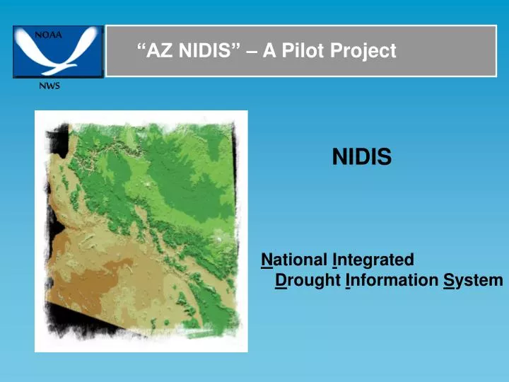
NOAA. NWS. “AZ NIDIS” – A Pilot Project. NIDIS. N ational I ntegrated D rought I nformation S ystem. NOAA. NWS. Background. WGA (Western Governors Association) – Recommendations Integrate All Levels of Drought Information NOAA – Named Lead Agency

E N D
NOAA NWS “AZ NIDIS” – A Pilot Project NIDIS National Integrated Drought Information System
NOAA NWS Background WGA (Western Governors Association) – Recommendations Integrate All Levels of Drought Information NOAA – Named Lead Agency Near Term Opportunities Were Defined
NOAA NWS Birth of “Az NIDIS – A Pilot Project NIDIS Background NOAA-NWS-Western Region 3/8/2006 Meeting-SLC,Utah NOAA-NCTP Chet Koblinsky NOAA-NCDC Tom Karl NOAA-OAR Randy Dole NOAA-NWS/OHD Gary Carter NOAA-NWS/CPC Jim Laver NOAA-NWS/CSD Bob Livezey
NOAA NWS Goals Phase 1 Expand Observation Network Expand Hydrologic Modeling Capabilities Derive Products Tailored to Drought Phase 2 Outreach/Education Evaluation Interface State/Local Drought efforts to NIDIS
NOAA NWS Benefits Increase Ability to Describe/Detect Drought Enhance Ability to Respond to Drought On Appropriate Scales Assist ‘National’ NIDIS in Refining Requirements, Program Direction, Concept of Operations Provide Direction on How Current State/Local Efforts in Arizona Interface to NIDIS
NOAA NWS Components • Phase 1 • NERON (including soil moisture sensors) • Soil Moisture Grids (observed/future) • Water Supply Forecasting • (4) Long Range Streamflow (ESP,Low Flows) • Phase 2 • (5) Interface AZFW Database • (6) Interface National Web Portal • (7) Outreach/Education • (8) Evaluation
NOAA NWS Component(1): NERON First Installations Historical Climate Network (HCN) 17 Locations in AZ Secure Funding for Soil Moisture Sensors HCN Sites Add additional sites in Salt/Verde – Finer Scale Modelling
NOAA NWS Component(1): NERON Baseline Site: Valleyhead, Northern Alabama
NOAA NWS Component(2): Soil Moisture Grids Soil Moisture Grid – Model Calibrated With Observed Soil Moisture Spatial Scale 4km (1km) All of Arizona Soil Moisture At Various Depths Hourly Precipitation Input Calibrated With Observed/NERON Sites Upper Soil Moisture Profiles Lower VERDE RIVER SALT RIVER
NOAA NWS Component(2): Soil Moisture Profiles ComputedandObservedSoil Moisture: 0-25cm Depth ComputedandObservedSoil Moisture: 25-75cm Depth
NOAA NWS Component(2): Soil Moisture Grids NWS HL-RDHM Hydrology Laboratory Research Distributed Hydrologic Model Runs over the entire State of Arizona Model is driven by gridded precipitation computed from the Multi-Precipitation-Estimator (MPE) on hourly time step MPE uses all observed rain gages (800+), NEXRAD RADAR Computed estimates, Satellite Estimates (data void areas) Model executed at least 3 times per day, 365 days/year By the NOAA-NWS-Colorado Basin River Forecast Center (CBRFC)
NOAA NWS Component(2): Soil Moisture Grids Multi-Precipitation- Estimator Includes all of AZ Hourly Precipitation Grids Uses all Observed Precipitation Gages Combined with NEXRAD & Satellite Estimates Used as Input to The HL-RDHM
NOAA NWS Component(2): Soil Moisture Grids Example of Soil moisture for The top 10 CM Other layers or Combination of Layers can be Calculated both In values and Percents Historical values Can also be Represented and Compared Against
NOAA NWS Component(2): Soil Moisture Grids ‘Forecasts’ of Gridded Soil Moisture Forecasts can be out to a year. Most likely when a ‘strong’ enso or other climate signal is occuring or expected.
NOAA NWS Component(4): Expand ESP Use NDTO(1) Number of Days to Get above a Value NDTO(2) Number of Days to Get Below a Value NDIS(1) Number of Days Greater than a Value NDIS(2) Number of Days Less Than a Value
NOAA NWS Milestones 2006 Draft Plan Written NERON Sites Identified Site Surveys Completed Secure Funding for soil-moisture-sensors Installation Begins HL-RHDM setup and running for AZ at CBRFC 2007 NERON Installation continues Produced Initial soil-moisture products Expand ESP Forecasts (Low Flow, # days) Interface to AFWS Interface to Local Web Portal Interface to National Web Portal Begin Outreach 2008 New Web Tools Available on Web Portal Outreach Continuing Evaluation